The Pages Solo Expedition 22-24 August 2018
August 22nd
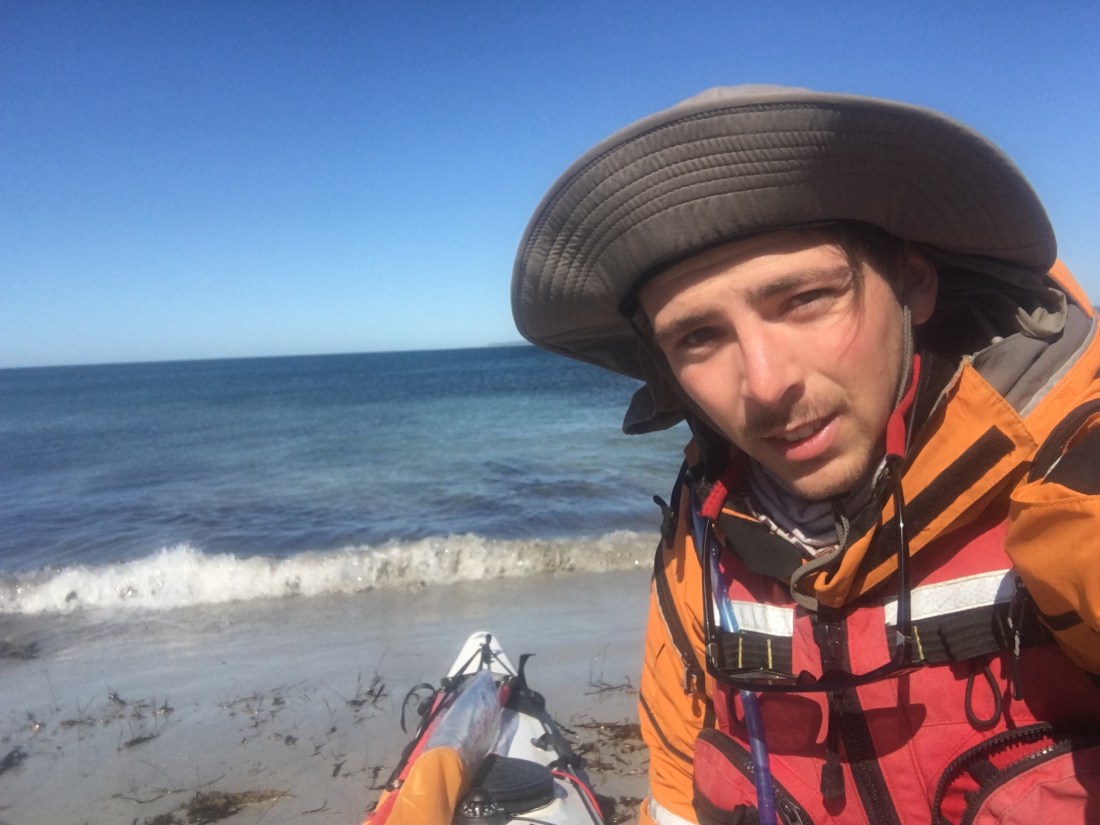
This was to be my first solo expedition in a kayak I’d been working on since the start of the year. I purchased it as a pretty basic boat in the hope to learn how to upgrade it to make it expedition worthy. Already it has done a few sea trips with groups, but I hadn’t yet had the chance to really see what it could do or how it would handle. It’s certainly not a greatly designed boat and was probably built in the 90’s. With plans to do bigger expeditions throughout the state, I thought this relatively local and short paddle would be a great opportunity to test it out and hopefully build my confidence.
I had planned the trip around the weather originally looking like favourable 15kt NE winds that would assist the crossing to the Pages and after to Kangaroo Island, but as I began packing the boat on the beach the forecast updated to 20-25kts. This was very much pushing the limits of what I was comfortable with for an exposed ocean crossing alone. However after a chat with Malcolm I set off for Tunkalilla and decided I’d just have to make a decision the next day regarding the winds.
A 17kt northerly was blowing as I left Fishery, and I suspected it would create a head wind as I rounded the Peninsular. The topography of the end of the Fleurieu with its domed hills into the sea is such that the wind prefers to follow the coast around the hills, as opposed to straight over and out to sea. Today that was the case. As I rounded Blowhole Beach I was met with 15-20kt head winds – but I was travelling predominately east. Still I managed an average speed of 6kph. I put this down to the weight of the boat; being nearly fully loaded it carried momentum through the winds. Regardless, a head wind is never enjoyable. Head down, paddle on.
As I neared Deep Creek Cove I caught eye of a whale’s tail fully in the air as it dived down! I began thinking ‘wow this could be an experience’, but I never saw it again.
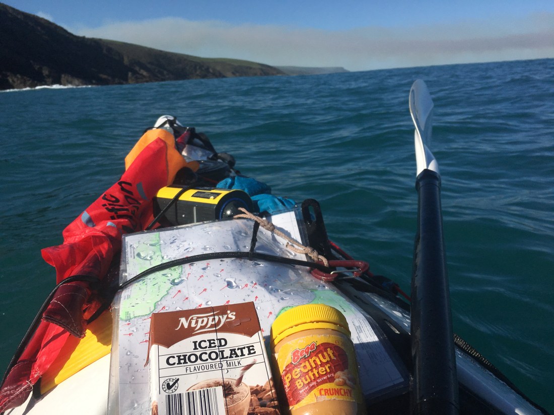
Photo: Near Deep Creek Cove. A quick lunch of peanut butter and a choccy milk during a lull in the wind!
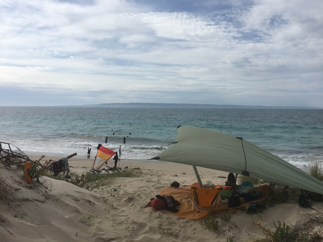
Reaching Tunkalilla Beach I began scouring the coast for a door through which to land without shattering my boat into uncountable pieces in the dumping surf! The last time I had entered the surf zone here I had broken my spine in 5 places while body boarding. Though the waves were only a meter from behind, the sucking break was deceptively two meters on the breaking side.
After a quick chat to a surfer I realised I’d had my first casualty of the trip. The sunnies were gone. All I could think about was an article Peter Carter showed me explaining the damage of UV on the eye. Oh well.
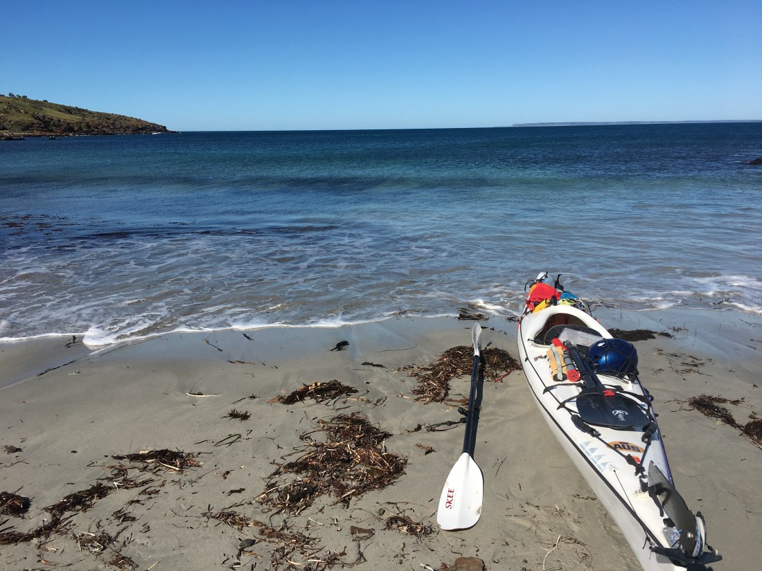
I decided on a landing spot, took my time, picked a window and landed safely on the beach.
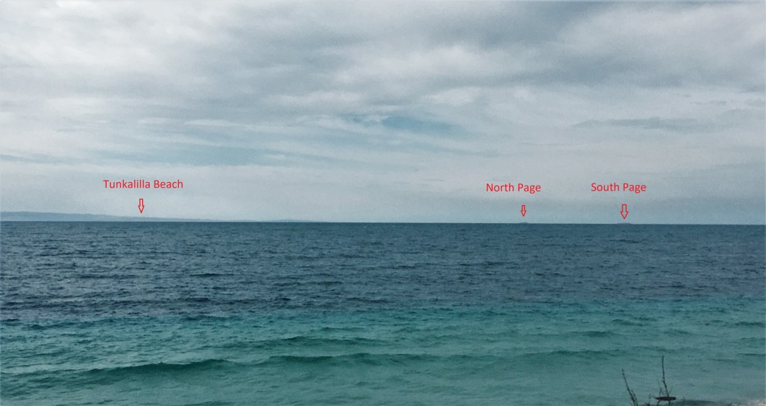
As I sat on the sand dunes watching the dolphins surf the barrelling waves I could see the Pages sticking out on the horizon. They were inspiring, and I received a fresh determination to make it out there. A quick phone call from Ben was also reassuring as he wished me well. I’m sure the thunder of the waves will be a wonderful lullaby tonight. Will I make it tomorrow?
Fishery Beach – Tunkalilla Beach 23km
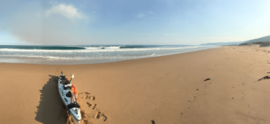
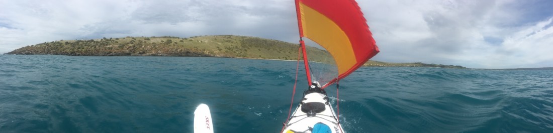
The Pages are hidden in the smoke on the horizon behind the kayak,

Burning off in Deep Creek had caused a haze that only enhanced the sunset.

August 23rd
I woke up after a healthy sleep ready to go only to find it was only 2355! This tends to happen when you’re in bed by 8pm. The rest of the night was broken sleep dominated by anxious thoughts. But one thing I was curious about was that the 20kt winds were meant to have arrived by now, but it was all calm and gentle.
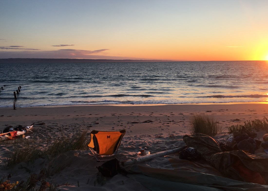
Morning came with a red glow and still no major winds. Was this a trap? Would I get halfway and then have something worse blow in? I checked all the surrounding wind readings, and found 10kts was mostly it! Looks like we are going.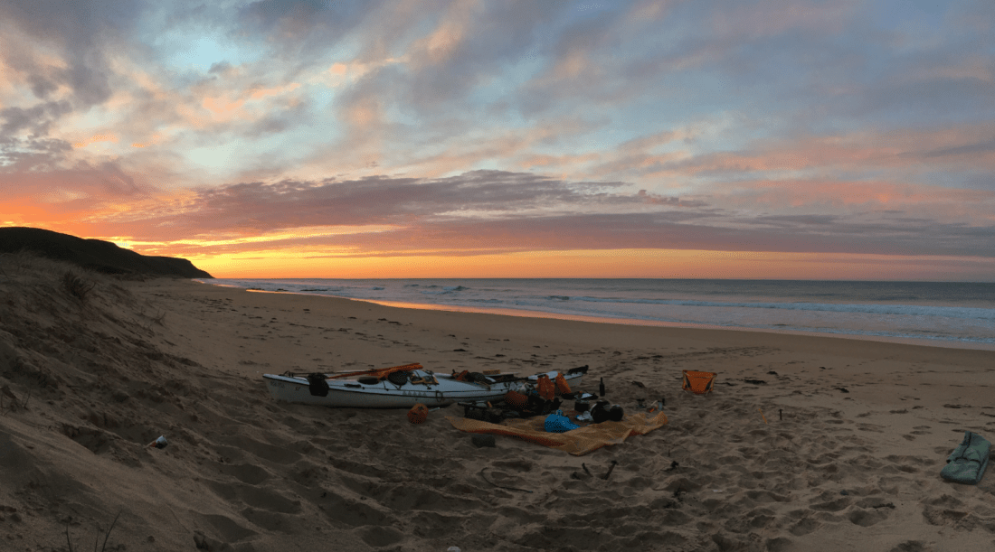 Tunkalilla sunrise
Shortly After the crossing began I was surprised to have been met by 1.5m swell rolling in from the east! It had a short swell period suggesting it was created not too far away by the previous days’ winds. The forecasted 20kt NE winds were instead 15kt easterly, meaning the whole way down to the Pages was spent buffeting waves beam on, occasionally breaking over my deck.
I find there are 2 main categories of roughness on the ocean in my mind, and it’s decided by this: Can I stop now and take a piss? If yes, then it’s not rough. I hoped I’d find some shelter in the lee of the Pages where the waters would allow me to do so!

Half way there I came across 3 large sea birds just hanging out on the water. Curious.
One got up and proceeded to circle me for 5 minutes. These were Shy Albatross, and the bird effortless circled me again and again. As it banked a turn it would skim the tips of its 2.2m wingspan through the water. If only the water wasn’t so rough I would have filmed the bird, instead I just had to appreciate it.
The Pages eventually drew nearer. With Southern Ocean swell hammering the south through to western side, and the wind and seas hammering the north through to eastern sides, I quickly eliminated any hope of landing on these dark rocks.
The Pages are the definition of heavily battered, exposed small ocean Islands. Its tall rocky coast stands like a fortress defending it from intruders. It’s the blackness of the rocks that are surprising and very uninviting. Being a windy cloudy day didn’t help the mood either, but I likened it to Azkaban, where the worst offenders in the wizarding world of Harry Potter are imprisoned.
But this fortress is not desolate. Amongst the typical sea birds, the Pages are home to one of the two largest colonies of Australian Sea Lions in the world!
I couldn’t help but imagine how many of their larger predators I had passed over.
After a small rest in the lee of the South Page it was time to face Cape St. Albans. Being 16km from the Fleurieu and 17km from Kangaroo Island, and the possibility for conditions to deteriorate I wasn’t sticking around to “put the kettle on”.
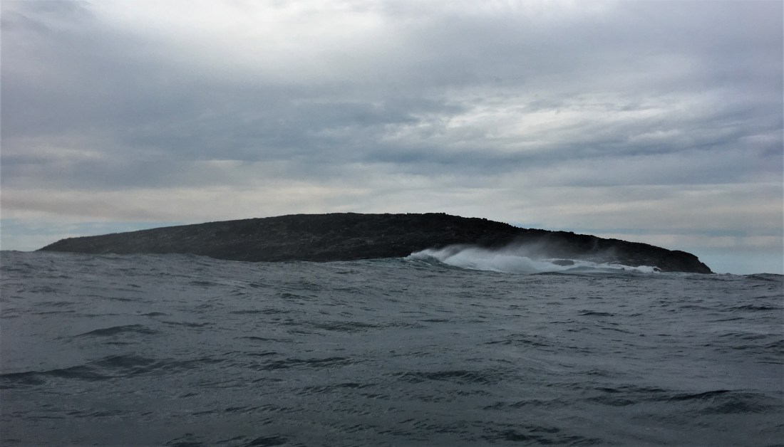
North Page viewed from the west
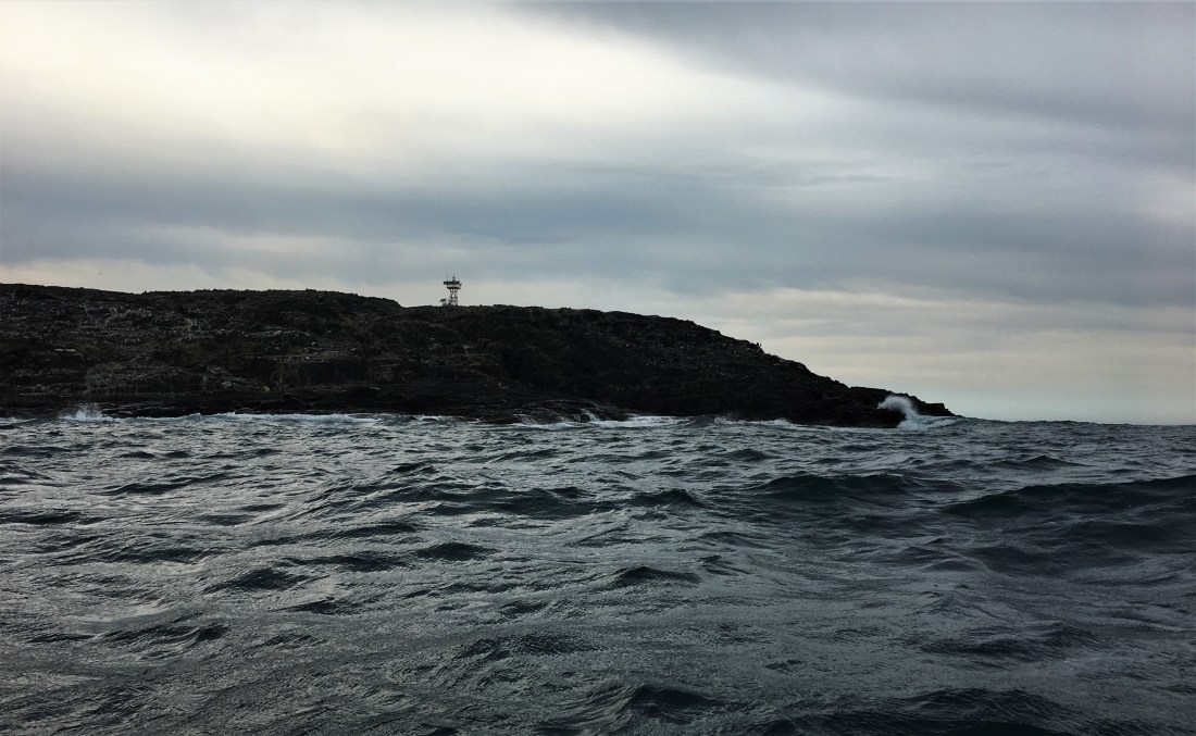
Above: The Navigation Beacon on South Page.
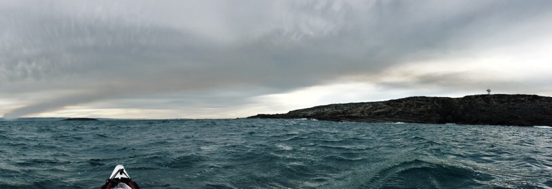
Below: South Page looking back to North Page and the Fleurieu.

Time for another Nippy’s!
The run to Antechamber Bay was easier than I expected. I was unsure of how I would fare sailing down a reasonable following sea, but as I moved along all I kept thinking was “we are boofin’ along!” I made the 17km journey to Cape St. Albans in an hour forty.
After finding a spot to call it a day in Antechamber Bay I was feeling pretty satisfied with the 37km journey taking only 5 hours to complete and achieving my goal.
Had it been the forecasted 20kt winds it would have really tested me mentally. The sea state was already all kinds of chopped up out there and was bouncing my kayak every which way. A longer thicker rudder is one of the parts I will change on the boat when I get back. The craft has a very flat hull, providing minimal tracking, often times leaving me to the mercy of the seas. On a positive note its buoyant bow was only plunged underwater once as a wave picked me up. “here we go” I was thinking, but much to my delight it only flattened the sail and popped back up and we kept going.
Cape St. Albans. Feels great to enter the protected waters of Antechamber Bay. Its near impossible to take a pano on lumpy waters!
The sense of achievement is great, however the mental game of sitting on open ocean for a day isn’t an easy one and for now I’m happy just to relax on the beach.
That is the amazing thing about Sea Kayaking. If you find yourself tired, over it, intimidated or wanting to quit, well you just can’t stop. You actually cannot. So the mind flogs its slave body a bit harder so it can keep on living, and a fresh energy spurs you on to make it to land. The sooner you get there, the sooner it’s over. Just like the crossing of backstairs passage that awaits tomorrow. Right now I’m tired and just not keen to battle wind all the way back. But I have to, so I will.
Tunkalilla Beach – South Page 16km 2.5hours
South Page – Antechamber Bay 21km 2.5 hours
 Looking back on the journey
 The abandoned jetty, Antechamber Bay
Antechamber Bay at sunset
24th August
I had a pretty ordinary night, the wind picked up again and caused the sand dunes to begin swallowing me up. Despite the north east wind coming off the water, once the sun came up I realised it’s a glorious day. Warm, sunny. The scrub surrounding the beach is so peaceful with all its little birds singing away. More importantly this is the first day I’ve noticed the smell of spring in the air, and that makes me very happy. Warmer longer days are close at hand!
 Sunrise over backstairs passage.
The following is more so about the technical side of Sea Kayaking for those who are interested.
On the last page is a map which will help make more sense of it all!
As I pushed out from Antechamber Bay it wasn’t long before my stern no longer pointed to where I launched from, but rather further west. Even though it was only a 60cm tide that had just began to flood there was already movement. I suspect the main driver behind the movement was the previous 2 days of easterly winds. A constant wind can create a surface current.
When I’m doing a crossing I like to be regimented in my approach. It helps you move faster and also makes time pass quicker. It’s one of my favourite quotes in action; “How do you eat an elephant? Piece by piece”.
The structure is as follows: Paddle for twenty minutes, then a one minute drink break. Paddle for nineteen minutes, then a one minute drink break. Paddle for nineteen minutes and then on the hour have a five minute break in which you have a snack, pee, and check the GPS to see how the currents and winds are affecting you. Then repeat.
I also have a rule when I’m crossing on a ferry glide regarding bearings. Judging distance can be very hard on water and when you can see where you want to finish up it can be very tempting to aim straight at it!
To start with, aim your bearing off a bit further than you’d expect to for the ferry glide. Let’s say if wind and current want to push you west while you’re trying to travel north, I over compensate the angle to the east. The second part of the rule is this: Hold that bearing for an hour or so (or some deliberate length of time), so that you can actually measure its effect. (Unless of course you really do need to change it sooner!)
This gives you the luxury of adjusting bearing later to run more with the wind and current. Also wind and current may have pushed you further than expected, but because you have over compensated it’s not as much of an issue as it could have been.
Getting a ferry glide wrong can result in a difficult battle against tide and or wind.
The tides the past few days had not been significant for the area, having just been a neap tide on Tuesday, and it was now Friday.
Today Penneshaw’s tides were forecasted as:
H 0357 @ 0.79
L 0755 @ 0.65
H 1354 @ 1.19
L 2146 @ 0.26
Cape Jervis was forecasted as:
H 0429 @ 0.82
L 0856 @ 0.65
H 1526 @ 1.26
L 2230 @ 0.27
It is important to match the two locations tides against each other, as well as victor harbor as it provides a picture of how significantly the water will be moving. The charts say up to a 3kt current can occur during a spring tide, but locals have told me that at times it can be more like 4 – 5kts in sections.
Fortunately nature had allowed for me to leave comfortably at 0900, and gain some assistance from the incoming tide back towards Cape Jervis.
The magnetic variation for this area is roughly 8 Degrees east of true, and I was operating off magnetic bearings rather than true north bearings.
I began the first hour paddling at 15-20 degrees, and I travelled at 13 degrees.
During the second hour the flooding tide had increased in strength and so had the wind. This effect can be seen through my heading of 20 degrees, but my actual movement was at 0 degrees.
The last thirty minutes was the strongest. The tide was racing around from deep creek. I had planned to finally aim at Fishery, but found I was going sideways at 4kph. As a result I was heading at 15 degrees, but was travelling at 345 degrees!
Had I left Antechamber on a bearing straight for Fishery I would have ended up being swept past Cape Jervis and entered a very hard slog against wind and tide. I wanted to get this right because to understand wind, tide and ferry gliding is at the very core of being a sea kayaker, and it does make you proud when you calculate and complete a ferry glide with the least amount of effort.
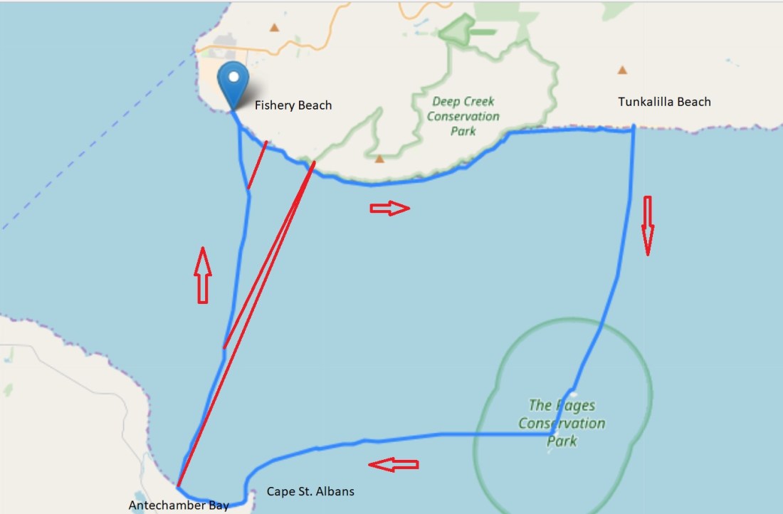
The red lines drawn on the crossing from Antechamber Bay to Fishery represent the bearing the Kayak was headed on, compared to the blue line representing the direction of actual travel.
Other elements to the map are the crossing to the Pages as well as from the Pages to Kangaroo Island. On the map you can see a deliberate curve to the Pages. This was to accommodate for any effect the easterly winds and a small flooding tide might have. Again I over compensated to avoid having to chase the islands as the forces at play try to take me away from them.
The crossing from the Pages to Kangaroo Islands also reflects a deliberate attack of getting to the island. The section of coast between Cape Willoughby and Cape St. Albans can be a very un-friendly section, particularly when exposed to easterly weather. A powerful current collects at Cape St. Albans, and a treacherous reef named “the Scraper” has waves breaking in multiple directions over roughly 400m. It was very much my plan to avoid that mess, then duck around Cape St. Albans from a safe distance.
As I sat on the beach at Antechamber Bay that afternoon, the tide was ebbing and I could see the standing waves made from wind against tide off the coast of Cape St. Albans.
To wrap up, it was wonderful to see Mal as I drifted into Fishery, ending the trip with a traditional handshake.
We shared stories as we drove home, and he talked of how he and a group of others paddled out to the Pages some twenty years ago, being the first group to ever do so. Neither of us had heard of anyone going there since and so a delightful possibility crept into my mind. Had I just been the first to ever solo kayak out to the Pages?
Antechamber Bay – Fishery Beach 19.5km 2hr30m
Total 80km, 2 nights, 11hrs45m on water. Average speed of 6.8kph

Wonderful account of your journey in the kayak and the journey in your head. I have never been a sea kayaker myself but in my twenties used to white water surf in the North Sea off England so I get a little bit of what you are talking about. I’ll never forget the feel and thump of the kayak moving through water. Please keep us all in the loop x
LikeLike