Kangaroo Island by Sea Kayak

Featured

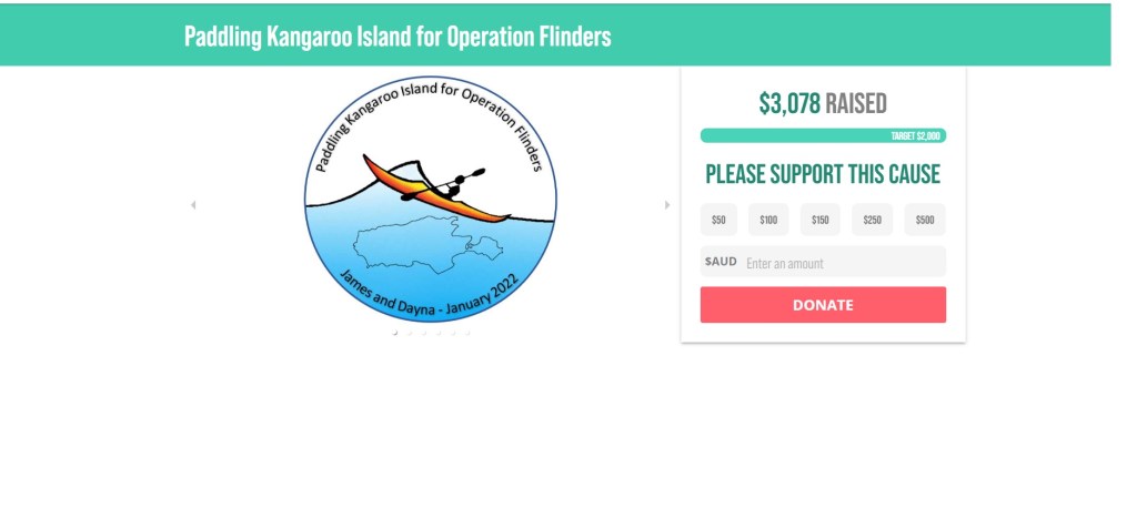
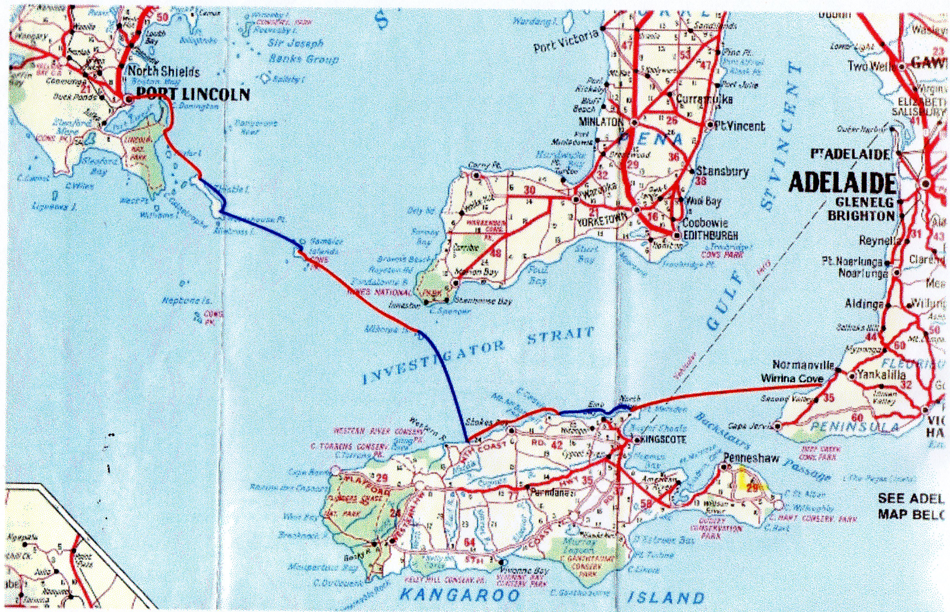
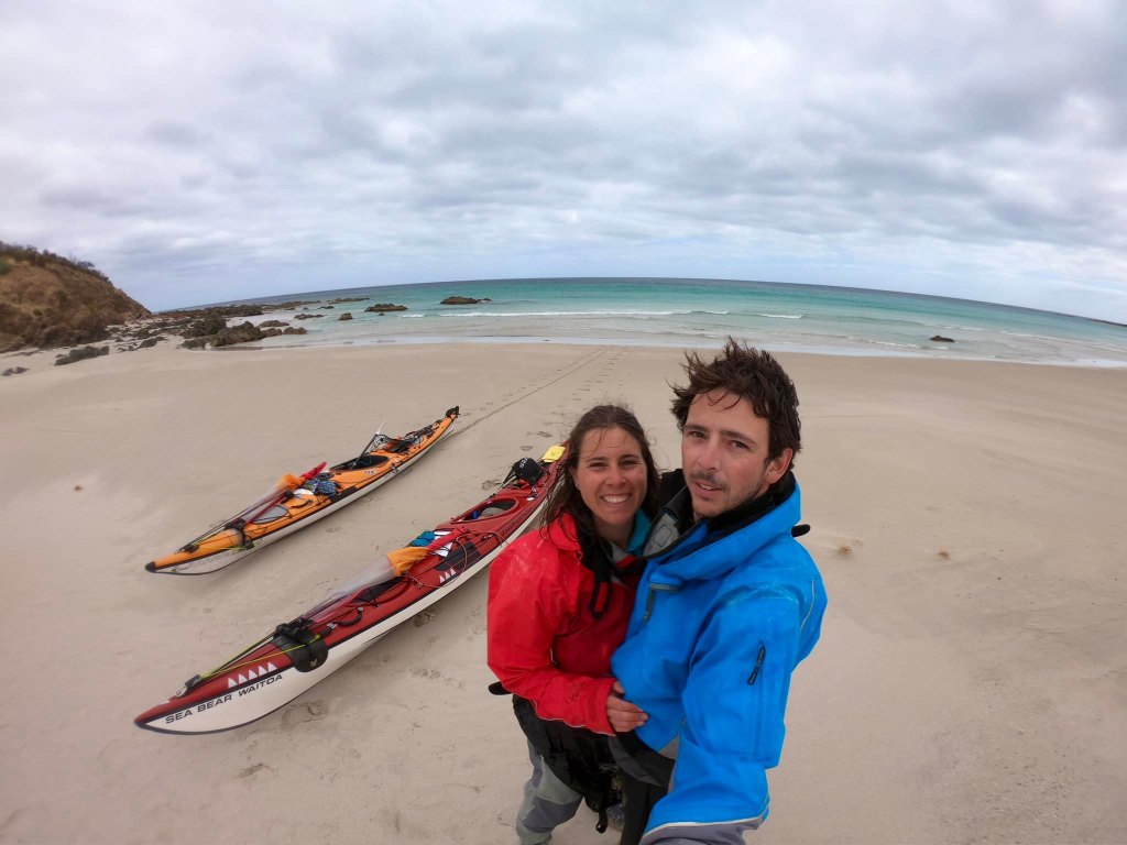
Sea Kayaking Expedition around Kangaroo Island by James and Dayna Fishers

January 2022

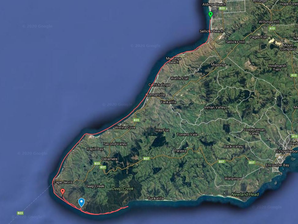
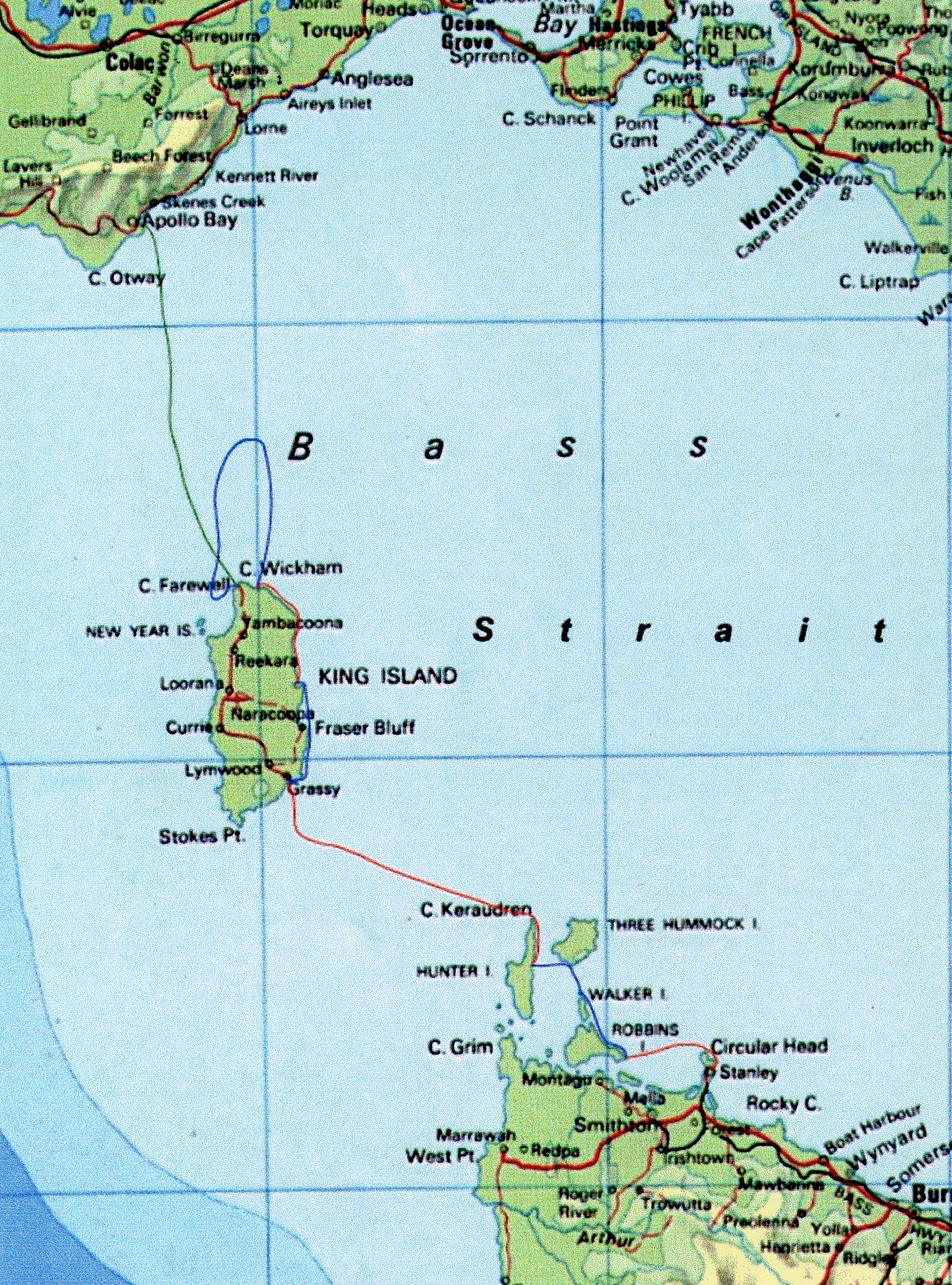
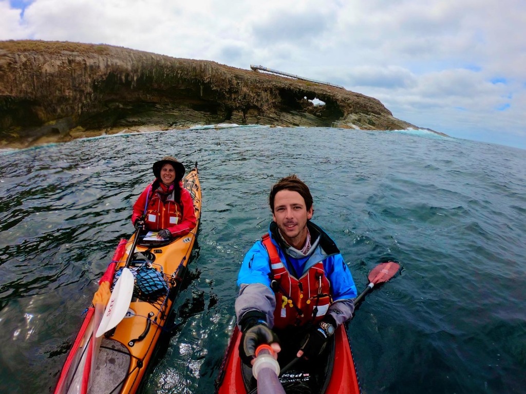
Ever since I started sea kayaking in 2015, circumnavigating Kangaroo Island has been on my mind.
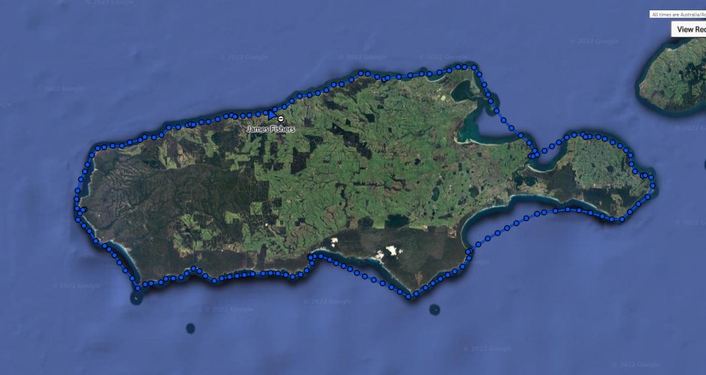
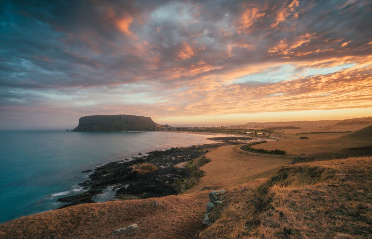
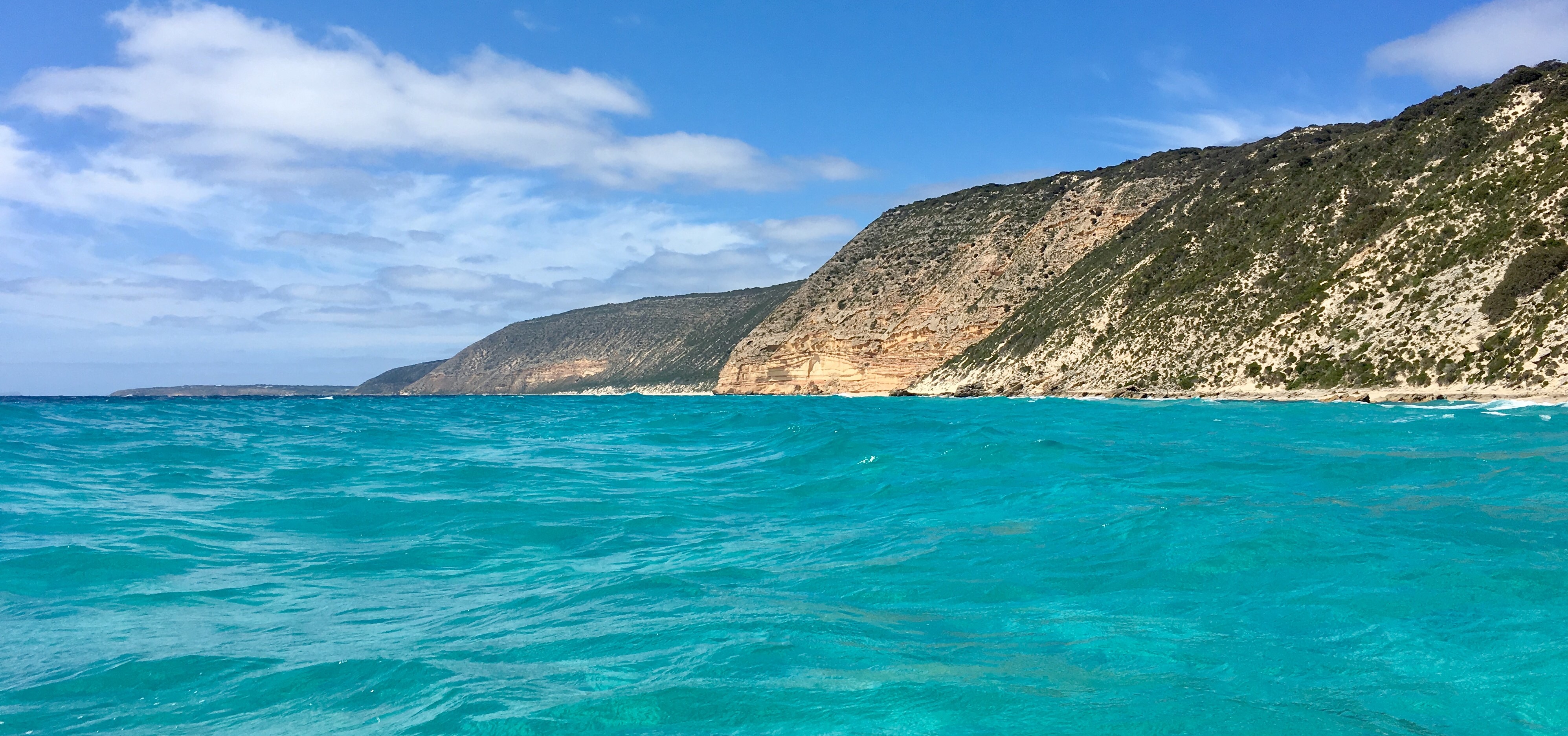
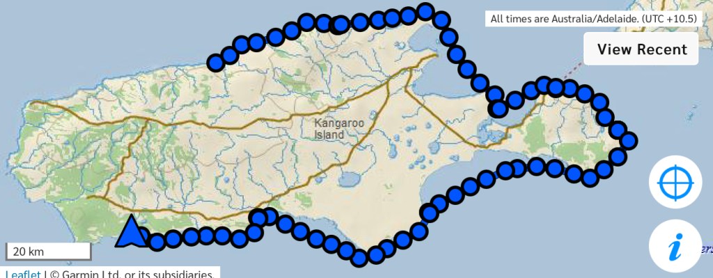
With over 450km of coastlines and sitting exposed to the Southern Ocean, Kangaroo Island has it all for the sea kayaker.

During 2021 I had been struggling with the question “what to do with my life”. As for many of us, Covid had disrupted many things.
Do I continue with freelancing? Go study something else? Or perhaps start a business? Either way, I just knew I had to keep pushing my boundaries and building experience. In October/November I thought stuff it, it’s time to do KI.
Originally I was going to go solo, I hadn’t heard of any one doing it solo before, but after some quick research I found a Queenslander who’d recently done it in just 8 days.

In November I decided to try have a crack at starting sea kayaking business, and supplement my income with freelancing still.
As part of that freelancing, one place I’d grown a passion for was Operation Flinders. I’ve done 7 walks with Operation Flinders since 2017. My honest thought was, well if I’m going to do something as hard as KI, let’s see if we can raise some funds for Op. Flinders at the same time.

Given that KI appeared to have already been done solo before, I offered to my wife Dayna to come along.
I didn’t want to ask her to come or tell her she should come, it was an offer.
With an undertaking like this, I imagined there would be some very challenging moments, and a high chance the weather or something prevents the trip from being completed. I needed for her to choose to come, to make the decision so she would be mentally ready for it. And to somewhat remove my self from being blamed if she hated it!

When Dayna asked if there was anything that she could do to help I said “well the worst part for me is organising food.” To which she said
“Oh, well I can do that, that’s easy”. Happy days.

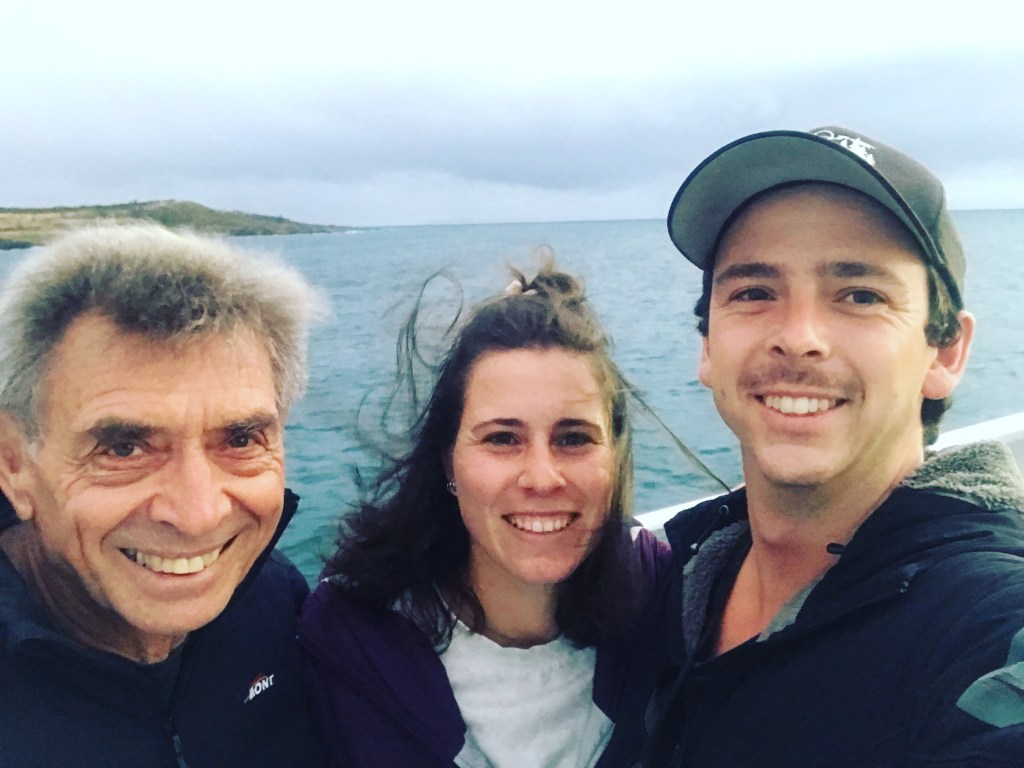
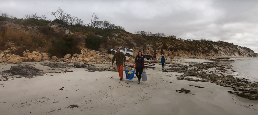
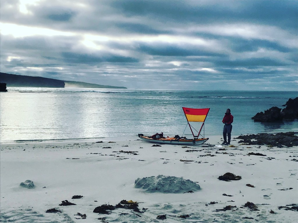
We organised for trusty Malcolm to come over with us. He would have our Hilux and trailer, and follow us around the island. He’d carry a heap of food, water and other supplies to top us up as we reached accessible beaches. As it turned out, without his support the trip would not have been able to be finished.

In December I received an early Christmas present. I was offered the role of Lecturer for the Outdoor Leadership Diploma at TAFE SA – A dream job I thought was out of reach. Starting on the 24th January, this reduced the window set aside within which to complete the trip to just 14 Days. 7th – 21st Jan. Given KI’s weather, it was a pretty small window.

5th January
After very close monitoring of the weather, it looked as if we can start the trip on Saturday the 8th of January.
So far all indicators are that we are going to have reasonably good weather to get us started, which makes me so relieved and happy.
I mean as far as January weather goes for the south coast of KI, it’s really quite good. I am becoming more and more excited, and not so much nervous. This is really the greatest adventure of my life, and Dayna’s so far.
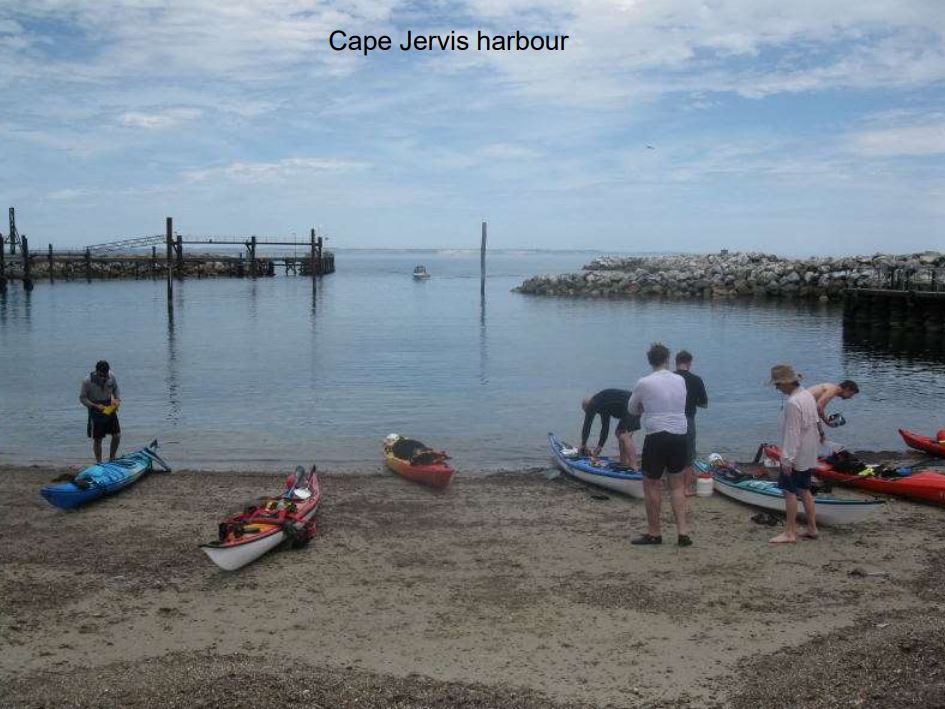
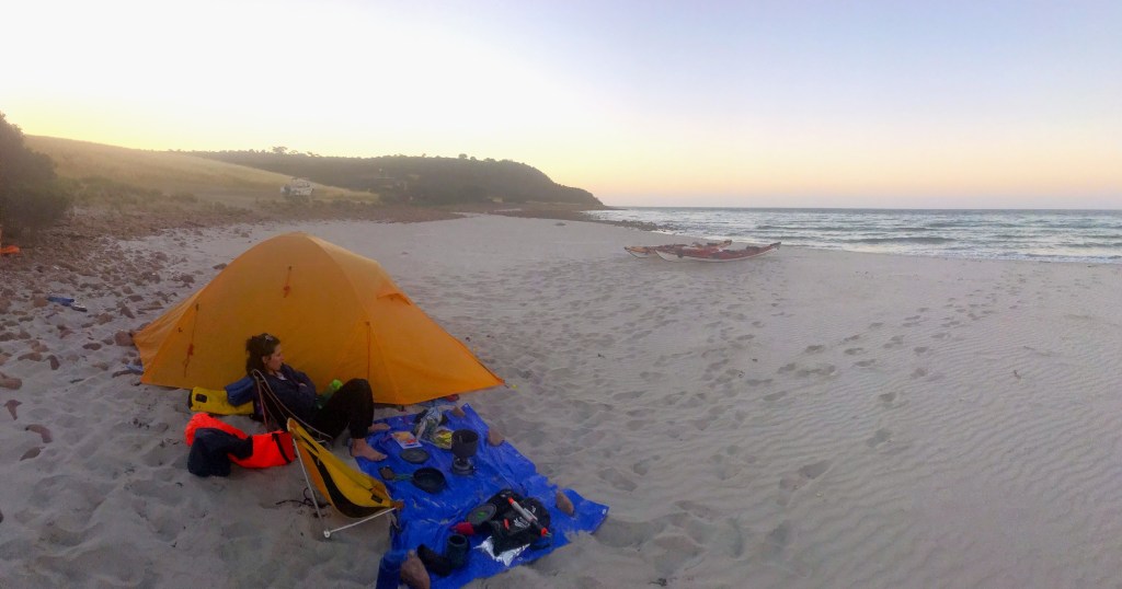
Friday 7th
We caught the ferry in Cape Jervis at 9pm Friday night and set up camp in the darkness at the Penneshaw caravan park. I stayed up to enjoy a beer and ponder over everything.

But, it was nearly impossible to sleep that night, with a thousand things running through my head, and the anticipation of finally starting the trip in the morning.

Saturday 8th January

We took our time in the morning, not wanting to rush ourselves and forget something. Coffee and a bacon and egg roll has become a standard start to many of my sea kayaking trips.

Just prior to launching off in Penneshaw


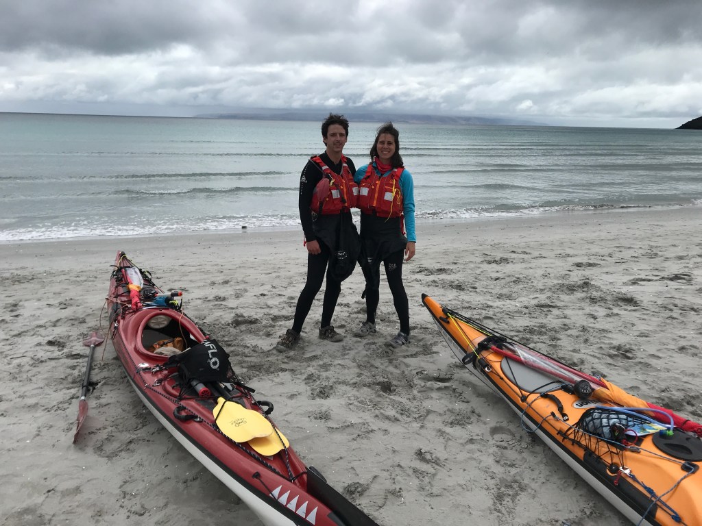
The tide was going to start flooding around midday. It was our intention to be on the water before then to catch the ebb out down to Redhouse Bay about 20km away. A nice easy warm up day before rounding the Capes to the South Coast.
Unfortunately – regarding the tide, it wasn’t until just after 11am that we got going. It was easy at first but became harder and harder.

Headwinds steadily grew, wrapping around the wall of land that makes the north east coast of the Dudley Peninsular.
At Cuttlefish Beach it all got hard. Winds built to 15kt headwinds, and the tide began flooding against us, keeping us below 4kph despite working quite hard. This “easy leg” was taking way more energy than we hoped. The exposure to the wind was even worse once we reached Antechamber Bay.

The 20km took us 5 hours, and I felt ashamed of how fatigued I felt. I developed a very strong headache, causing me to feel dizzy!
Hopefully an early night will fix all after just 4 hours last night.

Sunday 9th January

We woke up to a 10kt easterly wind. We were on the clock today, needing to ride the ebbing tide out around Cape Willoughby and Cape Hart before it started flooding in again around 12pm.
We needed to make 60-65km to D’estree’s Bay today to make the most of the weather, and probably 48km to Vivonne the next day. I can only hope we are up for it!

Dayna woke up to feeling sick an nauseous.
Far out.
Once we go around Cape Willoughby, there are no safe outs for 50km. Do we commit? It’s only Day 2.
She got herself sorted, and as we made our way to Cape St Albans she was still feeling poorly.
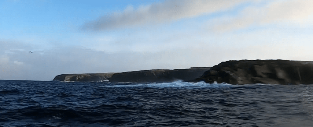
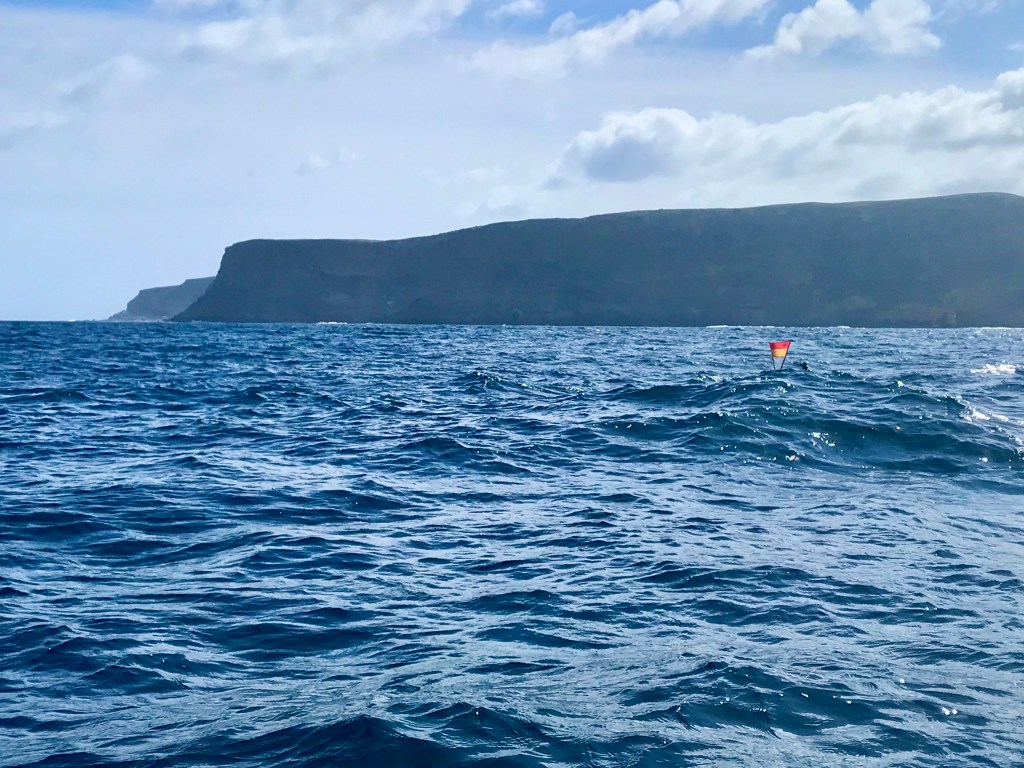
We got sucked into the tide race at the Cape, which was really moving. 1m standing waves, it looked like the water was mad. Then it flattened out.

Dayna dunking her hat at Cape Saint Albans.


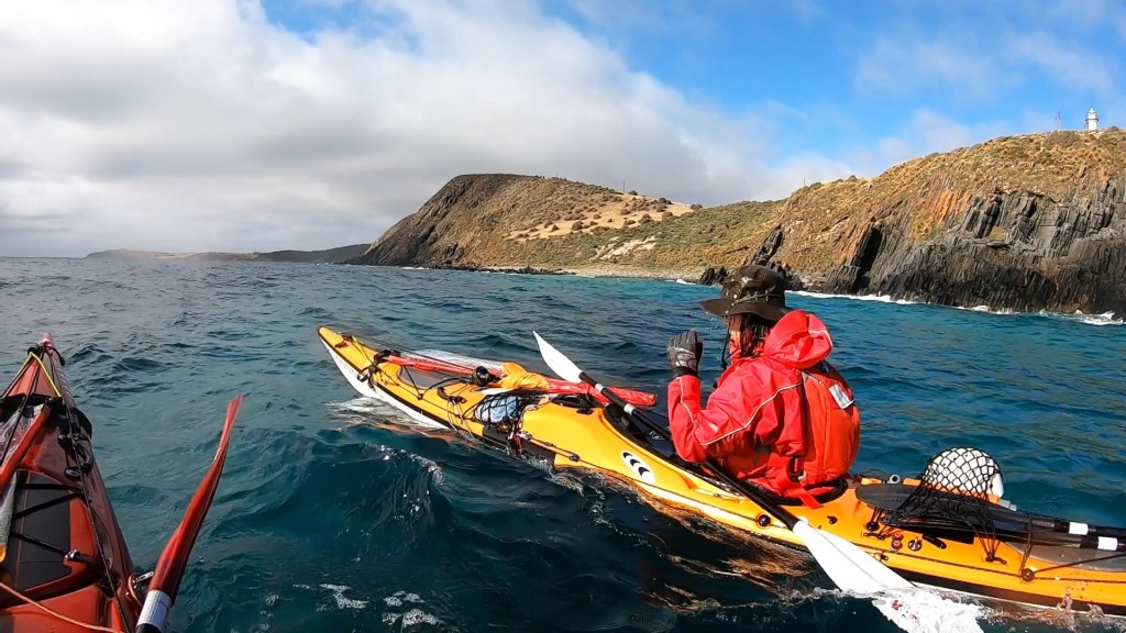
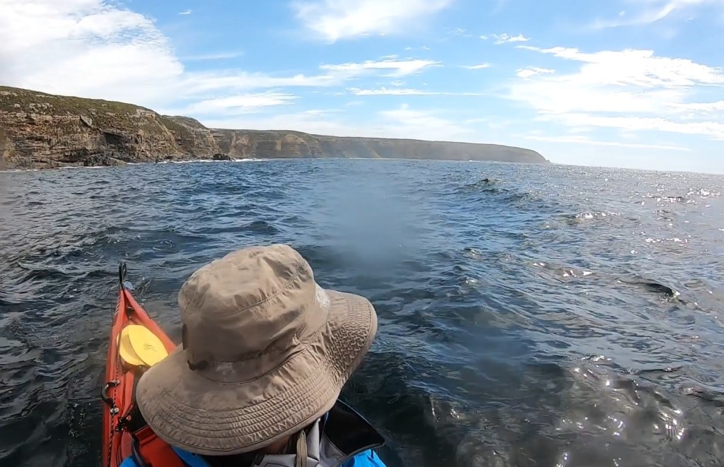
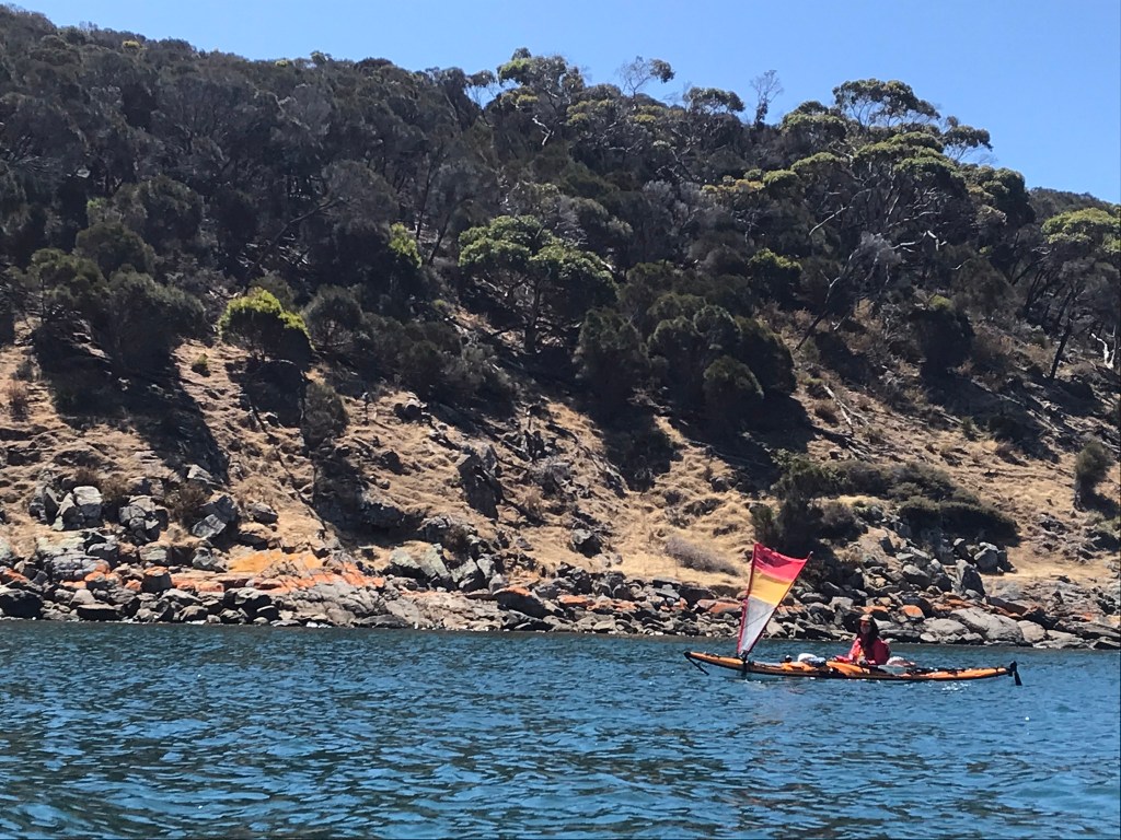
Dayna said she could keep going, so we went on to Cape Willoughby. At first it looked fine, but around the corner the tide was racing even harder! Easily flowing over 3kts, with the waves standing up to 2m, it was the most hectic piece of water I’d ever paddled. It’s an intimidating scene, with the 70m granite cliffs of Willoughby and the isolation that lay ahead of us.

Cape Willoughby


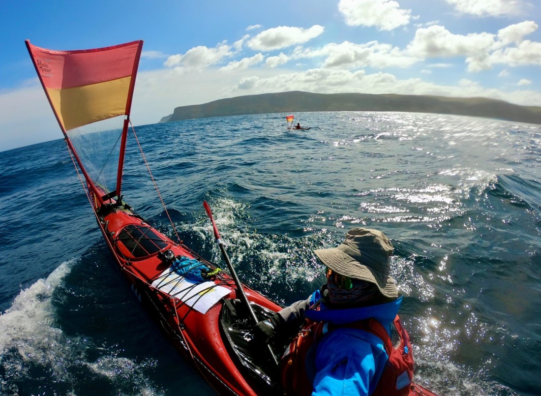
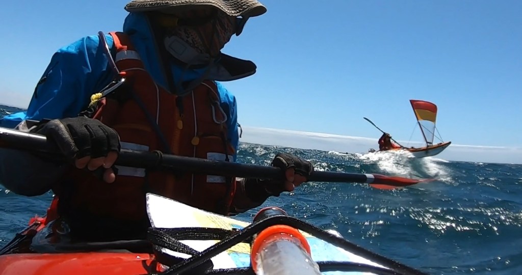
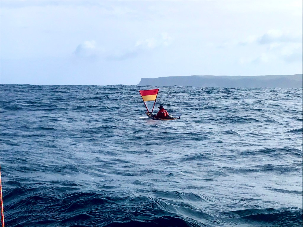
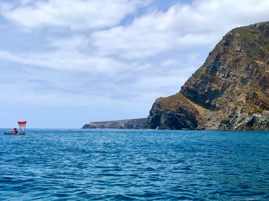
It wasn’t long before we were through the race and the water calmed down. Tracking SW now we flipped the sails up and made a health 8-10kph to Cape Hart with the wind on our beam. It was a pace that gives you confidence that we could make the 60k’s today.
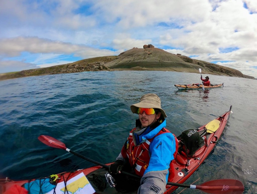
We were now paddling unfamiliar ground for me.
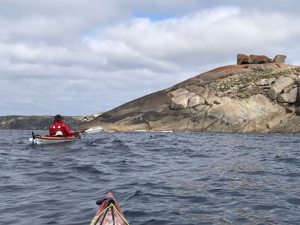
Cape Hart had stunning waves breaking all around, and we marvelled at the size of them.
Then the winds increased to about 17kts ESE, with seas about 2m, and an un-easy feeling crept in. These conditions would be our life for the next 40km.
It just took some getting used to and looking around at the remoteness certainly adds to the mental challenge.
Nowhere safe to land.
To save distance and wind angle, we cut across the huge bay, meaning most of the way we were 4-8km offshore.

7km off shore looking at Pennington Bay and Prospect Hill


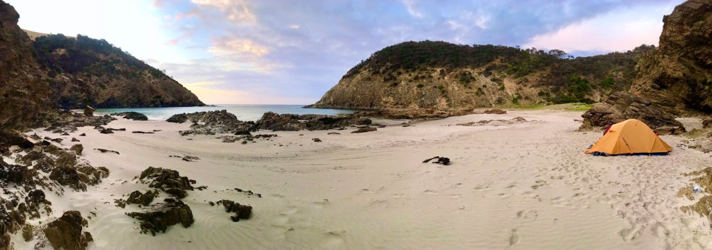
After 8 hours and 61km we negotiated the various reefs off Point Tinline and landed at Wreckers Beach, just past the western end of D’estree’s bay. Dayna’s furthest day on the water yet.

Wreckers beach, named after one of KI’s many shipwrecks. This one being the Osmanli in 1853 which was caught on one of the many reefs.

I suffered borderline migraines and dizziness again that evening on land, and wondered if this was to be the pattern each day.
It wasn’t long before Malcolm’s head popped up over the sand dune to have a chat.

Wreckers Beach Sunrise

Day 3, Monday 10th January (81km total)

Vivonne Bay is the goal today – 48km via Cape Gantheaume, the southernmost point on the island.
Then a race to Hanson tomorrow and a few days rest after that as the weather was forecasted to come in windy. We needed to make the ground to keep the trip alive.

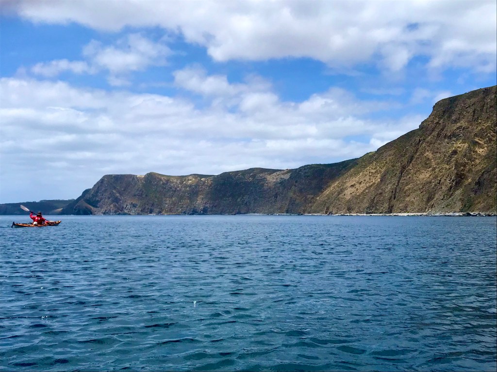
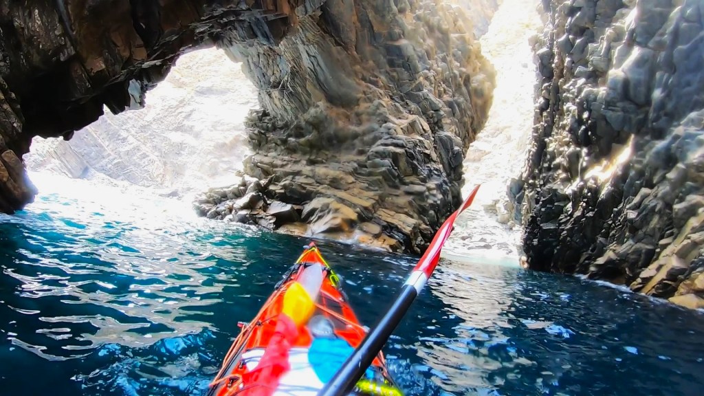
We woke to glassy conditions, and warm air. It was spectacular paddling through the breaking reefs, and then alongside the cliffs towards Cape Gantheaume. Truly out towards remoteness and exposure.

Looking back along the cliffs of Cape Gantheaume


Once again Dayna was plagued with dizzy nauseating spells. Relieved temporarily by dunking her hat in the cold water. But she was determined to push on.
Cape Gantheaume was spectacular and terrifying. The deep Southern Ocean swells pushed up onto a ledge at the Cape. Though it was only a 2m swell that day, at the Cape they appeared to be more like 4m. At the same time a gloomy cloud cover came over, and the wind came to life.

Big swell pounding into Cape Gantheaume


Suddenly fear started to creep into both our minds. Once again seeing the sheer remoteness of our location, it sank in that this would truly be one of the worst places imaginable to be in if the weather was to deteriorate un-expectedly. What are we doing here.

We pushed on, getting used to having these big swells roll under us, just knowing the only solution was to move. The sense of enjoyment vanished with an increasing heart rate. Survive. Stay on top of your emotions.

Fortunately, after an hour conditions settled down. And while we passed Seal Bay from about 4km offshore the wind began to die.
Still 20 odd km to go.
At 2pm Dayna broke and remained so until we landed in Vivonne at 3:30. She had developed horrible chaffing on her armpits, lower back and butt. The battle raged in her head – how was she going to keep going tomorrow, already feeling broken by day 3.

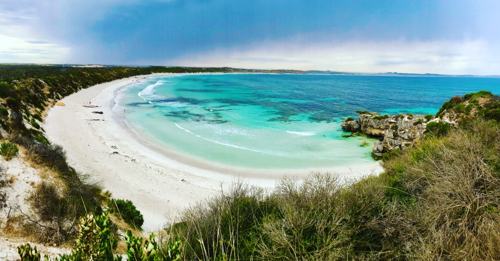
Finally we approached a busy Vivonne Bay.
We had to tuck in to a beach near the far western end of Vivonne to get protection from the Southern Ocean swell.
But this meant people, and many more than we had thought to anticipate.
49km over 7.5 hours

After we had settled in, I went to check the new weather forecast. Originally, we were going to try beat the wind by pushing to Hanson Bay (36km) in the morning. However, the fresh forecast indicated it would come in at 18-20kts ESE, but that Wednesday would be more friendly. So no paddling tomorrow. Besides a rest day would not go astray.
My headaches returned, though not as bad this evening.

Progress after 3 Days’ paddling

Day 4, Tuesday 11th January

It was delightful to have a lazy morning, enjoying the coffee and the spectacular scenes at Vivonne.
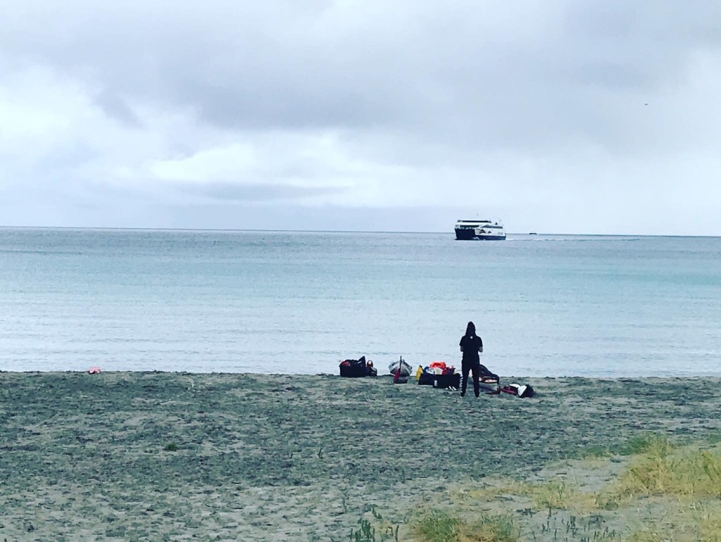
Rest days are fantastic, they make you stop. Though we had a little bit of what we called “choring” to do. We organised to pick up fresh supplies from Malcolm at the boat ramp about 400m away.
So from 10am – 12pm we were busy with that. Then the wind came in hard, so we thought we’d move 70m up the beach and hide from the wind in the cove there. So, we dragged all the gear.

Our rest day was becoming far from restful, especially now our presence on the beach was certainly being noticed. We hadn’t originally planned to stay here this long, near people.
We’d talked with plenty of curious locals, who wished us well.
But then one local came over to us, firmly telling us to move off the beach.
Later another local came to tell us to move but refused to come within 4m of me for fear that I had brought covid over from the mainland. I could not hear her over the sound of the wind and waves.

The conversation with the first local was extremely difficult, with no appreciation for our situation.
Reasonably enough she told us to go camp in the public campground. So to appease her I set off to investigate the Harriette River campground, some 500m away, which was entirely full.
Later she came back, telling us again that we can’t stay where we were.
I told her the campground was full and looked out at the Southern Ocean, covered in white caps and simply pleaded that there is nowhere else to go. She then threatened that if we stayed, we’d find our tent burnt down and our kayaks smashed up. We still couldn’t move.
Later she threatened to call the cops on us. I wondered if the cops would dare send us out on the ocean during dangerous conditions. In fact, I wondered since she was the one making the threats of violence, maybe they would arrest her for us. Go on..call the cops.
Eventually we were able to have more of a conversation, as I seeked to understand her and get her to empathise with us.
She explained that tourists were always coming and driving on the fire damaged sand dunes and camping where ever they liked. She then expressed that she felt the council never do anything about it, so they felt it was up to them to “defend” the town. The image of us camping on the beach then raised questions to other tourists, “oh, we can camp on the beach”.
I could totally understand her perspective. Once she learned we were “outdoor educators” she said we should know better.

There was a sick uncomfortable feeling in our stomachs, and our rest day had now nearly entirely been unrestful.

To help the situation we decided to pack up all our gear, as to make the appearance we were just chilling on the beach with our kayaks. Not camping. This would not be the last time I’d use this tactic.

A fresh forecast came in that evening, and the game had changed once again.
The winds had changed drastically to be 20-25kts Westerly for the next 3 days.
I was quickly on the phone to David Williamson, whom was “spotting” the trip for us.
His advice was that we might need to re-consider how we look at the trip if we are to make it all the way around. If we wait for the weather, we’ll loose 3 days sitting in Vivonne Bay.
After today’s experiences, I wanted nothing more than to get out of there.

It had always been our intention to paddle KI in a continuous loop, but now it looked like we would have to let that go.
Dave reminded me that being a sea kayaker is about being as flexible and dynamic as the ocean itself. That a smart sea kayaker would use the elements to their advantage.
So it was decided, we would extract out of Vivonne Bay, and head to Snellings Beach on the North Coast, and run the strong westerlies to Penneshaw.
This solved a problem that I feared might come. That during January’s prevailing South Easterly winds, we might have to paddle against them on the North Coast – originally a problem for later.
The only issue was a communication flaw with our on land support – Malcolm. Still wielding a flip phone from the 2000’s, and conscious of getting a flat battery, had already turned his phone off for the night, and we did not know when it would be turned on again the next day. He was camped at western KI caravan park, and for our plan to succeed we needed him to meet us at Vivonne as early as possible so we could move and get started on the north coast.
We did not manage to get hold of him that night.

Oh and then finally after dinner, close to 9pm we set the tent back up and went to bed. What a busy “rest” day.

Day 5, Wednesday the 12th
We got up early to pack up the tent ASAP and remove any trace of us being there.
Scooted 500m on water around the corner to the boat ramp, and carried all our gear up to the car park. It wasn’t until about 9am we got hold of Malcolm, who was able to get there within an hour. The plan was alive.
Goodbye Vivonne, we’ll be back later.

By 1230 we were underway heading east out of Snellings beach. Winds were fresh, building from 13 kts to 20 kts. Under sail we were able to poke our noses into the many spectacular coves along the North Coast, turning green with envy at all the houses with their own private beaches. How.

North Coast
Springs flowing half way up the cliff near Cape Cassini


I was beginning to learn something about KI that I was beginning to really dis-like. Almost any beach that was not exposed to large swell, either has a road, houses or people on it. A seriously lack of empty, inaccessible beaches that only a sea kayaker gets to enjoy, unless you risk the thumping surf on the south and west coasts.

As we moved east we found the tide began to run against the wind at Cassini, and produced really quite a large sea state up to 2m. We began to discover the discrepancies between Dayna’s kayak and mine. The rudder on my Sea Bear is significantly bigger than on her Marlin. This meant I was able to track significantly straighter in the following seas than Dayna, who endured endless zigzagging. This explains why after Cape Cassini I was happy to push on, but she was more than ready to call it a day, and at 5pm we pulled in to Dashwood Bay.
 I was pleasantly surprised by how pretty it was, much prettier than I expected.
We began our routine of setting up, replenishing food and water and drying stuff out. Unfortunately, now we had to deal with a new thought that would not leave us for the rest of the trip – are we going to get heckled or threatened today. Fortunately, we did not see anyone. To gain phone service, a decent walk was required up the road. After draining most of my phone battery on 1 bar of 3G, the weather was looking the same as it was the previous day. Good sailing weather.
That night Dayna made fantastic burritos for us.
We managed 34km in 4.5 hours taking us to 162km so far.

On a positive note, I did not experience any major headaches that evening, and Dayna didn’t have any dizzy nauseating spells on the water.
We were both beginning to learn that perhaps there is a direct correlation between the suppressed emotions – fighting to keep the fear and panic down – that caused our bodies to behave this way.
Dayna’s anxiety manifesting in physical ailment, and mine in headaches as I exited “survival mode” upon safely landing.
She had experienced these symptoms on her first crossing to KI, and last year when we attempted to paddle to Saint Francis Island.
We had now become more comfortable and confident in our ability to handle the ocean. We had faith in our kayaks to keep us alive. And perhaps our bodies had adjusted to the rigor we were putting them through.
I believe that corresponded to our symptoms returning no more for the rest of the trip.

Up the hill to get phone service at Dashwood Bay
Dashwood Bay Camp

Day 6, Thursday 13th

We woke up both feeling quite tired, we hadn’t managed to sleep very well.
Another discovery to our surprise was that we seem to be eating 1/3rd less than what we usually would at home. We seem to get hungry, but it’s okay. Then we just seem to fill up easily.
Another windy day on the water, but wind that was assisting us. For me it was one of the easiest 53km I’d ever paddled. It wasn’t so for Dayna, with her boat continually zig zagging all day.
We rounded North Cape – KI’s most Northern and North-eastern Point, and we could see the Fleurieu and Dudley Peninsula’s again. It was a weird thought that originally this view was going to signal the near end of the trip. But not any more.
We cut SSE south towards Ballast Head, skipping Kingscote and running aground on the Beatrice Islets. This gave us a nice break from the sea state before we surfed down to Ballast Head averaging 10kph.
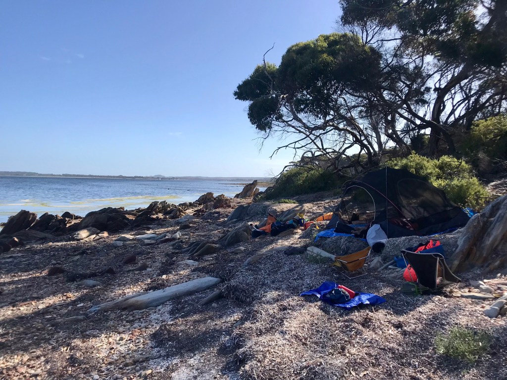
We planned to camp near Ballast head, but what was a beach last time I was there, was now just rocks. So we pushed further in towards American River, and out of the wind.
After today’s effort we had now completed over 200km, and that felt fantastic.
We had plenty of time to relax in the afternoon on a stunning bank in the shade of trees!
With a short paddle to Penneshaw tomorrow morning, our minds were already on the unfinished business of the Western Half of KI.
From Penneshaw we’d get picked up by Malcolm and move to Kingscote to reset and shower at the caravan park. Amazingly at this stage the weather looks brilliant, but with more strong SE winds coming later, we couldn’t afford to miss a day of paddling.

53km, 7hrs (217km total)

Having a break on the Beatrice Shaols
Surfing waves in Nepean Bay
Camp just outside of American River
Progress after 6 Days

Day 7, Friday 14th

Almost instantly after setting off from American River we both quickly felt the weight of fatigue. It was a gloomy overcast day with light misty rain. We were very thankful for the wind kindly blowing on our backs all the way to Penneshaw.
We landed at 1030, loaded up and set off for Kingscote, arriving by 1230.
We showered, washed clothes with body soap and set out our food for the next 5 days. Then we ducked in to town to pick up a pizza and a beer
In bed by 8pm.
We had completed 233km.
Only 5 days left an 150km.
We are so close, yet this last bit we will be the most tired.
The North Coast, though windy, had been a nice reprieve from the seriousness of the South Coast.

Day 8, Saturday 15th

We were now back in Vivonne Bay, gearing up to survive the last leg of the expedition.

Heading towards Pt. Ellen


Paddling out around Pt. Ellen was exciting, we were back in exposed waters, however the joy soon evaporated.
A wind set current seemed to be working against us from all the westerlies. The wind was only around 10kts southerly, but because of the geography of the land, this translated to a head wind for half of the day.
It became a real grind.
It would have to have been my least favourite day of paddling so far, as I found the coastline “uninteresting” compared to the other days, the water felt thick and hard and the day just seemed to drag on, managing only 5kph.
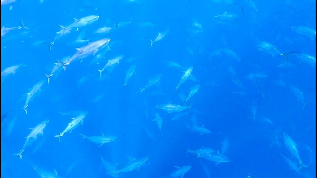
The highlight of the day though, was paddling over two massssive schools of Tuna, over 70m long. There were so many that they disturbed the surface of the water, making it look like tidal flow.

Schools of Yellow Fin Tuna below us.. Still no shark sightings


We saw 3 boats too, bringing the grand total of boats seen on the south coast so far up to 4. Not many people around.
We spend large amounts of the day paddling 50-100m apart. Not because we were sick of each other, but because it was just hard. It was easier just to get into your own rhythm. I looked over to see Dayna singing along to herself.

Near Cape Bouguer


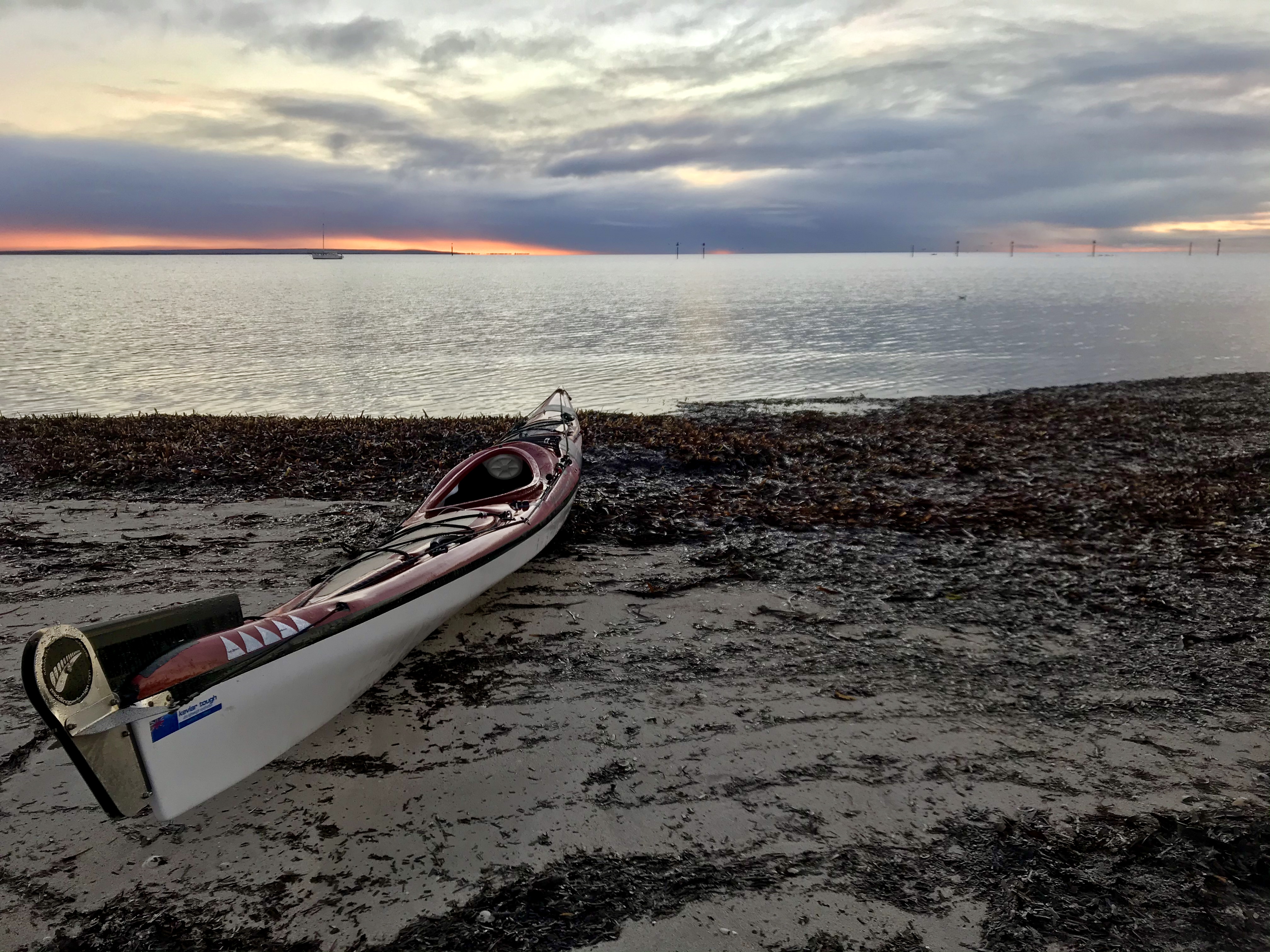
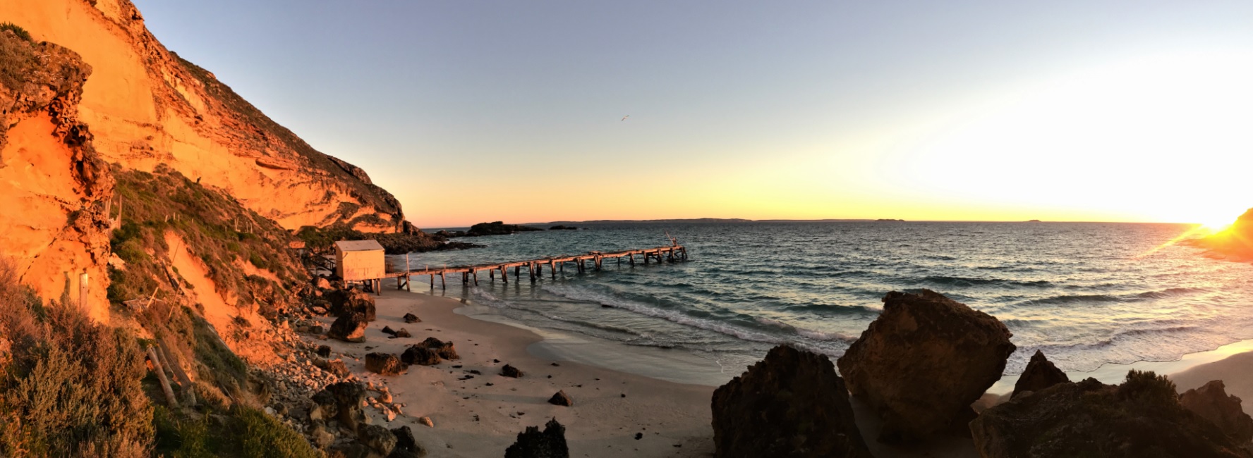
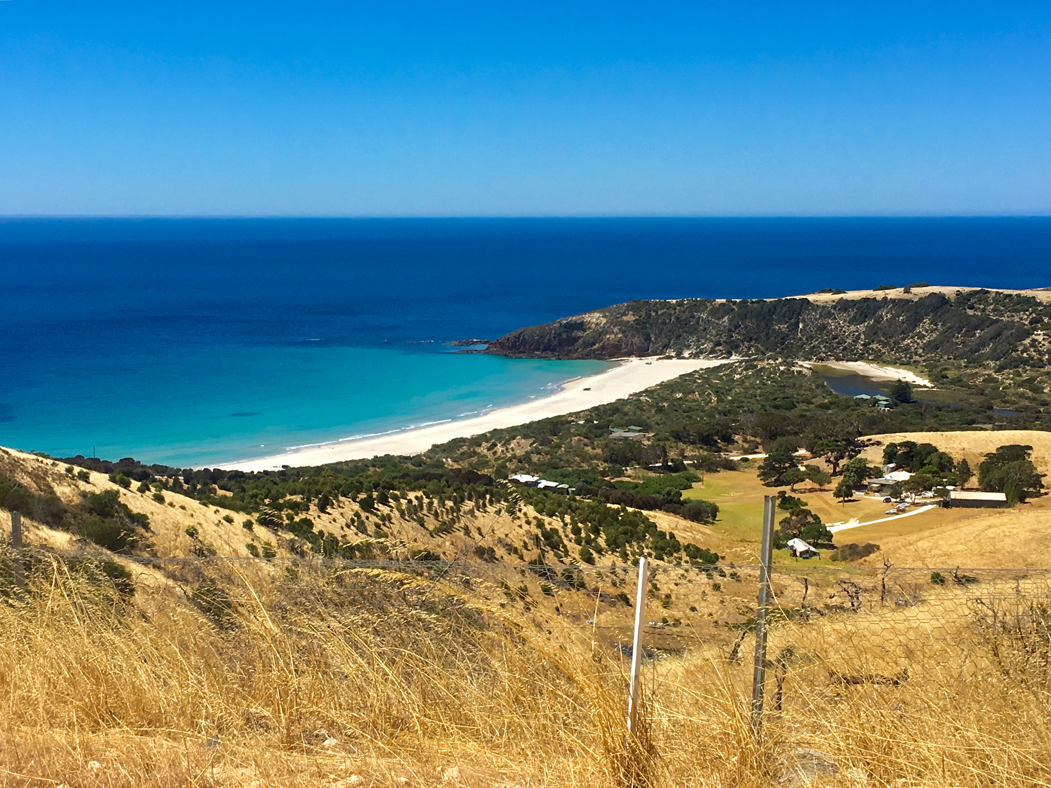
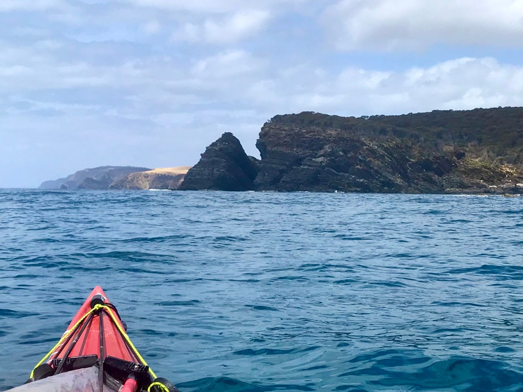
The last part of the day was playing on my mind though. The entrance to Hanson Bay is guarded by a series of reefs, with a deep narrow slot as the gateway. Southern Ocean swell breaks on the surrounding reefs. Only on big swell days does it break in the deep slot but finding it from the seaward side can be a challenge. When we arrived, I was relieved to find the swell extremely small, with barely anything to worry about. Launching and landing remains one of the most nervous parts of the sea kayaking day when on exposed coasts.
We landed, went through the routine, and shared the beach with a number of families who came down for the evening. This again sinking in how much I appreciate the other offshore islands of SA, where you have it all to yourself.

Hanson Bay

Day 9, Sunday 16th

Today is a big one.. Around Cape Du Couedic and on to West Bay for the night, 45km or so.
Then we plan to run as far as we can to snug (45km) to reduce the distances remaining with horrid 20-25kt SE’s (Which would translate to headwinds) forecasted for Tuesday and Wednesday.

Getting ready to leave Hanson Bay

The morning was spectacular. Barely any wind, minimal swell. The forecast was for light variable winds in the morning, and then a 10-15kt SW in the afternoon, which sounded perfect to push us up the West Coast.
It meant we could get right up close to the Remarkable Rocks and Cape Du Couedic. A true highlight.
Malcolm and Alison waved at us from the viewing platform at Cape Du Couedic.

Remarkable Rocks
Admirals Arch, with Malcolm and Alison looking down at us


It was then on to cross the massive Maupertuis Bay to Cape Bedout.
During this stretch the wind built from the WSW. The forecast said a SW’erly, and we banking on it.
But what we experienced had far more westerly in it than it did southerly.
At first it was a fantastic aid enabling us to sail, but the westerly in it was also driving us into the bay. Even though you can see it on the chart, we both underestimated the depth that Maupertuis Bay has, and the NW angle you need to clear it. It’s huge.
We were driven in close to the coast at Cape Bedout, and a real struggle and battle began.
If we rested, we were driven into the rocks, where the clapotis waves became very unfriendly and made for slow paddling.
From here it took 2.5hours of fighting to round the Paisley Islet at the start of West Bay.
It’s a horrible yet motivating feeling – paddle or die.
Every half hour we would turn our kayaks into the wind and just grid away for 20 minutes or so until we had reclaimed enough ground. Then we’d flick the sails up to pick up the pace for a while, then repeat the process.
There are a number of remote beaches in that section, all exposed to thumping surf. If we landed at any of them, we were not getting off them any time soon as the swell was forecasted to jump up to 4m tomorrow morning. Everywhere else is just deadly rocks and cliffs. With the elements against us it was push on, or perish.
If there was a safe beach, in that moment we may have taken it. It’s amazing how not having a choice enables you to push on.
It was at some point during this battle we clocked up 300km for the trip. We had a feint celebration, and kept going.
We gave Paisley Island a wide birth, as deadly swell train can build in front of it, and I did not want to play chicken with it.
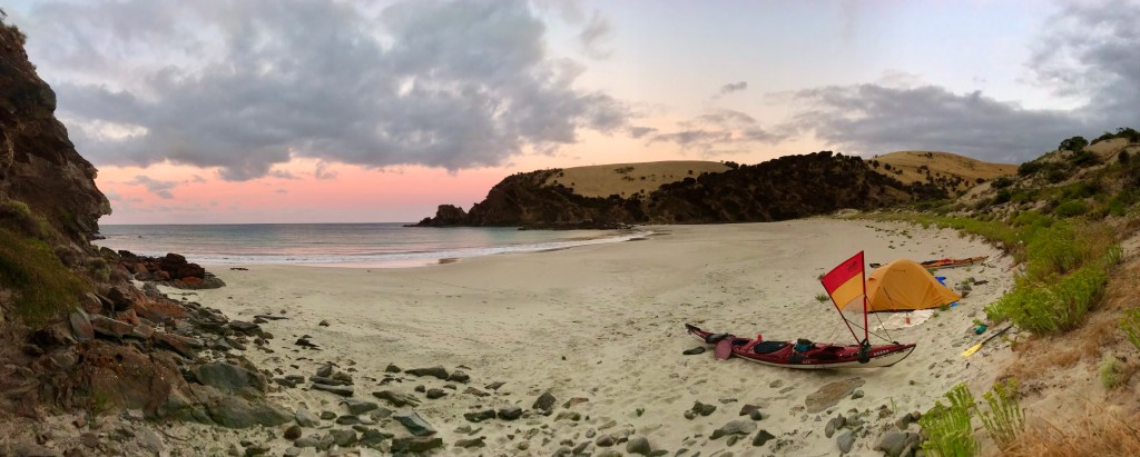
Finally we turned North-East and began heading into the depths of West Bay.
Now only one question was on our minds.. How big is the surf landing going to be in West Bay? It can get big, and very dumpy.. the last thing you want at the end of a big day… But it is the safest landing spot on the entire west coast.
As we drew near we could make out Malcolm on the southern end of the beach – closest to the carpark. We ignored him and went for the Northern end of the beach – the furthest from people!

We were delighted to find about only a 2 – 3 ft wave breaking in the bay, which made for a safe and easy landing.
another afternoon of choring and collecting fresh supplies from Malcolm.

Our stomachs began to drop when a lone figure came onto the beach, walking straight towards us. She appeared to have uniform. Were we going to be asked to move again?
To our great relief, it was someone we knew just coming to say hello! Phew.
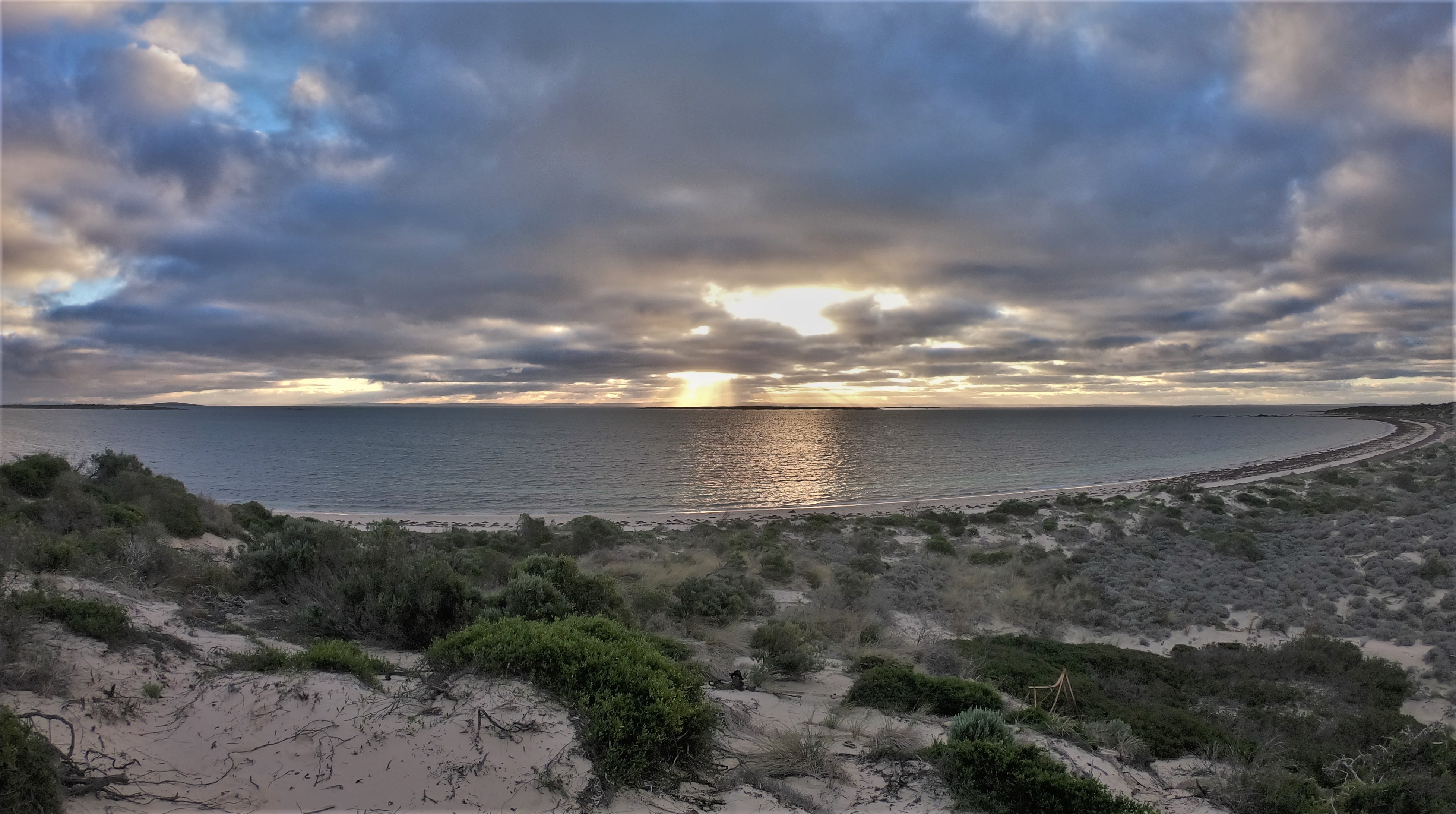
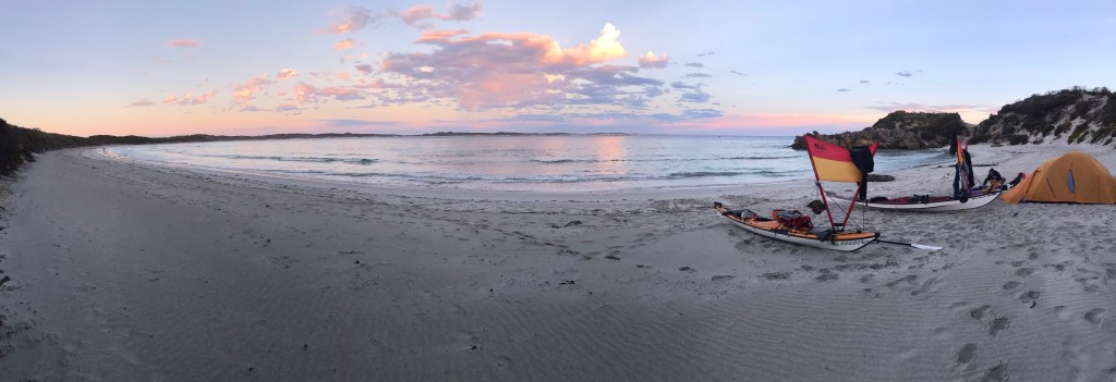
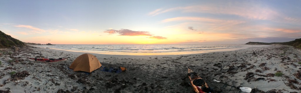
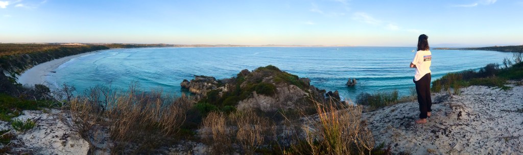
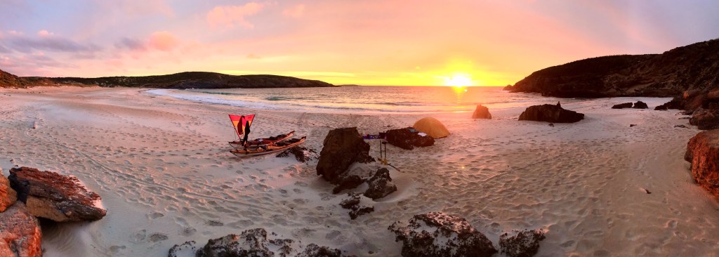
Finally we could relax and we were rewarded with a truly spectacular sunset.
I sat and pondered, “One more big dangerous day, and then we could breathe a little easier.”
Get out of West Bay, round Cape Vennachar and Cape Borda and on to the north coast again.
One thought however kept me awake at night.
The forecast was for the swell to increase during the morning, from 1.5m to 4.5m.
Will we get on the water in time…
If we can’t get out, then the trip is over.

We are both becoming ready for home. Has it been enjoyable? Not all that much really.
Is there satisfaction in what we have achieved? Absolutely. Huge.
45km, 8.5 hours. 314km in total

West Bay Sunsets

Day 10, 17th January

I was up just before 5am, concerned for that building swell.
We managed to be on the water by 0720. The swell had increased, but not greatly yet. The sets were still big enough to cause my adrenaline to go through the roof when launching. Thankfully we both got out unscathed.
The water was even more unfriendly as we ventured out of West Bay. The forecast was for 10-15kt Southerlies – this was looking fantastic to blow us up to Cape Borda.
As we poked our noses out from the protection of West Bay towards Cape Vennachar we met some very demanding water. Some serious water.

Ominous Cape Vennachar


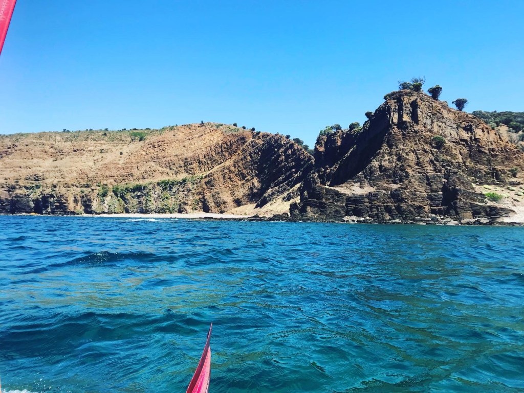
Cape Vennachar gets its name from a tragic shipwreck that occurred there in 1905 where 31 lives were lost. I could now imagine the horrible conditions they must have found themselves in.

In my fixation on the building swell I had neglected the tide.
Being on the west coast, the tide runs parallel to the coast, as the water floods and ebbs from the gulfs above. Cape Vennachar being the Western most point on the Island attracts quite a strong tidal flow it turns out.
And the tide was ebbing – flowing against us for the next 2 hours, and against the wind.
The conditions we found ourselves in were:
Tide running South
Wind blowing to the north against the tide.
4m swell from the SW.
Left over sea state slop from the WSW.
Rebound waves coming off the cliffs from the east.
Summary; scary and horrible.
I dared not take my hands off the paddle to use the go pro and we didn’t feel comfortable to use our sails with all the steep breaking whitecaps around. Every few seconds we would disappear from sight from each other, as we fell into troughs between waves. Sight of land would disappear as well. I looked at the ominous cliffs of Vennachar and recalled one of Malcolm’s’ stories from when he paddled past in 87-88’
Those cliffs were roughly 30m tall and when he went past, the waves we big enough to splash over the top of them. He said the sight of it began to make him hallucinate, so he paddled on waving at this classroom.
For us there was very little else to do, except just hang in there.
Wait for the tide to ease off.

Dayna looking very small compared to the water


After the first hour we had made it less than 3km.
After 2 hours the tide began to relent, and the land fell away to our right as we moved North. Conditions eased and we became brave enough to start sailing.
Conditions continued to improve as the big 4 -5m rolling swells would block our view of 160m tall Cape Borda.
The coast between Cape Vennachar and Cape Borda is meant to be truly spectacular. Unfortunately, in that moment we were not keen to hang around and check it out, and remained roughly 3km offshore.
We bee-lined it for Cape Borda, eager for the relief the North Coast would offer us. One more tide race and we would round Cape Borda after 4 hours of paddling.
A huge sense of relief came over us under the northern cliffs of Cape Borda. The water became calm and it felt like we had completed KI. We had now rounded all the corners, and the treacherous South and West coasts we now behind us.

Cape Borda in the distance
Coming up to Cape Borda


It was a totally different day on the North Coast. With winds from the South, we experienced what is known as “bullet winds” where the wind comes over the cliffs and dives down and hits the water vertically in un-predictable blasts. When they hit, they were easily over 20kts, and would last a minute or two.

North side of Cape Borda
Cape Torrens

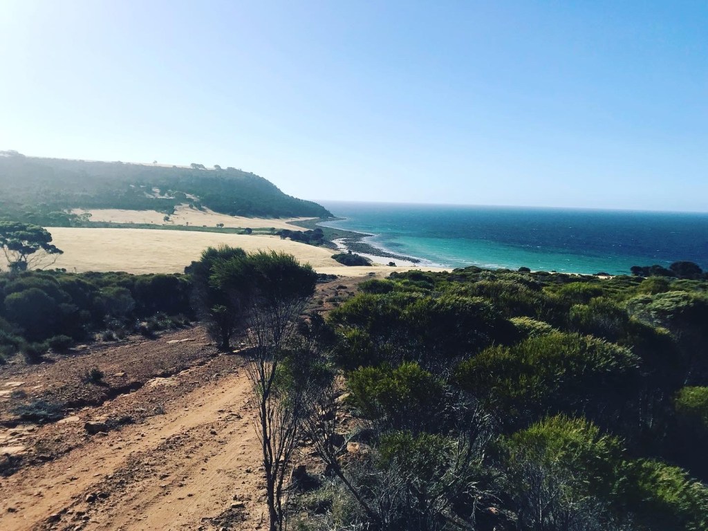
We were keen to camp at the secluded Harvey Bay – it looked phenomenal from the sea. But the knowledge of 20-25kt headwinds coming over the next two days was enough to keep us pushing onwards.
The tallest coastal cliffs in South Australia – Cape Torrens (270m) cliffs towered over us. And the coast from there to snug cove were some of the most spectacular I had seen.

Near Kangaroo Gully

After 45km we landed in Snug cove – a place I had dreamed of seeing. It wasn’t long before we were visited by a 4WD – the landowner. That dreaded fear sunk in again, are we going to get kicked off. Fortunately, he informed us that he can’t stop us camping on the beach.
I was getting very much sick of coming across people!

Now only 20km remain over the next 2 days. Yet, they will not come easily. 15-25kt headwinds are forecasted, but we know we’ll be fine. We are yearning for home and struggling to appreciate this moment we are in.

Snug Cove

Day 11, 18th January

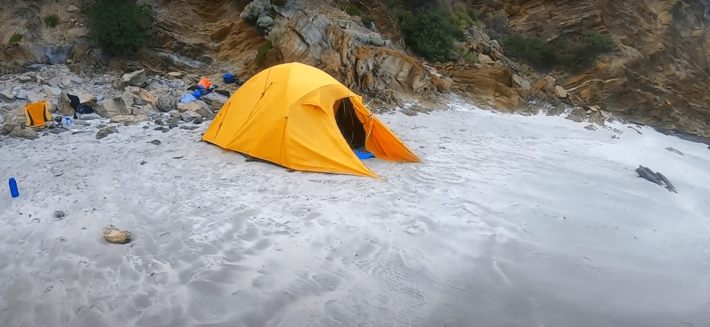
We woke at 3:30am to a nightmare.
Earlier as I had sat observing snug cove, I noted the waves performed in an unusual manner. It must have something to do with the shape of the bay. The waves would come in and build in height over 2 or so minutes. Each wave filling up the bay more and more. Then it would just drain and drain for a minute or 2 before it repeated the process.
We were nearing the spring tide and had set up our tent as far back as we could.
We woke to water streaming past us, spilling into the tent in a long long surging wave. It then drained and drained past us. I leapt up to assess the situation. Were the boats still there?
High tide was still 15 minutes away.
Another two big wave surges came, and after that the tide began to relent. I found my paddling shoe a few hundred meters down the beach. All the vestibule gear was soaked and covered in sand. Dayna was busy sponging out the tent. Exhausted, and with the threat over, we fell back asleep thankful that we didn’t have to relocate.
It wasn’t until 0745 that I got up that morning, a rare luxury afforded only once previously on this trip in Vivonne Bay.
The morning was slow, spent drying everything out again, and finding items like spoons scattered around the place.
The landowner checked in on us again and was friendly enough.

You can see there is no dry sand anymore. Water went up to the rocks


On water by 1015 we were met instantly by strong buffeting winds, both remarkable and scary.
We still managed 4-5 kph most times, except during the gust periods. A 5 minute spell of 30-35kts was brutal, and nearly sent us backwards, threatening to drive Dayna into the cliffs.
“Forwards!” I yelled
“ I am trying!” was the response. The crisis averted.
At 1335 we met up with Malcolm at Western River Cove. After evaluating the winds we decided to stay in Western River Cover, and enjoy one last night on expedition. We had only covered 12km that day. Again, we waited until dusk before we set up the tent.
The wind was still blustery, throwing sand everywhere. We’re starting to just crave being away from the sand that infiltrated everything with the wind.

Arches and slots on the North Coast
Western River Cove

Day 12, 19th January – Final Morning

It’s crazy to think this is the final morning of the expedition!
Though after last night I think we are both more than ready for the end. No late-night wave surges or unfriendly visitors, just wind and sand blowing in through the mesh of the tent inner covering us and everything in it.

I’m certain I’ll miss this lifestyle once we return to the world. News, covid, chaos and generally busy lives.
I’ll miss the sound of waves, but not the sand that permeates everything. I’ll miss how all that matters that day is to be ready for it, survive it, and then recover in bed.

On average we would spend 7 hours on water, 10 hours sleeping, 4 hours choring, 2 hours preparing and eating food, leaving just 1 hour of spare time each day. It wasn’t a holiday.

We set off into the blistering headwinds. Even this close to the finish, the Island was challenging us.

Horrendous headwinds heading into Snellings


After 2 hours we made it into Snellings Beach and were greeted delightfully by Malcolm and Alison.
Dayna remarked “please don’t make me do it again”
We cracked a beer and began letting the achievement sink in as we packed up.
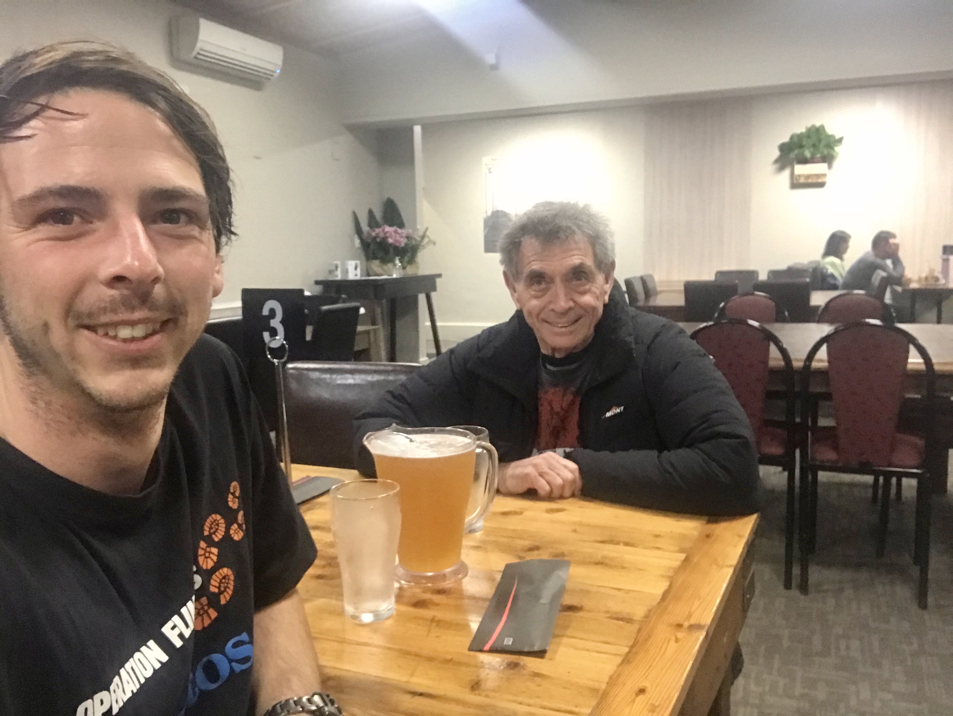
We were then off to Penneshaw for the night and a very traditional celebration at the pub.

Trip completed


380km
65hrs
12 Days

Kangaroo Island is certainly different to the other islands in SA. Perhaps I like the other islands more because I experienced them first.
I was surprisingly challenged just by it being so populated, and popular- Any good landing beach has a house or people or something. It really takes away from that wilderness feeling I seek when I go sea kayaking.
Sure we paddled remote sections, but to land after a big day and then have to worry if someone is going to hassle you, or catch you airing out your skin, or just wanting to talk when all you want to do is rest.
Our other smaller islands offer remote beaches with zero population or tourists and completes the wilderness feeling.
Sections of the Island were truly breath-taking, and I’m glad to have seen them. But I just forgot to expect so many people. It is the summer holidays after all.

The best part about KI? Well there are many. Truly spectacular coastlines, and a genuine hard sea kayaking venue.
The south and west coasts gave us the truest feeling of “Now, this is real sea kayaking”
Those coasts had certainly asked the question of us, even on the “good” days.
Our passage through had a price and had to be earned.
As if the coasts were afraid of gaining a soft reputation.
Our comfort zones weren’t tested, they were broken, exceeded immensely.
But stretching like this gives back to the adventurers’ investment sevenfold;
A greater knowledge of the depths one has to their character, and the knowledge you can persevere when things get hard. A gift worth more than gold.

At no point did I feel like the phase “we conquered” KI was ever appropriate. KI had let us pass, with no guarantee that it ever would again.

For the video of these events, please visit: https://www.youtube.com/playlist?list=PL3fXOJV1V0OAD9vYTdA2IdAUTMYqZmzrW
or search “Kangaroo Island by Sea Kayak” on youtube.

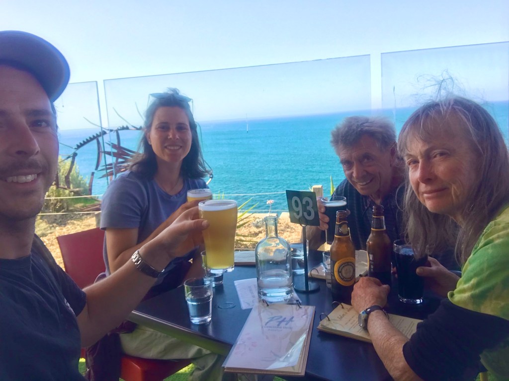
A very special thankyou to Malcolm and Alison for supporting us on land around the Island. Malcolm has empowered me to complete so many trips thanks to his generosity with his time.

Another special thanks to David Williamson for “Spotting” the trip. Keeping a careful eye on our progress and the weather. A profound sounding board for all thoughts and decisions.

And finally, a thankyou to all who donated to our fundraiser for Operation Flinders!

South East Eyre Peninsular Islands Solo

These are my journal writings while on the trip, so it may read somewhat clunky. But I have tried to capture the feeling of the trip as it happened, not in reflection in the warm comfort of home!
A video of the trip can be found by clicking here

During the planning phase of the trip, deciding where to go was to be dictated by my goals and objectives. What did I actually want from this trip?

This is what I came up with:
1. To see and experience what happens to me internally spending 4+ nights alone in the remote marine setting
2. Push/expand my comfort zone
3. To see and camp in incredible locations
4. Have time for recreation – Fishing, reading, and exploring the islands more intimately.
5. Achieve something that has never been done before.

It is these objectives that led me to choose the South East Eyre Peninsular to facilitate these goals.
Here there are over 24 off shore islands within 100km of each other. The Sir Joseph Banks Group and the Thorny Passage group separated by 40km of water.

One week out from the trip I found the background of my mind was consumed with the trip. A sort of mental preparation by living out the experiences you are anticipating before they’ve even happened. Preparing itself for the trials and discomforts that may come about.

Being June, I was not expecting to get many consecutive days of paddling in and was quite looking forward to being stuck somewhere and witnessing the ferocity of the Southern Ocean. Being forced to stay put.
I’d planned to start paddling on Sunday the 31st of May, but a series of strong cold fronts delivering 30kt winds and 5-8m sea state was a bit too wild.
However there would be a window on Sunday, where I could boost over to Reevesby before the wind kicked in, then just hide out there.
After a phone call with Malcolm, who had offered to be my land support, we thought it through. To his credit, he did not try to sway me either way in my decision but remained an honest sounding board. Soon I had to say, “well, I’m now asking for your advice, what would you do?”
His comment was “ It would be a marginal and demanding crossing, and if that is what you’re after then fine! But if things go wrong, it’s not going to be good, particularly on your first day’s paddle when you’re not quite in the rhythm. Could you do it? Probably. Do you need to put yourself at that risk? No.”
We decided that launching on Tuesday the 2nd of June would prove much wiser, with no further pending threat from the weather for the rest of the week.

Just prior to leaving home, I found myself becoming somewhat emotionally detached – to protect myself from the anxious thoughts. Thoughts that if left to their own devices can end a trip before it begins.
FOCUS: Don’t think, just do. Tick off the tasks until the only task left is to crawl into my tent at night on Reevesby Island.
Excitement and nerves, but I am just about as prepared as I can be.
I tell my self, don’t be surprised if you feel gloomy on the first night – It always seems to happen to me on solo’s. Remember the next day so far has always felt better.

IMG_3103.JPEG
Tumby Bay

2nd June –  Writing on Reevesby Island.

Although the day started in glassy conditions in the safety of Tumby Bay, today was filled with a mix of emotions; the excitement of heading out, and then the uneasy feeling as squalls came thundering through in the middle of a crossing. You would hear it before you felt it. A hissing noise. You look to see where it is coming from and see the ocean has turned to white caps and is coming straight for you. 15 minutes later, it would abate, and all was well with the world again.


I’m sitting now at home bay, enjoying some entrée and I am feeling as I expected – kind of scared and happy to never kayak again. What is this crazy thing that I keep convincing myself is a good idea to do!?
But if these emotions have been expected and arrived, then tomorrow I can expect happiness and peacefulness. It must be something of transitioning out of the rhythm of home, to the rhythm of the wilderness.. it is not a switch, it’s a transition. It is much easier to deal with now, knowing this pattern happens to me everytime – It’s normalised.
I had 10 – 17kt WSW winds for the crossing, so I headed at 150° with the wind on my beam. This evidently became in the direction of Kirkby Island (from Tumby Bay). Once at Kirkby I would turn to the east and run the wind into Reevesby.
I’m still uncertain on tomorrows plans, only that I need to make my way south – into the headwind and against the tide. A necessary slog to set up the success of the rest of the trip.
I ask my self, what is it I actually want to do with my time here? But I dared not answer that question with these gloomy emotions, lest I end up paddling back home!

DCIM100GOPROGOPR6171.JPG
Home Bay, Reevesby Island

Reflecting on the rich conversations I had with Malcolm last night; a big take away was to expect change, in all of life – opposed to being surprised when changes come. Similar to how I am expecting to feel uncomfortable at times on this trip, if I can expect changes to my plans, then I will be far more receptive to adapting well to change when it arrives unwantedly.
It is also strange to sit here where I’ve shared the company of TAFE groups, how they keep the darkness away, and now to be here in silence and solitude.

Tumby Bay to Reevesby Island Via Kirkby – 27km.

3rd June
Well, I do feel better this morning! At peace. The wind has shifted to the SE, meaning my location in home bay is still and calm. A pair of pacific gulls are fishing for crabs in front of me.
The plan is to aim for Langton Island, then possibly on to Spilsby Island.
A low blanket of cloud looms gently over, causing daytime to be just a lighter shade of grey from night time. I cannot yet tell if the sun has risen or is yet to rise.

IMG_3114.JPEG
Sunrise at Home Bay

I set off to Langton, managing a good 5kph against wind and tide. Beyond the protection of Reevesby, the water was unfriendly all day. The previous days’ wind from different directions had caused a sloppy sea state.
Having visited the Sea Lion breeding colony at Langton I set off for the protection of Roxby island to gain a break from the sloppy seas.

IMG_3120
Western coast of Roxby Island

Roxby to Boucaut Island was the sloppiest and seemed to take forever. I had wanted to investigate Boucaut Island, but found there were no friendly landing spots today! I was surprised to see such a swell coming up and wrapping around the island.
On to the NW side of Spilsby.
Again I was astonished at the swell coming in. The south coast of Spilsby had become a death coast of random breaking reefs and limestone teeth. But it was a breathtaking image!
Tomorrows plan; to cross to Thistle Island via Dangerous reef – a 40km crossing that has not been achieved as a solo, or from north to south.
Up at 6, on water by 7, that’s the plan. 10kt NE winds should be sweet!
I am feeling content.
Emotions deteriorate with fatigue – something else to be expected, but I am warm, dry and in one of the most stunning places I’ve seen with a long sleep ahead of me. It is good.

IMG_3134
South coast of Spilsby Island

IMG_3148

IMG_3156
Sunrise at Spilsby

4th June –  Writing at Observatory Point, Thistle Island

I was up at 6, and on water by 7:15. The swell from yesterday had reduced.
I set off into the featureless horizon bearing 210° to dangerous reef. Once I had left the protection of Spilsby, the previous days SE winds and the now NE winds created quite a messy sea state. If the wind was 5kts stronger, it would have been quite uncomfortable as the seas would turn into 1m breaking waves everywhere.
Heading to Dangerous Reef – one of the 3 largest breeding colonies of Australian Sea Lions – only meant one thing in my mind. Sharks. Though I’ve never seen one I fought my mind to suppress the thought of them and being so far from land.
I realised I was willingly putting myself into a survival situation – Get to land, or be in serious trouble. So I suppressed any un-helpful thoughts, even the thought of looking back to see if I was being stalked.
After 1hr 40m I had my first sighting of a white stick popping out the ocean – Dangerous Reef. This brought a strong feeling of optimism – It does exist!
After 3 hours I arrived and was pleased to find the southern side of the reef offered protection from all the messy sea state. A good place for a meal and a piss!
I felt joy and satisfaction in the achievement, a first to solo kayak to this rocky island, but I did not tarry long. Far from land in prime shark country, the safety of land beckoned me on. Though I regret now that I did not investigate the reef more.

IMG_3162.JPEG
Dangerous Reef

IMG_3163
Thistle Island from Dangerous Reef

I’m over halfway with Thistle Island now clearly in view and a calmer sea state meant I was able to relax and be much more positive.
I visited the Porter and Black Rocks because well, who knows when I’ll ever be coming this way again!
Just a few k’s off Thistle, the new ebb tide began threatening to suck me past Thistle and into the Thorny Passage!
When I arrived at Observatory Point, I was so surprised to find its western shores so severely damaged by the weekend’s storm that I chose to sit out. The beach had become steep and waves had eroded into the sand dunes making them appear as if someone had chopped them in half and thrown them into the sea.
I figured Snug Cove would offer a good landing, but I was wrong. As I went south along the coast I found  2m tall walls of seaweed to the water’s edge, as if the island had made its own fortification to prevent me from landing!
*Sigh*, turn around against the tide, find a better spot. This eventuated on the eastern side of Observatory point.
40km and 6 hours.
I took a moment to reflect and celebrate the achievement. I had truly found my rhythm now, and a wash in the winter ocean truly makes one feel alive!

IMG_3169.JPEG
Sunset at Observatory Point, Thistle Island

IMG_3170
Sunset across Thorny Passage

To say I enjoy these open water crossings would be a lie, but the sense of achievement and mental growth makes them more than worth it. They are becoming easier on the mind.
Now I have the uncertainty and unknowns of what lies ahead with Williams Island and Thorny Passage on a spring tide.
2m ocean swells are forecasted – which is on the small side for this area – and I do not know how that corresponds to the landing at Williams Island. All I can hear in my head is Dave’s words “Oh Williams, that’s a fantastic place! Just beware of the dumping wave and the tide rip off Cape Catastrophe!”
There are few worse feelings in sea kayaking than arriving at your only option to get off the water, but the price is a nasty surf landing.
The risk was increased further by an Ebb tide running from 1pm – 8pm, meaning if I do get there, and the break is brutal, I would not be able to paddle against the tide back to somewhere else!
But the reward? Seeing Williams, which appears to my research to be absolutely stunning, and who knows it may also have never been paddled to solo.


IMG_3173.JPEG
Sunrise on Thistle

5th June – Writing on Williams Island
I slept in till 7:30, funnily enough is when the sun does too in June!
I appreciated a slow relaxing morning, as the tide was flooding strongly until lunchtime, and I only had 16-19km for the day.
It was glassy still as dolphins and sea lions cruised past by.
Its cloudy again, yet so humid despite it being only 12°C
I got on water around 10 and set off against the tide flow. Rounding Nose Point revealed many breaking waves on the various reefs that are between Hopkins Island and Thistle. With little hope I wanted to see if landing at Mittler’s Cove was possible, and the breaking waves did not make me hopeful.
However, further investigation revealed a glassy calm bay with a steep landable beach. I was stoked, as I had wanted to explore the area on foot yesterday but had landed too far away.

IMG_3179
Mittler’s Cove, Thistle Island

On this day the cove provided no camping, as the beach was steep up to its cliffs. Malcolm later told me that TAFE has camped there before! So obviously things change.
I set of to Carrington Point with the hope of gaining a commanding view of the area. It was much further than my lazy judgement had made, but it was entirely worth it.
50m above the southern ocean I had views from Thistle’s exposed SW coast, the Neptune Islands, Williams, Cape Catastrophe and the Thorny Passage.
The ocean looked calm, and perfect for crossing with the Neptune’s tantalisingly close and tempting! *Sigh*, another day.


IMG_3184
Thistle’s SW coast

IMG_3185
Carrington Point – View across Thorny Passage

Entering Thorny Passage at high tide meant I would not have to battle the incoming flooding tide or worry about the tide races. It was my plan to get into a healthy position during the slack, then catch the ebb out past Cape Catastrophe and on to Williams. However, how the tide behaved between Williams and Cape Catastrophe I was unsure. Which way would it take me?
My move across Thorny Passage was eerily calm, but I thought I’d make the most of the conditions to get a closer look at the Cape while the possibility was there.
Fresh in my mind was the story of the 1996 Coffin Bay to Port Lincoln paddle, where the worst waters they encountered on the entire trip was in the Cape Cat vicinity. As well as the disaster that occurred to Matthew Flinders’ crew due to the rip tides, causing the name Cape Catastrophe.
As I reached the Cape the ebb tide began to kick into gear. The calm water which had no wind influence on it began rising up into little waves that were threatening to break!
I was easy to imagine what an opposing wind would do to this section.
I was sucked out past the Cape and into the Southern Ocean. For me it was a strange feeling.. Should I really be here? What a mad place. The Cliffs, the whole scene is just wild.
I started the crossing to Williams aiming between West point and Williams so I could determine the tidal influence. Aim to much at Williams and risk missing it to the east. Aim to much at West Cape and risk missing Williams to the North. I curved my way into the bay with no dramas.
As you enter Williams – which you really do.. its 800m deep V shaped northern coast means you really enter the island – the water swiftly changes from endless deep blue to a rich tropical blue. The high banks of the island surround you, and a pristine untouched beach awaits you. I was blown away. All this to my self!
I was delighted to see minimal surf on the beach! Though the sets were dumpy.


IMG_3187.JPG
Williams Island

A NZ fur seal colony lays on the rocks at the western end as well as a rock shelf along the beach which at times is hidden in the water as to catch a sea kayaker out. The eastern end proved the best camping, though not very flat.
In a spring tide and a big storm I imagine the entire beach would be submerged.
The view from the beach is splendid, looking across the water back to the southern most points of the Eyre Peninsular.
A quick climb to the summit revealed an impressive panoramic. Neptunes, Wedge, Thistle, Eyre. A commanding and inspiring view!


IMG_3190
Williams Island

While cooking my dinner something kept grabbing my attention in the corner of my eye. It persisted. So I turned off my light and walked to the water.
Behold, when a bigger wave broke, the entire wave became electric bright blue! Bioluminescent Algae! What a rare treat!

On this occasion there is only one downside to the island. The thousands upon thousands of mosquitoes that were all over the island. They were thirsty, not just for blood! But my guess is moisture. They would go into my food and hide in my vestibule! I received no bites, but they made it impossible to stay up and read.


I’ve decided tomorrow to head back up to Taylors Landing and end the trip there. The opportunity to get back to land is safe, and favourable for Thorny Passage, so I thought I’d better make the most of it.
Forecasted to be 5-15kt SE winds, with a flooding tide should make the 23k’s go rather quick.

6th June Writing on Williams Island
I still have food and water for a few days yet, and I’m not entirely sure I’ve made the maximum of my time out, only taking 4 nights. But I have achieved all my primary goals. With such good weather I’ve had zero no paddle days; something I was not expecting in winter!
It has been great, but the result is different. A day or two where I am stuck somewhere is kind of what I was hoping for. To be forced to stop somewhere. Hunker down, read and relax.
A Sea Kayaker in South Australia must take their opportunities to move on water as they present themselves, lest conditions deteriorate in un-foreseen ways. This trip has caused me to take the opportunities each day. I could happily sit to here longer if it was not safe to paddle, but it is.
Perhaps if it were not so infested with mozzies here, I would be inclined to remain another day, but they are beyond counting, and do not rest, for their thirst for moisture is so great. In this case it is them who have successfully repelled me.
They resulted in my least enjoyable night so far, which is a shame. Are they here all year round? If so, that would put some serious weight against coming back here again.
I am content with the successes of the trip, bar not having more time to do nothing – something that I’m sure will come in future expeditions.
The next trip is set for July, where I am certain the weather cannot be as kind as it has been to me this week.
I am ending the trip at a place of contentment – not sick of it, therefore leaving me happily to come out again.
Interesting how on the first night I thought my self mad and would happily never paddle again. Now my comfort zone has been stretched and increased and I have settled the rhythm of life in the wild.

Writing from Tumby Bay
After negotiating the dumping break, which seemed to increase in force with an incoming tide, I set off from Williams around 10:20.
I had taken time to soak in the island before returning to society. Near Cape Catastrophe the flooding tide was in full swing, running 2kts as charted.
The wind was far less than forecasted, and I could see the Neptunes, Thistle and Wedge all beckoning me their way.
I was genuinely torn as what to do! I still had 4 or so days’ worth of food and water, amazing weather, and I had grown to enjoy the solitude more and more. I don’t think I wanted to leave this simplistic rhythm, oblivious to the chaos in the outside world. No work, no virus, no riots. The only real evidence of imperfection was the guaranteed presence of plastic (mostly bottles and caps) found on every beach I visited. It always makes me sad, as all that plastic had drifted our oceans and landed on our pristine beaches. I have often found items covered in entirely foreign language!
I entertained the thought of recharging in Pt. Lincoln, then making a dash across to Yorkes. I was truly comfortable and happy, and I wanted more.
The good weather and time spent alone on the ocean had reduced my fears and grown my comfort zone. Simple life centred around the rising and setting of the sun and staying alive.
As I came up the passage, I began to wonder what I was bringing back with me. It was not entirely clear what had changed.
A sense of accomplishment, satisfaction, increased depth to my mental fortitude, and that unshakable confidence that comes from doing hard things.
I hope I am afforded more opportunities in the future to spend even longer on my own. I must remain cautious though, as the ocean is the great humbler and leveller of those who stand too tall. Bring with you too much pride and arrogance and it will certainly bring you back in check… if you have managed to keep your life.

1

IMG_3214.JPEG
Celebrations back at the Tumby Pub with Malcolm Hamilton

Lessons of Bass Strait, 2015

Lessons of Bass Strait

Written by Fraser Darcy

To a sea kayaker the allure of paddling from mainland Australia to Tasmania across Bass Strait is akin to an athlete competing at a world championships. Over the April school holidays six current and former South Australian outdoor educators, all with a connection to Westminster School, were able to experience the notorious section of water between mainland Oz and Tasmania in the hope of completing a tough crossing but even greater adventure. Gordon Begg*, Rob McLean, Evan Jones, Will Mildren, Sam Ferguson and Fraser Darcy represented a unique group of individuals showcasing the important connection made between student and instructor/teacher that is made in the outdoor world. (Gordon had taught all five other members of the group with Rob and Evan also either teaching or instructing the younger trio of Will, Sam and Fraser.) This connection highlights how instructors past trips and adventures can inspire their own students to complete the same adventures…with their old teachers along for the ride of course!


The groups adventure spanned 11 days and saw them successfully paddle from Wilson’s Promontory National Park, Victoria to Little Musselroe Bay, Tasmania. Along their way they paddled distances of up to 70kms a day (where wake-up was at 3:30am!) with most days averaging between 30-40kms. The paddling conditions varied along the way with most days thankfully having light-moderate winds. One day however brought a 20-25 knot cross-tail wind and a moderate-large ocean swell which generated a lot of excitement within the group as it took a while to get over the massive peaks. The most challenging part of paddling Bass Strait was negotiating the many different tidal influences in the area. Tidal races, standing waves and long eddy lines showed why Bass Strait is not just an everyday paddle. Despite the ocean’s attempts the group was able to overcome any current it threw at them (even if they were 3km off their bearing at one point!).


Apart from the paddling the trip also represented an opportunity to an experience an area only reachable by boat. The views, landscapes, environment and communities within the area astounded all members of the group (even those who were returning to the area). There were constant sightings of rare birds, stunning views of granite slabs, friendly locals and interesting rock gardens of which made for great paddling. The most appreciated aspect of the Bass Strait environment for the group though had to be the opportunity to catch some abalone on an uninhabited island marked simply as Craggy Rock on the charts. After a long 70km ocean crossing there was nothing better than treating ourselves to some fried abalone, even if there was a lesson on how to do that first!


One of the overall lessons from this expedition however was that it showed that an engaged instructor/teacher can have a major influence on a students experience that extends past the classroom. Outdoor educator’s can easily fall into the monotony of teaching students the skills to be sufficient for the activity at task. Whilst this is a justifiable practice, the student leaves the activity only experiencing the highs (and/or lows) of that particular activity.  Relating to students with your own personal trip experiences is one resource that a successful outdoor educator will heavily rely on to engage with students whilst on program. It won’t be obvious when you mention it but by simply referring to the climbing you did on the weekend or the dive you have planned coming up you may be inspiring a student to continue venturing into the outdoors, which I’m preaching to the converted here, we all know is beneficial to a students education.


*Gordon Begg has now completed three Bass Strait crossings which is a fantastic achievement!


Victor Harbor – Cape Jervis – Mike Dunn and the Adelaide Canoe Club 2009

In late 2009 Phil Doddridge organised for a group of paddlers from the Adelaide Canoe Club to do a 2 day trip form Victor to Cape Jervis.

Preparations were underway weeks beforehand with rolling & rescue practice sessions in Encounter Lakes, then a paddle around the Bluff to land at Petrel Cove to test out surf landing and launching skills, with more wet exit rescue practice near the Bluff jetty.

Capture6

An unseasonably burst of hot weather for the weekend in mid November was forecast with temperatures in Adelaide over 40 degrees and with the south coast forecast of mid 30’s, with low winds and low swell predicted, which made a 2-day trip from Victor Harbour to Cape Jervis a real possibility.

Ten members of the Adelaide Canoe Club met at Geoff Neale’s house early Saturday morning and took a mini bus towing 10 kayaks, arrived at the Encounter Bay boat ramp to setup.

The group paddled in warm calm conditions around the Bluff towards West Island for the first rest break. Continuing down the Waitpinga Cliffs a moderate SE wind blew up for about 2 hours, which abated as the group neared Parsons Beach.

With the calm surf conditions the group landed at Ballaparudda Beach for lunch and a brief rest, and then paddled west, past Tunk Head in glassy conditions towards Tunkalilla Beach for the first camp.

Arriving at Tunkalilla Beach the wave height was akin to a metro coast beach with tiny waves breaking near the shore which made for an easy landing.

A quick swim was had in crystal clear waters that looked more like a swimming pool rather than a surf beach, and then dinner was eaten and tents were setup and weary paddlers rested for the evening after doing just over 30km.

Capture3

Just after sunrise the next day the group departed Tunkalilla, launching through a small surf break and then continued to head west towards Deep Creek.

On the approach to the Deep Creek Conservation Park, tongues of fog formed in the valleys between the hills, then slid down the hills and then spread across the ocean like a blanket, also leaving a 2m gap above the waves to peer through– it was an amazing sight.
Within an hour the whole area was blanketed in fog until the group reached Blowhole Beach, where a landing was made through a small surf break, for a lunch stop.

Capture2


After lunch the group continued the last leg of the journey to Cape Jervis where another refreshing swim was taken, before loading the kayaks onto the trailer behind the minibus and then headed back to Adelaide.

Capture


Photos at http://users.adam.com.au/mikedunn/09Nov_Victor2Jervis.pdf

Mike Dunn

A 60k Day

May 16,17 2020

After being stuck in the house for the past two months, I have become highly motivated to get out and do some paddling. However, when the opportunity arrives, I have yet to commit.
Finally I rang Malcolm to see if he could assist in a car shuttle, which he was able to do, so a date was set and that was that. I guess that is part of goal setting, is to just lock a date in and to have someone else affected by your plans so that you cannot bail on them as easily.
I wanted to use the time to push a distance that I had never reached before, around 60k’s. Mostly because to cross the gulf St. Vincent it is roughly 60k’s.
But I thought it smart to firstly know what it feels like to reach that mark with the safety of a coastline nearby. So Aldinga to Blowhole Beach was chosen: 55-60km, and then if suitable on to Victor Harbor the next day (50km).

61127394281__A08028D5-C47D-4858-B6F9-434A1706EB03

I have created a film that describes the paddle so I will skip ahead now to the end of the first day.
The film is here

Well, I’ve just completed my biggest paddle yet, 60km. It started lovely, but I grew to hate it more and more. It is satisfying to have that distance under my belt. I’m sure I’ll feel better in the morning. If there is one thing I have learned about being out by my self is to never trust the emotions that come on the first night, they always call me to quit and go home.
Straight away I am missing being home with Dayna; I guess these trips help you appreciate home more.

I am so very sore! It is amazing what a struggle it is to walk in the first half hour.
I find it hilarious how satisfying it s to sit in my chair, after sitting all day. I cramp in my hips when I try to get up!
I intend to go on to Victor and complete this thing. I have certainly earned my sleep tonight.
I have a trip planned in a fortnight to the Eyre Peninsular, and interestingly right now I could not care less for it!
Let’s see how I feel in the morning. In bed by 7:15pm

IMG_2991

18th
I set off for Victor with an afternoon forecast of 10knts NE winds (headwinds) looming in the back of my mind. There were pockets of small headwinds as I went whittling my confidence down. I decided to paddle 1hr and see what my average speed was looking like.
After 1hr I had done 5.5km. hmmmmm. Maybe lets do 1 more hour.
I made it just past Deep Creek Cove, having completed just over another 5k’s.
Already feeling sore and tired and doing the maths in my head: 9:15am – 40km to go – 5kph – 8hrs – 5pm. Last time I paddled this leg to Victor alone I was managing 7-8kph.
There was the very real risk that the afternoon headwind could add 2-3hours as well as feeling totally exhausted, and for what? Did I need/have to? No, I’ve already done that stretch of coast twice before. Would I enjoy getting in after dark? Nope. With a 3m swell hitting the Waitpinga coast, it meant the only place to extract my kayak was either Victor or Fishery Beach.
So with that I turned around and headed towards Fishery, about 16km away.
(When I departed for the trip on the 17th, these NE winds were not forecasted)

It felt good to turn around. Heading for certainty, instead of uncertainty. I was satisfied that I had tried, and that I was also able to make a decision that changed the plan for the better.
On my way back I was able to enjoy the rugged coastline. It became recreational.
Finishing up I did 85km in 13hrs 50m.

  1. 6.8
  2. 14
  3. 21.4
  4. 27.7
  5. 36
  6. 42.6
  7. 48.2
  8. 54.7
  9. 58.9
  10. 64.5
  11. 69.8
  12. 74.7
  13. 80
  14. 85

Aldinga to Blowhole

That is another take away. It is good to have 60km under my belt. Most Island crossings in SA only require up to 40km. It is good to know it can be done, but not to go planning 60k days for fun, unless the wind and tide are with you.
Design trips to have time to explore; Islands and coastlines, because as David W once said replying to a comment that he must love paddling, “No, it’s the worst part!”
It is everything that comes as a result of the hard work paddling that makes us choose Sea Kayaking:
The pristine beaches, cliffs, remote islands, crystal clear waters, marine life, adventure, personal growth and satisfaction, open horizons with sunsets and sunrises over the water, and a sense of accomplishment. And the catalyst required to make all these things so satisfying is the hard work of paddling, of placing yourself in a small vessel into the mercy of the elements, and thanking the ocean that it let you pass that day.

So now my attention shifts to the Eyre Peninsular. Whatever doubts I have I must suppress, and simply just go and undertake this adventure. Accept that at times I may feel like I regret it, that I just want to be home. If I accept and expect that, then I won’t be ambushed by it, I’ll be ready and press on. Though it is easy to dream up trips from the comfort of home.
I’m both excited and nervous, I hope I simply find a rhythm of life out there and enjoy the opportunity.


Western Bass Strait, 2001

Here is David Williamson’s account of the first ever attempt at crossing Western Bass Strait (Via King Island) in sea kayaks.

(unfortunately I do not have any photos from the trip, so these are sourced from google)

January 2001

It had been over a year in the planning, Jim Townsend, Malcolm Hamilton and my self had checked everything, all our equipment had been packed and sent ahead of us by plane, and we had developed an on-water management and contingency plans which would determine how we would operate under a range of weather and sea conditions. It was only a matter of trying to complete our little adventure

Our goal was to paddle from Tasmania to Victoria via King Island.

The Flinders Island side, or eastern Bass Strait, being the more sheltered side, with shorter distances between islands, has been paddled several times, the first of which was in 1970. Malcolm and I had already paddled this side once.

The King Island side of Bass Strait however, had never been paddled before. This is due to the reputation of Bass Strait (Often described by ocean sailors as one of the most dangerous stretches of water on the planet), the great distances required to be paddled between islands, and King Island’s interesting maritime history. It is the scene of Australia’s worse maritime disaster and has more known shipwrecks than any other part of Australia.

It was this bit of water, with a great deal of caution, that we were going to try and cross.


Wednesday 3rd of January 2001.
It was a beautiful day in the Barossa, and I was on my wat to Adelaide airport to meet Jim and Malcolm. We flew from Adelaide to Melbourne and then to Burnie. On our arrival, we discovered that the Burnie airport is at Wynyard and some distance from Burnie. Just as well we had not booked any accommodation. We walked to the Wynyard caravan park, a beautiful spot right on the beach and booked a small cabin for the night. We then made our way to the local pub for tea and a quiet beer or two.

Thursday 4th and Friday 5th
The weather window looked very good for the next few days. I phoned to find out where we could pick up our kayaks so that we could take advantage of the weather window only to be told that our kayaks were safe in Melbourne. Apparently, their Freight plane had been taken offline for servicing and it may be a week before arriving in Tasmania.
To say that we were upset would have been an understatement, especially when we had been promised that there would be no problem in the delivery of our kayaks. We spent some time investigating other ways of transporting the kayaks to Tasmania to no avail. So there we stood with a great window of opportunity and all we had were the clothes we flew in. The rest of our clothes and equipment were in our kayaks. We didn’t even have a toothbrush. We spent that day wandering the streets of Wynyard, bought a toothbrush each and some food for the next few days and contemplated all the possibilities. The next day, resigned to the fact that it may be some time before our kayaks and equipment arrived, we decided to take a day trip to Burnie, about an hour away by bus. This would give us a chance to do some sight seeing and the opportunity to investigate ways of getting our kayaks from the Burnie airport to Stanley.

That afternoon I made contact with the air freight company to check on and progress with our kayaks and was informed that they would be flown into Tassie that night, and transported to Burnie airport by truck by 7am the next day. Relieved to hear the news I told Jim and Malcolm that we were back in business. It was good to see their faces light up. We made use of Burnie’s shopping centre and bought enough food to get us to King Island safely. We made contact with the trucking company to see whether they would transport our gear all the way to Stanley. For a small charge they were happy to meet us at the Wynyard caravan park and transport one of us and our gear as well.

Saturday 6th and Sunday 7th
The truck arrived on time and Malcolm went with the drive to Stanley leaving Jim and myself to hitchhike. We walked to the highway and managed to get a ride to the Stanley turn off fairly easily and walked the remaining four or five kilometres to the harbour where Malcolm had our kayaks set up.
We had to be extra careful about the equipment we had brought with us as it all had to fit into our kayaks. There was no leaving excess items in the car on this trip! Malcolm and Jim were paddling a double sea kayak and I was paddling a single. Everything fitted!
We had a quick bite to eat from Stanley’s famous seafood café and headed back to the kayaks. There were plenty of curious people around to help us launch our boats. Some thought that we were mad, and others thought that it was a great adventure.

It was such a relief to finally get on the water late that afternoon and with a hand shake each, we were off. We left the harbour and paddled past a landform called ‘The Nut’, some 152m of sheer cliff. It dominates the headland. We paddled past a small rocky outcrop which is home to a large number of seals, then around ‘North Point’ at the top of the headland and across to Robbins Island. The near perfect conditions allowed us to practice some drills on the way across. At about eight o’clock we arrived at Robbins Island just west of Cape Elie and set up camp for the night on the beach.

Tasmania_The_Nut_Stanley_CREDIT_Tourism_Tasmania_Jason_Charles_Hill_uyuxj7.jpg
The Nut at Stanley

Up with coffee, we listened to the ABC’s 5.55am weather forecast. The forecast was for light winds from the south in the morning, strengthening to moderate in the afternoon. We quickly repacked our kayaks and made our way up the northeast coast of Robbins Island and Walker Island to the Petrel Islands for lunch.
The strengthening southerly winds gave us a chance to play with our small sails on the way to the southern most point of the Three Hummock Island. We turned westward and followed the coast for a while, then it was across to Shepherds Bay on Hunter Island.
The strengthening southerly on our beam made it a sloppy afternoons paddle. Shepherd’s Bay is a picture postcard bay with a white sandy beach against a backdrop of thick green bushland. We decided to bivvy on the beach that night as the next day required an early start. The high tide that night gave us an interesting night’s sleep.

Monday 8th January
 We were up at dawn and ready to paddle, I phoned the Tasmanian weather bureau using the trusty CDMA phone. The forecast for the day was south-easterly winds to 20 knots which was within our management criteria. Today’s paddle was extreme – some 82km to Grassy Harbour on King Island – further than any of us had paddled before. We used the tide to pull us the 9km out to Cape Keraudren. We had a short break, put on some more clothing, and headed out across Bass Strait. We were now 68km from Stanley. The wind was from a favourable direction which allowed us to use our sails, however it wasn’t long before Malcolm’s sail broke, so it was back to paddling.

My sail was working fine, so well in fact that I was starting to pull away from the double. Our management plan stated that a maximum separation of 50metres was allowed. We, therefore hooked up a tow line to keep us together and to keep our overall speed as high as possible. Every hour we would raft up and have a quick snack. Constant waves of 3 to 4 metres made it difficult to raft up for long. Malcolm had convinced us to buy special Power Bards which were supposed to renew your energy levels faster than any other bar, the only trouble was that they tasted like cardboard and were so chewy that they almost pulled your teeth out. We had been paddling now for a number of hours and had been monitoring the GPS which said we were getting closer to King Island but our landing point required us to head further and further on a northerly bearing. The current had ben pushing us due west all day, we had hardly made any northward movement at all. In fact it wasn’t until late in the afternoon when we could see Reid Rocks and the reefs around it breaking that we started to move northward. It was also at this time that Jim and Malcolm started to fight their boat. Malcolm asked me to check the skeg and I discovered some of its missing which explained why it was hard to keep on track in the following sea. It turned out to be one of those long days.
It was just before dark before we could see our destination. As we picked up the lead light for the harbour a yacht approached us, a few of the crew gave us an unusual look and then sailed on. As we paddled into the calm waters of Grassy Harbour, once a busy mining port, we unhooked our tow system and made our way to a small beach area in the harbour. It was now 9.55pm We dragged our kayaks up the beach and made camp in a deserted playground, ate some food and crashed out for the night.
We had made King Island, something that had never been one before by kayak, we had also paddled 90km, the longest paddle for us to date.

Tuesday the 9th and Wednesday the 19th
After a much-needed sleep in we made our way up to the semi ghost town of Grassy. We were going to play tourist for the day and had booked a hire car at the local store. The lady at the store was surprised to see us and couldn’t believe that we had paddled across the day before. We headed out to the southern most point of the island. On the way we stopped to watch a kelp farmer, who gruffy educated us on what kelp was used for and how King Island Kelp is the best in the world. We then admired the view of the southern point called Stokes Point and nearby which we voted ‘the best bakery in the world’ due to their camembert and seafood pies.
We had a quick look at Currie’s Harbour and Lighthouse (one of the only recommissioned lighthouses in the world. It was reopened due to the pressure applied by the local community on the government of the day), then it was off to the northern most point on the island. On the way we made a quick stop at the famous King Island Dairy for a serious tasting (delicious!). At the northern end we had a chance to check out our departure spot before we headed across Bass Strait to Victoria. We also had a look at Cape Wickham Lighthouse, the tallest lighthouse in Australia. Then it was back to Currie for some King Island steak, Jim and I couldn’t wait. Malcolm opted for the seafood. Unfortunately for Jim and I, Malcolm made the right choice. I think our steak must have come from the mainland; it was tough as old boots. Sea and weather conditions for the next day were outside our on-water management guidelines so we used the day to visit the small village of Naracoopa and revisited our bakery. The afternoon went by doing some sail repairs and rebuilding of the doubles’ skeg thanks to the help of the guys at the port. We had tea that night at the Grassy pub and were invited onboard a yacht for breakfast the next day.

Thursday 11th and Friday 12th.
We were up early (the weather forecast for the next day or two was favourable) packed our boats and headed to the yacht for breakfast. Our quick breakfast turned into a very nice, and very long breakfast and the tide we were hoping to ride up the coast had almost past by the time we started paddling.
IT was a pleasant day’s paddle allowing us to explore the coastline. We camped that night at the point where Sea Elephant River meets the sea.
The next day we paddled toe coast to Disappointment Bay, On the way we watched a large bushfire burning, the smoke was so thick and you could see the flames jumping high into the sky- it was nice to be on the water. Disappointment Bay was our jump off point to Victoria and is 65km from Grassy Harbour. We arrived there just after lunch upon calm seas. We phoned for a weather forecast. The next day’s forecast was for light south-easterly winds shifting easterly around three o’clock in the afternoon and then building to a strong wind warning that night from the north east. The wind was then due to stay up for the next few days. We discussed our options and decided that we could paddle the 95km to Apollo Bay in 16 hours. If we left at midnight, we would be in Apollo Bay before it was too windy. We also figured that we could work hard for a few hours if it started getting windy a little earlier. So, we agreed to leave around midnight if the 9pm weather update confirmed the earlier forecast. We prepared our kayaks for the crossing, ate some tea, and got some sleep. My alarm went off at 9pm and I phoned for a forecast which confirmed the previous forecast so I told Him and Malcolm that we would leave around midnight and reset my alarm.

Saturday 13th
With the alarm going off, we packed the last bit of our gear, turned our night lights on, and started paddling. The water was calm just a gentle swell, we could hear the waves gently breaking over the Navarine Reef. It was a strange night; you could see the stars and moon through the smoke haze and smell the smoke. We took it in turn (hour-on, hour-off) to follow a compass bearing with a short break every hour. We were making good time, but as the sun rose I could feel the pressure in my bowel and I realised that it was time for me to ‘relieve’ myself for the first time at sea, much to the amusement of Jim and Mal. We rafted up, I climbed out of my gear and slipped into the water and while Malcolm held the boats together, Jim paddled us away from the offending matter, all in all an interesting experience but one I would rather avoid. We paddled on, it was now about 8am and we were over a third of the way across and still making good time when we had our first puff of wind from the northeast.
We looked at each other knowing that it was much too early for that wind shift.
My heart said ‘go on’, because that was where my wife Vicki and my two twins Daniel and Jami were waiting along with Jim’s partner Kyla, but my mind said ‘it was essential to turn around now or risk putting ourselves in extreme danger from the early weather change’. Without hesitation we all agreed to turn around and start heading back to King Island.
(I think this quick decision may have saved our lives) As we headed back the wind and sea increased, it was becoming hard work. We agreed to only have a break every two hours as the conditions were deteriorating rapidly, however, we found we could not even afford this without losing too much ground.
As we paddled I was monitoring my GPS and the bearing we needed to follow to get back to King Island. Due to the sea and wind conditions, our actual course was not even close to what was required. At this rate we would miss King Island altogether, knowing that the next top past King Island was Antarctica. I paddled over to Jim and Malcolm and said that “we are not in good shape here”. They knew from my voice that things were pretty serious.
For the first time in my paddling career I seriously considered my evacuation options believing that it was a real possibility.
We then lifted our paddling rate as high as was possible in the conditions. I can remember at one stage being so tired that I had to have a rest, so I paddled over to Jim and Mal and forced down one of those super power bars and to my surprise started to feel better again and we continued paddling.
We were not paddling into very strong winds and staying close to each other was difficult. A few times I was just being the double when a wave would break and was me some two hundred metres away from them. I would then slowly pick my way back to them.
According to the GPS we were now making some headway and if we could maintain this course and speed, we would just make it into Victoria Cove, some 5km from where we had started. We slowly watched the Cape Wickham lighthouse grow. As we drew near to the island we now had to contend with ‘bullet winds’ being funnelled off the island. At this stage I made my way out in front watching my paddle flex in these winds. My concern was that we had no idea what this cove was like and whether it was possible to land there. Knowing that we were all at the end of our endurance we had no choice but to go ashore, even if it meant waving goodbye to our kayaks.

As I paddled into the cove I was what I had hoped form a nice sandy beach, When I finally hit the beach all I could do was crawl up the beach somehow managing to drag my kayak up behind me, and then I slowly got to my feet. I went down to the water to help land the double. I grabbed the front and Jim and Mal just fell out and crawled up the beach trying to get to their feet. It was now about 4.20pm After a while they too regained the ability to walk and we pulled the kayaks further up the beach, made a quick make shift camp and crashed out for a few hours.
We were back on King Island, but most importantly – We were alive!!
That night we informed Kyla and Vicki of our situation and that we would update them of our plans the next day. We went to bed early.

cape-wickham-lighthouse.jpg
Victoria Cove at Cape Wickham Lighthouse

Sunday 14th and Monday 15th
After a sleep-in we woke to the winds howling from the south and the forecast had warnings our everywhere. Over breakfast we had a debrief about yesterday’s paddle.
Malcolm talked about how he felt physically. He believed he had it in him to paddle across to Victoria if all went well but did not believe he had the reserves of strength required if we got hit by another weather system like yesterday. On that basis, for his and the groups safety, he pulled out and decided to arrange transport home. That left Jim and I to decide what we would do. Jim felt he needed some time to think it over and discuss it with Kyla. I also needed some time to think about our situation and to talk to Vicki.

We spend the rest of the day exploring Cape Wickham. We met one of the locals who was showing his friends from Victoria over the island. He had a key to the lighthouse and offered us a look inside. The views from the top were breath-taking, you could see the wild sea and where the fires were still burning.
Later that day Jim had a long chat to Kyla, and came to the conclusion that he too would finish the paddle here. He felt physically fit, but he had prepared himself mentally for two extreme das on this trip, which he had already achieved. However, he did not feel he could adequately prepare for a third extreme day.
This left me to make a decision. Do I stop here or continue solo? I phoned Vicki and discussed my options, she indicated she would support me what ever decision I made. I felt physically well and had prepared myself, realising that it may take more than once attempt to cross. I had also done some long-distance solo trips before, so I knew I could handle the isolation at sea; so with Vicki’s blessing and with Jim and Malcolm’s permission, I decided to attempt a solo crossing.

That night we discussed how I could improve my safety as a solo paddler. I packed an extra EPIRB and VHF marine radio. My big concern was if I injured myself and could not paddle it could also mean difficulty in staying upright. To counter this problem, we rigged up flotation bags that could be clipped to the side of my boat to keep me stable while I waited for help if needed.
I was ready to go.
If the forecast was acceptable, I would go the next morning.
The next morning I woke early and phoned for a forecast – there were two fronts due through that day. So instead, we headed to Currie. We had walked about 5km hoping for a ride when we came across some council worker who kindly radioed for a taxi. Whilst waiting for the taxi we explained what we were doing and one of the gentlemen offered us a 4WD Ute and his kelp trailer to transport the double back to Currie, which we gratefully accepted. The Taxi took us into Currie. Once again we visited the bakery and then picked up a 4WD Ute and trailer. I made contact with the weather bureau and learnt that the forecast for the next day was favourable. We bough some more supplies and headed back to camp. Jim gave me the rest of his high-powered sports drinks and I went to be early.

Tuesday 16th
I woke early, phoned for a forecast, and learnt that I should have light south to south-easterly winds all day. I quickly got dressed and packed my things. Jim and Malcolm helped me launch my kayak, and with a handshake from both, I was off. It was not 6:30am. I planned to paddle the first two hours just to get into the swing of things and it was great watching the sunrise behind Cape Wickham lighthouse.
The swell was at a height of 3 to 4 metres with very little wind. After the first two hours I had a short break and a power bar (they still tasted like cardboard). I put my sail up hoping that I would be able to sail but it just flapped in the breeze so I resumed paddling, ensuring I now took a break every hour as well as some food and a sports drink. It was not long before I could not see land in any direction.
This was the first time I had paddled solo and not been able to see any land at all. It certainly made me feel insignificant I continued to follow my paddling regime whilst listening to ABC talkback radio. From time to time I even joined in on the conversation – perhaps the isolation was getting to me. At one point I could see a small trawler heading towards me, so I radioed the vessel to let them know a kayak was in the water just ahead of them. I received no reply, so I paddled hard to ensure that I was well clear of them. As I looked back at the vessel, I could see its name ‘Coral Sea’ – I hope it had someone at the helm. I paddled on. In the distance I could finally see the Otway Ranges, so I tried to phone Vicki. I got through and she was relieved to hear my voice. I told her my position and Vicki informed me that Kyla had sports drinks waiting for me. I politely told Vicky to tell Kyla “I never want to see another sports drink in my life”. She laughed. I slowly watched the mainland grow and eventually was able to pick out Apollo Bay. It was now starting to get dark; the sea had dropped to a 1 to 2 metre swell and no wind. I picked my way around Point Bunbry and into Apollo Bay harbour. I had now been sitting in my kayak for fourteen and a half hours, and with tidal movement added, I had paddled over 100km solo across Bass Strait.

16969581.jpg
Cape Otway

I could hear Vicki and Kyla cheering from the breakwater. I felt a huge relief and sense of satisfaction, but at the same, a little sad that I didn’t finish this paddle with my friends. As I came close to the shore my 3-year-old twins Jami and Daniel came running down yelling “we love you dad”. It was hugs all round and Kyla did force a banana and sports drink into me before we celebrated with champagne.
It was over – the first crossing of Bass Strait via King Island.
The next day we started on our way back to the Barossa Valley (Jim and Malcolm were picked up that day by Kyla at the Melbourne Airport)

David Williamson, 2001


Equipment / provisions
Personal
Personally camping equipment
Spray deck and paddle, paddle park
Personal clothing – toiletries – BYO medication
Personal navigation equipment and charts
Personal Floatation Device with whistle, worn at all times.
Emergency Position Indicating Radio Beacon (EPIRB) – Attached to PFD
All round night light and strobe (Attached to PFD)
Food and water – BYO wine, camera

Equipment for each kayak.
VHF marine Radio
Flares
Kayak with pump, backup hand pump, sea anchor, back up paddle, tow line and compass.
Group equipment
AM/FM radio
Radar Reflector
Group first aid kit
GPS

Paddle plan had been sent to Australian Maritime Safety Authority using small ship reporting form (note A.M.S.A does not monitor progress. They do keep it on file, until you phone them won your trip completion)

img076.jpg

img077.jpg

Bass Strait, 1999

Here is Malcolm Hamilton’s account of the first ever all South Australian crossing of the Strait by sea kayak.
The group of six consisted of the very familiar names: David Williamson, Phil Doddridge, Scott Polley, Gordon Begg, Tim Vogt and Malcolm Hamilton.
img074.jpg

Major disasters have a way of focusing your attention on certain situations – especially when that disaster occurs in an area you intend to traverse. Our intention was to paddle our sea kayaks across the stretch of water between mainland Australia and Tasmania – The Bass Strait. Tragedy of the deaths during the 1998 Sydney to Hobart Yacht Race made us fully aware of these treacherous nature of that area.
The disaster highlighted for us the necessity to be fully prepared for whatever conditions and scenarios Bass Strait presented to us, Would our preparations be sufficient? This was something to contemplate as the six of us – David Williamson, Phil Doddridge, Gordon Begg, Malcolm Hamilton, Scott Polley and Tim Vogt – stood at the mouth of Tidal River, in Wilsons Promontory National Park, surveying the surf zone through which we had to paddle to being our epic adventure.

It was almost a two-year saga of events that led us to this point in time. This group became first came together in 1997 in preparation for a paddle to the Neptune Islands with a vague idea that maybe if the trip was successful, we would then tackle Bass Strait. That trip was completed during 1998 Here.
Shortly afterwards the Bass Strait crossing preparation began in earnest. Much was learned from the Neptune Island trip that would need to be implemented for future expeditions. Four of us bought new or different kayaks. Meetings were set up, training programmes put into place, paddling days were organised, and tasks were divided amongst us to ensure as best as we could that we were prepared for Bass Strait.

We paddled out, with mixed feelings, from Tidal River, through the surf zone and all met ‘out the back’. With a final wave to our onshore watchers we headed off.
Several minutes into the trip Scott remembered he had not taken a seasickness tablet. With that sorted out, we paddled into a steady wind and moderate waves. Most of us were getting accustomed to how heavily laden sea kayaks handled the conditions. The magnificent scenery soon took our minds of such matters and we eased into a comfortable paddling rhythm
We rounded the lighthouse at the tip of Wilsons Promontory (Southern most point of mainland Australia) and pulled into a small bay with a landing and steps leading to a track that headed towards the lighthouse. Phil couldn’t resist checking out the tricky rock Landing, so he climbed ashore briefly The conditions now favoured the use of Kites and sails so the group split into two – the paddlers headed of first while the others set about getting sails and kites ready for use.
Refuge Cove was the agreed destination We all arrived at this superb location within a short time of each other. That night David attempted to make a call out for a weather check on his satellite phone, only to find that the batteries had not held their charge. This piece of equipment was now useless. So it was back to relying on the humble radio for weather reports.

The 50km paddle to Hogan Island is the second longest leg on the crossing. It is also the only leg where paddlers can’t see their destination from shore, so paddling on a compass bearing is required.
One of the structures we had in place to manage the group on the water was that one person would paddle out in front and lead the group. That person would set the pace and if required, follow a predetermined compass bearing.
We were on the water relatively early that morning and were greeted by favourable paddling conditions – a following wind and sea. Into the third hour, it was my turn to lead. The process of constantly changing from watching the compass to where I was paddling coupled with a following sea made it uncomfortable enough for me to succumb to seasickness. I took a tablet and was towed for half-an-hour until the affects of the tablet made it comfortable to paddle again. David, under sail and Tim with a kite, tried a V tow. It wasn’t long before the inefficiency of this method showed up. David unhooked his shorter row rope, allowing Tim, with a longer rope, to easily handle the situation.

Hogan Island was reached comfortably by mid-afternoon allowing us to explore the island. A walk to the lighthouse gave us a view of our departure point that morning and our destination for the next day, the Kent Group of Islands. A brief shower and the accompanying rainbow that arched over our campsite, added a special and memorable feeling to this windswept island.
It was a casual mid-morning start for the next day. The prevailing conditions were causing Scott to have problems maintaining a constant direction in his kayak. As Scott politely put it, he was having his own “Tour de Bass Strait”. Into the third hour on the water, Gordon, tired of following Scott’s meanderings, hooked him to his kayak. With Scott under tow but paddling, the group kept together reasonably well.
The Kent Group of Islands consists mainly of three islands; Deal, Erith and Dover. The Murray Passage separates Erith and Dover from Deal Island. We reached the northern entrance to Murray Passage at 5:30pm and stared in amazement at the spectacular granite cliffs. We paddled to the beach on Erith but could see no flat spots suitable for several tents. Across the passage we could see a beach on Deal Island and headed for it. In the rapidly fading light we pulled up onto the beach alongside the jetty, glad to have found a suitable place for the night.
We could do with a break, we wanted to explore Deal Island, and tomorrows conditions were only reasonable for the long crossing to Flinders Island – enough good reasons to have a rest day.

64294412_10156848260934219_2884421012890320896_o.jpg
The Impressive Deal Island

The next morning, we wandered through the island’s museum, then caught up with Bruce and Jenny, the caretakers, three weeks into a month’s stay on the island. Afterwards we walked to the lighthouse to see Flinders Island in the distance and enjoyed the spectacular views of the island group.
Later that afternoon we spoke to the police who had arrived by motor launch and the crew from a yacht anchored in the bay. The yachties had their tea around the nearby barbecue and later Bruce and Jenny joined us. It was quite a social event that evening.

Gordon awoke us at 4am the next morning. At 5.30am we were huddled on the beach for our daily briefing. Most of us set up either cyalume sticks or torches so we could see each other in the dark. The group kept a tight formation as we paddled out of the bay into the lumpy conditions in Murray Passage. We stopped briefly at the southern tip of Deal Island, then followed the compass bearing for our destination, Flinders Island. During the morning, the ebb tide had pushed us several kilometres south of our destination. However, this was more than compensated for during the afternoon when the flood tide, the following seas and the wind greatly assisted us. Well ahead of schedule we pulled up on to the each at Killiecrankie at 3.45pm – just over ten hours for what would have been a 70km paddle.

Another rest day had been scheduled. We walked to the local store and arranged for a hire vehicle for the next day’s exploration of Flinders Island. David managed to get a fire going in the camping ground’s toilet block. This heated water for a well-deserved hot shower – primitive but effective and enjoyable.
The rest day was put to good use. We checked out several areas as future campsites. At Whitemark we stocked up on provisions, then headed to Lady Barron. The Three Peaks Race was in progress, so the town had a festive atmosphere about it. Several lookouts were visited on our return journey to Whitemark where we enjoyed a good pub meal for tea. On the night drive back to Killiecrankie, Scott’s previous ability to weave across Bass Strait came in handy as he weaved his way through numerous wallabies which crossed the road – and he didn’t hit one in the process.

It was agreed to have a casual start the next day. There would also be two groups; the paddlers and the sailors and kite users. Our agreed destination would primarily be Peacock Bay or the closer Spit Bay as a back-up; both bays being on the eastern side of Prime Seal Island. The paddlers were away first and cruised the coast then the island chain leading to Prime Seal Island. The sails and kite users stayed further west, out to sea, to benefit more from the wind. When the paddlers arrived at Spit Bay beach only David and Time were there. Phil, sailing faster, had arrived earlier, headed south the Peacock Bay but finding no one there, paddled back to re-join the group.

Next morning, we left Prime Seal Island, just after 9am and headed for Chalky Island. Here the group split – One group headed to Whitemark to get supplies for a barbecue, the others headed directly to Trousers Point.
Storms clouds began to develop; there were some heavy showers. The occasional clap of thunder and lightning caused concern as the open sea is no place to be in a thunderstorm. We made good time to Trousers Point which at times was obscured from view by cloud and heavy rain.
We landed during a heavy rainstorm to find the camping area inundated with running water. Some day trippers, who were hurriedly leaving, had started a fire for their barbecue. We kept the fire going, more by good lunch than anything else. We eventually sought shelter in the toilet block until the rain abated enough to allow us to change out of our wet paddling gear.
The others arrived sometime later with their own story to tell about the same heavy rainstorm. They arrived in Whitemark in time to change into dry clothing only to be caught in the rain and get saturated again. They then changed back into their wet paddling gear for the trip down to Trousers Point. The warm fire and an enjoyable barbecue tea soon made up for any inconvenience suffered during the day.
This poor weather looked like it would prevail for a while so the next day would be a rest day. Weather permitting, Time David and Scott would climb Mt. Strzelecki. Phil would walk with them for a while then continue on to Whitemark to phone for a predicted forecast for the remainder of the trip. Gordon and I intended to laze around the camping area.
Most things went according to plan for the rest day. Phil returned with a positive forecast; good for a few days but with a possible sever change late in the weekend. Today was Tuesday so we thought we’d like to cross Banks Strait by Saturday by the latest.

The next day’s schedule revolved around the tidal movements in Franklin Sound. We were on the water just after midday and had a comfortable paddle to the town of Cape Barren This was our lunch stop and to fill in time while waiting for the tide to change we all eventually made our way into town. There was a telephone near the store, so the final phone calls were made to arrange puck-up times. By late afternoon we were on the water again. The rock gardens along the coast made for an adventurous afternoons paddle. It was getting late, but the tide and favourable seas and wind allowed us to push on to Preservation Island. We arrived just after sunset.
Next morning we crossed the Armstrong Channel to Clarke Island and found more enjoyable paddling amongst the rock gardens along its coast. Spike Bay was stunning with its granite monoliths. Rebecca Bay, or destination for the day, was equally impressive.
The afternoon was spent exploring the area. From nearby Lookout Head, we could see our final destination, the north-east coast of Tasmania. On our return we found that Gordon had cut his finger deeply while snorkelling. Scott reciprocated Gordon’s earlier towing favour by bandaging his finger. Some time was also spend planning the crossing of Banks Strait as we needed to get the timing right to handle the three-knot tidal stream.

We planned to get away by 8:30 in the morning but trying to get some interesting on-water group photographs delayed our start until 9. The lighthouse on Swan Island was our intended destination as we paddled out into the last part of the ebb tide. About two-thirds of the way across, the tide changed – the flood tide now began to take effect. Its influence was so strong that we had to change direction considerably and head for the closest beach on swam Island. The group rested for a while then pushed around the top of the island into the tidal stream. It was an exhilarating and challenging time paddling and weaving through rocks and standing waves in a long tidal stream. We landed at Jetty Bay then waked back to the lighthouse where we met Nigel, the Islands’ caretaker and weatherman.

The final run to Tasmania was with the assistance of a full flood tide. We eventually found the small entrance into Little Musselroe River and paddled quietly through it. The group negotiated the shallow water to finish at the camping ground. One elderly camper volunteered to take a group photograph for us with all our cameras. Our ground crew wasn’t expected to arrive until the next day so the same gentleman organised a ride into the nearest town for us to get some drinks. We celebrated quietly well into the night and reflected upon the many highlights that occurred during the crossing.

Malcolm Hamilton, 1999

img073.jpg

The Limestone Coast, by Malcolm Hamilton 1997

Here is Malcolm Hamilton’s account of the 6 Day expedition he and Gordon Begg took along the South East of South Australia.
January 17th -22nd 1997
img071.jpg

Sea kayaker’s have an answer to that perennial problem of “what do I do? Where do I go for the Christmas Holidays?” They find a paddling companion and go sea kayaking in interesting and challenging places along South Australia’s fascinating coastline. One Such rarely paddled area that meets the above criteria is the South East of South Australia.

So Malcolm Hamilton and Gordon Begg set out to paddle from Nelson – just over the border in Victoria – to Robe during January 1997. Researched indicated that only one other person had successfully paddled this area. That was Paul Caffyn who traversed this area during 1981/82 as part of his circumnavigation of Australia. Research also indicated that the best time to paddle this area was early in the year to avoid the swells that build up by April and to be assisted by the prevailing SE Winds. Robe people like Roy Denning and Steve from “Steve’s Place” Surf Ship convinced us to change the trip from April back to January

On the afternoon of Friday the 17th January 1997 we were dropped at the Nelson estuary beach on the Glenelg River. As the sea and wind conditions seemed favourable Gordon suggested leaving for Port MacDonnell that afternoon. So by mid-afternoon we were paddling our fully-laden sea kayaks towards the surf zone at the mouth of the Glenelg River. The waves ‘out the back’ proved to be too big for us to handle. Both of us were flipped over backwards and tossed out of our kayaks. We swam back to shore to find our kayaks waiting for us on the beach. After a shore patrol we recovered most of the items that were washed from on or in our kayaks. Well it seemed like a good idea at the time.

Later we set up camp at the foot of the sandhills; cooked tea in the scrub to shelter from the persistent SE wind and retired to be early. An early start was scheduled so we could tackle the surf zone during the quieter hours of early morning.

We arose early. The surf seemed to have subsided. There were a few tense moments with a big set of waves ‘out the back’ but soon we were paddling parallel to the coast being assisted by following seas and wind. After a couple of rest breaks we had safely landed adjacent to the Port MacDonnell Jetty, a distance of 26km, in under four hours. Over lunch we discussed the possibility of pushing on to Carpenter Rocks. Eventually we decided against the idea so paddled back to the Woolwash Caravan Park. The tent were erected then it was off to enjoy a nice shower. Later we checked with the caravan park proprietor and with the local surf shop owner about getting out through the reef that is offshore from Port MacDonnell. Afterwards we walked to the breakwater to check our possible direction for the next day.

Favourable conditions greeted us the next morning and we were soon paddling outside the breakwater and inside the Wreck; a short-cut to get beyond the reef. This was no without incident as quite large waves had a bad habit of appearing out of nowhere which caused a rush of adrenalin as we paddled hard to avoid their breaking crests. Gordon was caught by one such wave but skilfully managed to avoid being dumped. From then on we were wary of these ‘surprises’, but still had several anxious moments when large sets would materialise out of the ocean to remind us of the intimidating nature of this coastline.

Port MacDonnell is a safe anchorage to South Australia’s largest rock lobster fishing fleet, so many crayboats were seen every day of the journey. However we were probably not as noticeable to them as they were to use. When we were seen, several boats changed course to check us out. Calingal 2 was curious about our presence. After seeing that we were OK and giving us directions to Carpenter Rocks, she left us to wonder about the entry into Bucks Bay. We skirted the large breaking waves over the reef then eventually lined up the two triangular markers, our guide through the entrance to the bay. It was a comfortable paddle to the beach through the crayboat fleet that uses this bay as safe anchorage

“The Dreamtime Voyage” is Paul Caffyn’s account of his kayak circumnavigation of Australia. In the book he states why he wasn’t impressed with Carpenter Rocks, describing it as an ‘ugly and unfriendly place.’ Any fears we may have had about the place proved groundless – people were certainly friendly towards us. Being a hot Sunday, the beach was crowded and several locals who were intrigued by our sea kayaks inquired as to our reason for being there. They also suggested we check out the local tavern for further advice. The hot weather had placed a visit to the pub high on our list of priorities. Later at The Rocks Tavern we introduced ourselves to Dave Miller, a local crayboat owner. Over a few drinks and a pleasant meal, we were given good advice about tackling the paddle to Southend. The tavern owner also informed us as to how he and a group of friends had watched us through binoculars make our entrance into the bay earlier that day. He also asked as to who was paddling the red kayak. I put my hand up for that. “You looked really tired,” he stated. You can’t hide anything these days!

By 5:30 next morning we were up and packing. Dave Miller and his son stopped by, on the way to their crayboat, to again assure us that conditions for the day were suitable. By 7 we were out of the bay and paddling in ideal conditions. The landmarks of Number Two Rocks, Number One Rocks and Whale Rock appeared regularly. Close to midday the wind picked up to 15-20 knots, so for nearly two hours we paddled non-stop. Then the monotony of sandhills of the Canunda National Park set in; the distant cape – our destination – seemed to take hours to draw nearer. By mid-afternoon the wind had eased considerably; the sea ‘glassed off’ and the rocky features of the coastline south of Cape Buffoon were a pleasant change of scenery. Just before 5:30pm to very tired paddlers eased their kayaks to the beach in front of the caravan park at Southend. And no wonder – it was a 50km paddle – a total of ten and a half hours paddling with only 45m rest.

The forecast for the next day was marginal for paddling and a change was imminent. We awoke to strong northerly winds and decided to put the paddle across to Beachport on hold. About 9am the winds abated slightly so we agreed to go. We were on the water at 10:15 and headed for a hazy Beachport. An hour later Beachport had vanished in the mist, so we stopped to take a bearing. Half and hour later we had a quick rest on the shoreside of Sherbert Rock. Beachport had reappeared so we aimed for the caravan park, arriving at the beach in front of it at 1pm.

The weather looked threatening, so we quickly pitched our tents. Before we had finished erecting them, light rain was falling, and not long afterwards quite heavy rain set in for the afternoon. This was used to our advantage as we hung ur paddling gear in the rain to wash the salt water from it. The rain cleared by later afternoon, so we walked into town to enjoy a meal at the Beachport Hotel. Again, another early night in readiness for a long last day’s paddle.

Just after 7am we were paddling the calm waters of the bay heading for the gap between Penguin Island and the mainland. The swell was up so we picked our way carefully through the reef breaks, then headed some distance offshore. Out the back the swells had increased, and it seemed like we were continuously paddling uphill. The crayboat ‘Panache’ changed direction to check us out. The skipper inquired as to whether I had a depth sounded on board. Hmmm! Do they make on to fit a kayak?

Nora Creina was out as a landing place in these conditions even if we just wanted to stop there for our lunch break. Conditions were now starting to take their toll – it was slow going in the choppy seas, large swells, and head winds.

Cape Lannes and its surrounding islands slowly became more defined. With the sight of large waves breaking over the reef we headed out to sea. Conditions had changed slightly – we were almost being assisted by the wind and the sea. The lighthouse appeared, then the obelisk. However, we were still unsure about heading inshore because of the uncertainty of the position of the channel between Cape Dombey and South Reef.
We’d wait to get on top of a large wave to give us an idea of what direction to take. Still uncertain we decided to make a run for it with the large following sea. Minutes later one crayboat, closely followed by another, passed a hundred meters or so to our left; both heading for Robe. So, we were on the right track! Around the cape we sighted the triangular beacon in the caravan park, our destination. Tired – It was more than a 50km paddle; 10 and a half hours paddling with little rest – but pleased to have completed the journey we landed just after 5:30 on the beach in front of the caravan park.

Then it was off to the Caledonian. The pleasant atmosphere of the Inn, a celebratory drink and a nice meal was a fitting end to a sea kayaking adventure.

Malcolm Hamilton, 1997

img072.jpg

The Port Lincoln to Wirrina Cove Sea Kayak Expedition, 1996

In April of 1995, David Williamson and Malcolm Hamilton paddled sea kayaks from Port Lincoln to Wirrina Cove.
A similar feat was first accomplished by Peter Carter… who returned to Adelaide from Port Lincoln via the bottom of the Yorke Peninsular in 1981.

Here is Malcolm’s account of the 6 day, 280km expedition.

It is a long day’s drive from Wirrina Cove on the Fleurieu Peninsular to Port Lincoln but it takes considerably longer to paddle a sea kayak from Port Lincoln back to Wirrina Cove

That’s exactly what two paddlers, David Williamson and Malcolm Hamilton set out to achieve during April 1995
The cabin at the Kirton Point Caravan Park was organised chaos as the two back-up crew, Dennis and Gloria and the two paddlers checked , organised, sorted out and packed the gear to be used during the coming days.

Overcast sky, hardly a breath of wind and favourable forecast greeted us on our departure day. After nearly eight months of planning, holding many meetings, having much discussion and several training trips, we were ready to go.

It was good to be paddling again; feeling how the fully laden sea kayaks handled.
We headed for the lighthouse at Point Donnington – surprised not to see our back-up crew there – so we paddled on. That’s the great thing about having radios aboard; any unexpected problems can be relayed between the two groups. They were still driving to Point Donnington, having been delayed in Port Lincoln.
A friendly sea lion came to check out who was invading his territory near Carcass Rock, then it was on to Taylors Landing for lunch.The original plan was to head for Taylor Island for an overnight stop. However, several kilometres from the lunch stop we decided that as the weather was favourable, Thistle Island would be our destination.

IMG_7591.JPG
The view to the south-east to Taylor and Thistle Island over Thorny Passage from Owen Island. Photo: James Fishers

We landed on the eastern side of the island, just south of Shag Point. Later that night we walked several kilometres to a hight point to make radio contact with our back-up crew who by now were camped at Memory Cove. Our hand-held CB radio was working exceptionally well.
Morning was cool and damp – it had rained overnight but was clearing. We were slow to get away that morning, but soon gained our paddling rhythm past the impressive cliffs on our way to Whalers Bay.
There we stopped for an hour or

IMG_E8264 (2).JPG
The Cliffs along Thistle Islands eastern coast. Photo: James Fishers

so and caught up with Murray Franklin and John and Jenny Hussey; people we had previously phoned to gain permission to camp on Thistle Island.
Their hospitality was appreciated but Wedge Island beckoned; and time was running out.
Being 206m at its highest point, Wedge island is visible from Thistle Island, so off we set, our goal clearly in view.
The rolling Southern Ocean swells from the SW combined with moderate NW winds made for choppy seas; conditions that made paddling in the right direction awkward.
Luckily the long beach on the northern side of Wedge Island offers a safe landing as we arrived there after dark. Our guide for the last few kilometres was a light atop a boat’s mast.
David checked out the only house with a light to ask for permission to camp. We were invited to spend the night at the house – the hospitality was certainly appreciated.
Our host John Culshaw had insisted that we visit the sea cave “around the corner” so the next morning we did – It was certainly impressive. We checked our compass bearings for distant Althorpe Island and set off in good paddling conditions. It was several hours before we caught a glimpse of Althorpe from the top of a wave, and several more before it was in constant view.
About midday we were able to contact our backup-crew who informed us they were stationed at Cape Spencer. High-tide leaves very little beach on Althorpe Island and landing after sunset complicates that further.

Althorpe Morning.jpg
Sunrise’s are truly spectacular on Althorpe Island. Photo: James Fishers

Next morning, we were up in time for a spectacular sunrise and to make things even better, almost perfect paddling conditions for the crossing of Investigator Strait to Kangaroo Island.

IMG_E8115 (2).JPG
The north coast of Kangaroo Island viewed from Althorpe Island. Photo: James Fishers

By late afternoon we had safely landed at Snellings Beach.
The next day’s paddling was considerably shorter, so we followed the spectacular coastline of Northern Kangaroo Island exploring as many of the features as possible.
Dashwood Bay was our overnight stop. Here we were reunited with our back-up crew and over a pleasant mean, good wine and a campfire, exchanged the details of the happenings during the past few days.

IMG_7062.jpg
Snellings Beach on the north coast of Kangaroo Island. Photo: James Fishers

Dashwood Bay to Boxing Bay was our shortest day’s paddle, so after cruising the offshore reefs we were at our destination for lunch.
The afternoon was spent relaxing and preparing for the longest leg of nearly 60km to Wirrina Cove.

As the weather was holding for us it was decided to finish the trip by going straight to Wirrina and not land at Rapid Bay.
Just after 7pm we pushed our kayaks into the calm water for the final leg. Time drags during long, open crossings so every hour or so we would break the paddling with food, drink and radio stops. Slowly the distance features of Rapid Head, then Wirrina Cove itself become clearer. Just prior to landing, the Channel 7 helicopter “buzzed” us and nearly succeeded in blowing both of us into the water! We landed at the Wirrina Cove ramp just after 5m to be greeted by a television crew, a back-up crew, and several of the Wirrina staff and a bottle of champagne – a pleasing way to finish the 280km paddle!

Malcolm Hamilton, 1995
img070.jpg

Coffin Bay to Port Lincoln, 1996

Here is the account, or should I say story of the first ever trip from Coffin Bay to Port Lincoln in sea kayaks.
The author is a man named Mike Round who was on the trip.
Although this exciting story is long, it truly captures the essences of the expedition, and is easy to imagine yourself right there along side the group.
photo.jpg

“What? You cant canoe there! The waves are as high a church!”

“I hope you’re talking about the roof and not the steeple!” I replied..thinks hopefully…or did you mean the pews?

As the prophets decreed it soon came to past that and expedition consisting 5 paddlers and three land support crew, would set forth from Coffin Bay follow for 240 kilometres in the footsteps of its seaside equivalent, of Matthew Flinders and Nicholas Baudin around the southern coastline of Eyre Peninsula. But First…

…I was in Coffin Bay phone box to make a couple of phone calls to try and recover my glasses; missing somewhere between Adelaide Airport and Port Lincoln. SWIPE THE CARD. I Tried and nothing happened. I Tried again. Still nothing. Again in a different way but with the same result. I looked carefully for the small print, no problems since I’m short sighted, but there was none. Maybe this card precedes swipe technology I thought. Do they mean SWISH the card? I tried swishing. Again nothing. Should I be rap dancing while swiping? Next morning, no-one could get their cards to work. And no wonder, someone had excavated the cable!


Tuesday 16th April. Coffin Bay to Point Sir Isaac (34km)
I had resigned myself to making the first authenticated out of focus kayak trip between Coffin Bay and Port Lincoln, consoling myself with the thought that, as the least experienced paddle it in the group, I should be happy just to survive the journey. But as luck would have it, David lent me his spare glasses and they were almost perfect! We were looking forward to it promised to be a fairly warm day and after some press photos, we said goodbye to the shore crew and set off through a narrow channel and out into coffin Bay. I paddled along practising body rotation when I thought of it. This is the approved and proper paddling technique and means you should end up with a sore back rather than sore arms at the end of the days paddle! we stopped for lunch on the tip of point long nose, a long narrow sand isthmus which pokes over 3 kilometres into the Bay. The northern coastline and hills looked extremely clear and distinctive. After lunch we headed straight across the Bay, well out from the shore towards point Sir Isaac. We saw three Dolphins before lunch and a seal after and this was really just a taste of what was to come. We were fairly sheltered from a southerly 10 knot breeze and a couple of kilometres south of the Point, we landed on a long beach where we had seen the land party signal to us that they were setting up camp. There wasn’t much time before dark so I quickly set about preparing for the next day’s journey which would take us out into the swells of the Southern Ocean along the western coastline of the coffin Bay National Park. Sounds swell to you? I was still recovering from the previous week of feeling unwell, so I went to bed straight after tea to help my recovery for tomorrow. Forecast was for good weather, but I still felt apprehensive.

Wednesday 17th. Point Sir Isaac to Misery Bay (36km)
I put on my knew near print long Johns for the first time, and a woollen jumper that Gordon had lent me, thinking that if anyone was going to get wet it would be me. Malcolm was getting into his wet suit as well and when I asked why, since the day was going to be quite warm, he replied that you can never tell if you’re going to get wet, which I took to main cap size. All true I suppose but I didn’t really need reminding. We set off at 8:50 AM and headed north for the point. We paddled west past Seasick Bay and the light on the point and then swung around to the south with the ocean swell coming from the right front quarter. Nearly 3 hours later, Malcolm and I rafted up at the northern end of Houseboat Bay so that I could get into my CAG as I was getting cold. We landed on a steep narrow beach, moved the boats to dry sand and rocks and climbed up a small cliff to join the 4WD support party for lunch. You’ll read more about this wonderful innovation for sea kayaking trips along the wild coastlines. I was nearly back to full health and so, not to take any chances with it, decided to get dressed into all dry clothing for lunch. What a business. First, a fight with my wetsuit,  starting with the main zip, handily placed behind the wearers back and jammed into my thermal singlet. Then a further fight to remove this rubbery second skin over my feet after forgetting to undo the ankle zips. No sooner had I eaten lunch and it was time to reverse the dressing procedure. Relaxing in damp clothing would have done the body more good I decided. We pushed out through a low surf and continued heading south for point Whidbey. Once we had rounded the point, the swell was coming more on the right beam and with a bit of messy chop. I was too nervous to reach down and adjust my skeg which helps control the direction of the boat and seemed to gradually move further out to sea away from the others despite attempts to steer by edging the Hull. Two- or three-times waves crashed over my back deck. Would anyone hear me shouting if I went over? ‘Stay relaxed’ I keep telling myself. It’s one thing to know that a tense body can end in capsize but another thing to stay relaxed. Staying relaxed takes a bit of effort. Probably I was not so far away from the others as I thought. Sitting so close to the surface of the water probably leads to over estimation of distance. Later on, Phil came out to join me I began to enjoy the paddling again. Several kilometres further on at the headland of Misery Cove, we crossed a reef that separates the head land from an island 200 metres offshore. The crossing had a foaming 2-foot chop along with the swell. Just when I thought I had gone past the worst of it I capsized. Capsizing almost always involves an element of surprise for paddlers, who don’t normally however allow themselves much time being entertained by that sensation. Once upside down, it’s a matter of allowing themselves much time being it’s a matter of either attempting to roll up or release this product from the cockpit and getting out and surfacing so that breathing may be resumed and outside help sort. Rescues involve the rescuing paddler dragging the flooded kayak over the deck of his own boat, turning it upside down and emptying it and then returning it to the water and supporting it for re-entry by its sodden owner. After this operation, carried out on this occasion with no fuss by Malcolm, we headed into Misery Bay and I went over again in 18 inches of water next to the beach. The beach here is known as Sensation beach. Seasick Bay, Misery Bay? I don’t know who named them, but a beach is a beach by any other name. If you like these names and perhaps the feeling of foreboding that they convey, don’t worry there’s more to come.

Thursday 18th. Misery Bay to Point Avoid (20km)
T
oday would be spent crossing Avoid Bay and we left the beach through a small surf and paddled along about 1.5 kilometres from shore. At one stage three Dolphins swam around Malcolm’s orange Skerray while the rest of us sat back in our white hulled boats and looked on. We eventually reached the Black Rocks and approach them on the mainland side. The rocks are small rocky islands with their cliffs undercut by the sea. A white breasted sea eagle flew slowly over. In the lee of the rocks we were entertained by a curious Seal which gave occasional snorts like large dog only much louder. Towards the end of the day’s paddle we spent some time in close to the western side of Golden island and saw four Cape barren geese fly over. The other large birds we saw on the trip were a distinctly black and white bird I think was a Gannet found in these waters, and some brown birds like Shearwaters (Mutton Birds) and Pacific gulls. These large gulls were generally near to or on beaches and were very unbothered by our close presence.

As on the previous day, we had to cross a reef that stretched between the headland and an island, this time Golden island. The swell, the reef and back swell from the headland combined to produce a confused looking sea, but the crossing proved to be more straight forward than I had feared. As soon as I came to the beach, I saw David doing headstands in shallow water while still wearing his kayak. What was he up to I could not understand but it did mean that the land support party could no longer say “there goes Michael again” and anytime they saw a white hull upside down in the surf in future they would need to have a second look.
Still, I would be giving them some more opportunities for practise. It was only early afternoon and I put some of it to use getting the boat prepared for the following day. Just before sunset, the sun came out for the first time that day and cast a brilliant glow on Golden island.
The route to the next landing spot would take the support party virtually back to port Lincoln so amongst other things for them to do their, I gave them the first three days of my diary to post to my family, and I request to buy some Silicon sealant. The support party consisted of Kevin Salt  in charge of a fawn 4WD Toyota and Dennis and Gloria Wright driving a white one. Gloria is of course Malcolm’s sister and this whole wonderful arrangement of joint expeditions involving 4WD’s and sea kayaks along deserted coastlines demonstrates the purpose and value of in laws. It was Malcolm who dreampt up this expedition and who was overall in charge. Most of the time. For his small fee I can tell you that he runs blue water sea kayaking and would be happy to take you out in the Briny! The support party generally spent several hours a day navigating on tracks suitable only for full drive vehicles and mules. Each night and morning, the land party would set up a meal area and cook meals far better than any I ever experienced in similar conditions. These were eaten in drawn out fashion as we sat around with the background of good but restful music, thanks Dennis for a great selection of tapes. All the paddlers had to do was pitch their tents.
I’m still not sure who enjoyed their day more; the land party or the paddlers.
Both equally I’d say. I noticed the others often help clean things away after tea, but what,  with both a lack of expertise and a fear of getting in the way and a curious idleness that struck me after tea, I admit to lying low on most of these occasions . We didn’t stay up late that night


Friday 19th. Point Avoid to Red Banks (40km)
A big day today with no landings as we would be passing 15 kilometres of surf beach and 25 kilometres of cliff. You can always land one way or another on big surf beaches I’ve been told but whether you can get off them again is another matter. This beach also had no vehicle access to recover stranded kayaks. I had slept a bit restlessly, so Malcolm didn’t exactly get a “top of the morning to you” greeting when he woke me at 5:30 AM.
A big day and we all seemed to sense it as we ate bacon and eggs for breakfast in silence. After longish while of this, it was Gordon who said “could we have the radio on please Ken? Something to break up the mood?” This struck the right chord and we all laughed just a short quiet-ish sort of laugh of course, as appropriate for the situation. We prepared salad sandwiches for lunch and stocked up on Muesli bars and lollies. I got into my thermal long sleeve singlet, light woollen jumper (still wet), long Johns, damp woollen bike pants, thermal head cover and surf shoes. Forecast was good; 0 – 10 kt winds.
We paddled out through small surf and headed across the bay towards the start of the cliffs at Shoal point. Just offshore, four or five Dolphins came near the boats. About 2 hours later when I was paddling along in front of the others, I saw a pod of four or five Dolphins about 60 metres away and sure enough they came over to my boat. They swirled back and forth under the bow and created quite a stir on the surface of the water. Three times the hull was brushed as they passed under and I wondered if it would be possible for a dolphin to tip the boat. I think that Dolphins really come to visit the boat for being all smooth skinned and shiny, rather than the boats occupant.  As Phil later said, the boats could look either decidedly male or female to a dolphin depending whether the skeg is up or down . Maybe the thought of being tipped over by a bull dolphin was not so crazy after all. Maybe Dolphins do somehow sense that presence, who knows? All I know is that visits from Dolphins more than make up for my uneasiness I might sometimes feel well out on the water.

We were a long way offshore, aiming directly for Cape Carnot. The sea was smooth apart from the swell and I felt happy staying out but we went inshore at the start of the cliffs. The surf at the end of the Bay looked big but we only had to contend with a bit of back swell from the cliffs. It was more comfortable further out. Purely out of interest in rock climbing and shipwreck Mariners, I kept a look out for any line of weakness that would offer an escape route, but not anywhere along the 25 kilometres of cliffs could I find a single one. We sighted Red Banks and after some uncertainty, identified the jutting narrow promontory of rock behind which we would soon be landing. During the day we paused every hour or so for short rest generally rafting up. Not everyone necessarily joined the raft at each raft up, but I generally prefer to as it removes any fear of tipping over while you are resting and eating. Breaking up the raft can feel a bit tippy though, until you are sufficiently away from other boats and used to your paddle. After one raft up in particular I felt a bit disorientated among the swells and queasy in the stomach . I think this is because I’d had no attention to and lost my sense of the horizon while rafted up. During the last raft-up of the day, Phil got out of his Voyager and went in for a swim to stretch, while I decline the invitation to follow him. If only I knew how aching my back would be during the last 10 minutes of the day’s paddling I would have gladly accepted.
We rounded the rock promontory  and paddled in to the left of two narrow inlets with a following choppy sea. Malcolm was close by, telling me to stay focused until I had landed, and to look behind for coming waves. Just what was I supposed to do with the waves once they got to me? I wasn’t quite sure and my mind was now blank.
I felt that those few minutes of pain before landing were almost the hardest I’ve endured but maybe that’s because the latest trial with its incumbent pain always seems to be the worst. In hard land events though, you can almost always stop to ease the pain if you want to. I think it’s just more difficult at sea, at least it is with my current level of skill. “And let’s face it, you’re just not fit Mike”.

We had been out for nearly eight hours; double the longest time I’ve ever sat in a kayak. On landing we were greeted with the smiling faces of Dennis, Gloria and Ken, and handed cold beers. I told Malcolm that I needed appointments with three professionals – a chiropractor, a physiotherapist and Malcolm suggested a psychologist, which had us both in fits of laughter.
“You wouldn’t get me out there!” said Dennis,
“then who’s going to paddle this thing tomorrow?” someone replied,
“nothing can stop me now” I said to Malcolm “surf, slop, nothing!”
Malcolm was pleased to hear the enthusiasm, but seemed maybe a little cautious in his response. Phil went back in and entertained us with a bit of stylish canoe surfing. The beach was only a few metres long and we carried the kayaks over the rocks to dry sand below a low cliff. We were now on the private reserve Whalers Way.
The campsite was set in a flat area amongst clean sand dunes and about 80 metres back from the beach. Each landing would see me emptying many litres of water from the enclosed hatch of my kayak. Later that afternoon I sealed the front hatch with Silicon sealant before bolting it closed. For the next 2 days coastline, the coastline would be more broken with granite headlines poking out from the limestone cliffs. I was looking forward to the shorter paddling days mainly because it would allow more time for exploring the Bush. Little did I anticipate just how short one of those days would be.

Saturday 20th. Red Banks to Fishery Bay (16km)
We break-fastered a bit later than usual and spent some time driving and walking around to look at some of the features of the shoreline cliffs of Whalers Way. These are the most spectacular and highest cliffs on the Eyre Peninsular with waves as high as churches according to our previous commentator.
We read memorial stones of two young people who had been washed off different granite headlands on the same day in 1970-something. Was it the same wave I wondered, as we drove back to the camp discussing the meaning and cause of freak waves.
Today we are blessed with the mildest of swells for this southern coastline. I was told that this situation could be attributed to the northerly winds that were forecasted to rise to 20 knots and signalling the arrival of a cold front. For the first time, I took my camera out, nothing fancy of course, just a reusable panorama Instamatic. We initially paddled close to the cliffs which kept us out of the wind and entered a spectacular chasm with a natural vertical shaft opening into a sea cave. Paddling into the cave would have offered quite a sight but I didn’t go in, fearing as usual, that a big swell would come in and lift the boat, bonking my head on the roof of the cave in the process. Not long after we left the chasm, we saw a seal that jumped completely out of the water. Someone said it had a fish in its mouth.
We paddled around Cape Carnot and landed on Cowrie Beach, a small steep beach with no road access and containing many bits of driftwood, but no cowries (a type of sea shell).
We paddled out through a dumpy low surf. Soon after, Phil went further offshore with his Voyager under sail and was really trucking along. Some time later he returned and greeted me with the news that he had just had “One of life’s great existential experiences – Sailing along with the company of 5 Dolphins on each bow!”
Phil’s second and our main highlight of the day was paddling through the very narrow channel between the cliffs of Cape Wiles and two small rocky islets. Some seals were asleep in the water while others slept on rock ledges nearby. Seals sleep in the water by floating on their backs, perfectly balanced with their flippers, noses and tails sticking up out of the water. The floating seals woke with a start but were obviously relieved to see that were were nothing more harmful than kayakers. We stayed in their company for a while before paddling the final two kilometres to the popular surf beach at Fishery Bay.
I fell asleep before tea and, waking up feeling quite bright and energetic, went off to explore in the scrub. Fishery Bay is run by the Pt. Lincoln council and apart from good dirt road access open to conventional vehicles, the site has no facilities.
The each is well used by surfers with waves up to 2-3m. Only one small group of friendly marooned surfers was camped at the bay for a duration dependent on their mother’s intentions. Unburied toilet paper almost everywhere you walked would be my only lament for the whole trip. Listening to the Crow’s drubbing of Hawthorn that night put the forecast for strengthening SW winds and rising swells temporarily out of our minds.

Sunday 21st. Fishery Bay to Cape Tournefort (16km)
Today was declared a rest day because of the forecast change in weather and rising seas. Ken took Gordon into Port Lincoln, less than 40km away across the narrowest part of the peninsular, so that he could get some attention at the hospital for a throat abscess that had put him on an almost liquid diet for the last couple of days. I went along to phone home and to enjoy contemplating the quiet waters of Seaford Mere as we drove past. Arriving back at camp, Malcolm advised us to get ready to leave straight after lunch to paddle to Cape Tournefort because conditions were holding.
The afternoon was an interesting paddle with a 2-3m swell on the right beam and some chop. It really felt like being on ocean waters. A highlight of the whole trip was when we rafted up for 40 minutes and drifted several kilometres offshore across Sleaford Bay, with Phil and David’s kayaks on our let and right with their small sails up and with the rudder of David’s Seafarer steering us towards Cape Tournefort. After separating, we continued paddling towards the cape and, after rounding it, had a following sea. Soon after, I had an episode of capsizes. As usual, the first one took me by surprise, but with a strange resignation taking over as I found my self entering the watery domain.
Phil came to the rescue and I was soon back in the boat. Phil anticipated the next capsize, which happened only moments later, and paddled over so that I could roll up off his bow. This all happened not far from the cliffs of the cape and a bit over a kilometre from our landing spot.
Not long after, I went over again – following seas never were my strong point! To break the monotony I attempted a roll but failed. Phil came to the rescue again, and when I was back onboard, we completely emptied the cockpit of water. Whether it was that, or Phil’s advice not to overdo the stern rudder but to keep up speed and reduce the turning effect of following waves, I don’t know, but I capsized no more and landed after broaching in low surf.

The beach here is about 400m long. We left the boats well above high water mark and went to the camp site set high above the dunes in a nice open place. I walked to wards the end of the cape in failing light but got a good view of Cape Wiles with its two rocky islets which we passed the previous afternoon. Maybe a photo in the morning I thought, but gave up that idea as I got lost in thick scrub on my way back to camp which I reached after dark. Funny to get lost on foot when you’re following a 4WD track, but when I reflected on this to Ken, he told me that the same thing had happened to him – while driving!
We had a merry conversation after tea that night. I can’t think what about, except that Malcolm’s renaming of Cape Tournefort as “Cape Tawnyport” probably had something to do with it.
Tomorrow’s plan was to paddle around Cape Catastrophe and north along Thorny Passage with the in-going tide.

Monday 22nd. Cape Tournefort to Memory Cove (25km)
Both before and after breakfast I took the long steep walk down to the beach to continue devotions to my boat, this time to seal the rear hatch with silicone sealant. Now the boat must surely be water tight! Malcolm brought my lunch down and we all carried the boats to the water line The surf was up a lot from the previous afternoon but I was more concerned with what might lie beyond. The Notice To Mariners on the Admiralty chart of the area warns of “…dangerous races off Cape Catastrophe…”and that “…violent rip tides exist in the vicinity of the islands between Cape Catastrophe and Thistle Island…”
Gordon launched his Nordkapp and with his usual un-fussed style, paddled out beyond the three lines of breakers. Gordon’s paddling seems never to alter in style or strength regardless of what the water is doing around him. However, when I mentioned this to him, he assured me he did put some extra effort into his paddling on that occasion.
David launched next and then Phil, who spent time after breakfast studying the wave pattern. We were at the western and quieter end of the beach but the green waves that seemed to rise without warning to confront us as the third and final break were high enough. Malcolm pushed the Voyager off the beach and I paddled out through the white slop to the first break. I capsized – but with no surprise this time! – and felt relieved to finally get out of the boat. I spent a long time trying to swim with the boat to shore but seemed to get nowhere. Finally Dennis signalled me to let go of the boat and swim in as we were drifting towards the granite boulders at the end of the beach. Phil surfed back in, told me to grab hold as he passed, which I did, and landed on the beach only a few meters from the rocks. My kayak landed on a small patch of sand between the boulders.
Phil said the surf was near his limit and thought that I should stay ashore.
Malcolm thought that I should have another go but I needed a rest. Malcolm made two attempts to get out, capsizing, rolling and capsizing again. We both ended up staying put as the others got the radio message to leave with out us. I felt a bit upset and I suppose that Malcolm felt the same, but as he said “there’ll always be another day’. We both agreed of course that the surf had risen since the time that Gordon launched nearly and hour earlier – but it had!
Dennis was a bit peeved to see that Malcolm and I hadn’t started any move to carry the boats to the other end of the beach for loading while they went to find the track that led there. Just as we were about to leave in the vehicles, we saw two huge waves, at-least 4 metres high, crash onto the beach. Maybe the sea was trying to tell me something. We drove around to West Bay and, confronted with a steep step down to a rocky beach with waves and no exposed sand, didn’t attempt to launch but drove to Memory Cove and arrived at 3pm. It was high tide with a narrow beach of dry sand. I took the boat out to practice rolling and paddled out to greet the others as they entered the bay.
A friendly woman camped nearby came up to talk to them after they landed. She had previously seen the kayaks offshore at Whalers Way. She was genuinely excited about the trip which couldn’t help but make everyone feel good. From all accounts, today’s paddling had undoubtedly been the hardest sea conditions of the trip with big following seas and with difficult conditions around Cape Catastrophe and in Thorny Passage. Maybe it was good for everyone, not least myself that I wasn’t able to get off the beach that morning. Earlier on that day, David had to cut short the two-way radio contact with the shore party, normally held every two hours or so, because of the difficult sea conditions.
The camping area at Memory Cove is very pleasant. The site has five campsites and is restricted to 15 vehicles a day. Only 4WD vehicles have access. Today’s passage and the rest of the trip passed around the Lincoln National Park which also includes all the smaller offshore islands not cleared for grazing. Phil remarked how he liked the trip because every day had different paddling conditions and highlights. From now we would be paddling more sheltered waters.

Tuesday 23rd. Memory Cove to MacLaren Point (20km)
The forecast was for 5-10 knot NW winds increasing to 17 knots. Phil and David got away early to go to Thistle Island which rises to over 700 feet (Over 200m) with spectacular cliffs along much of its coastline. Phil was keen to have a closer look at the cliffs and also wanted to do the extra distance so that his voyage would clock up 250Km! Phil’s background includes a bit of canoe surfing and a lot of canoe polo – he was a member of the successful Australian senior men’s team in canoe polo and is currently State coach. This was his first long coastal trip. David had paddled to the island last year with Malcolm on the first stage of their gulfs crossings to Wirrina Cove via Wedge, Althorpe, and Kangaroo Islands. Malcolm’s other major kayaking exploit was to paddle around the coastline of Kangaroo Island.
After Phil and David left, I walked around on the granite rocks on the north side of the bay and approached a photographer Peter Dobre, and who I took to be Ken. Peter pointed out two seals in the middle of the bay and I offered him the use of my kayak if he wanted to go out to meet them. Malcolm walked up and seemed a bi anxious for us to be leaving. I wondered why the hurry but the explanation for this and some of his later behaviour I only worked out in retrospect later that night!

Gordon, Malcolm and I paddled out of the bay and headed north along the coastline. We were now protected from the direct SW swell of the Southern Ocean but, like the others, faced a NW wind which increased throughout the day. We paddled out to a landing spot just west of the northern tip of Taylor Island and stopped for lunch. We spend an hour there and walked up the cleared ridge to look out for David and Phil but could not see them. We paddled over to Owens Island, a small and un-spoilt island belonging to the national park, and shortly after, sighted David and Phil. Phil had his sail up and was crossing over to our position. They were pleased with their mornings work which had them coping some fairly arduous sea conditions in the exposed passage over to and along the coast of Thistle Island. We all remained together while they had lunch and then set off for the final 8km to camp. After two more hours of paddling, I suggested to Malcolm that we pull into a nearby beach to explore. Malcolm seemed to have other ideas and we pushed onto where he suspected the campsite would be. Not long after, we spotted the shore party signalling to us. We turned back – It turned out that we had both been talking about the same beach.
We arrived on a very scrubby shoreline typical of the whole eastern coastline and walked up to the campsite only to be told, in good humour but with obvious purpose, to keep out of the kitchen. Unsuspected by any of the paddlers except for the scheming Malcolm, a coupe of hours of madness was about to begin! Malcolm had been under strict instructions from the land crew to gut us to the campsite – not too early and not too late! Still suspecting nothing, we settled down with drinks and reclined in chairs with the easy manner of those to the manor born. The tables were set rather formally (Candles, etc.) and with places only for six. (Dennis later explained that the sixth place was for Ron from the media but who was unable to join us.) In due course, the support crew came to the table formally dressed, the male staff in white shirts, tuxedos and bow ties, herself in a stunning ensemble with, if my memory serves me correctly, a gold tiara!
Oysters Kilpatrick with martinis and olives were duly served.
A printed menu! Shiver me timbers!

We were up to the occasion. Our casual if not tired dress added to the incongruous scene. Chicken entrée and homemade soup were served. The normal protocol for kitchen staff – or culinary personnel and waiters as they prefer to be called – is to retire a respectful distance from the table between serves. Whether it was our easy-going, almost expansive manner or something else that was encouraging them, I don’t know, but whatever it was, the staff seemed to hang around the table a lot more than protocol demands. Without considering the long term possible social consequences, we invited them to sit down and join us for the main course, centred on beef. “But just this once”, counselled Gordon, “Don’t go getting any ideas that you’ll be doing this every night!”
After cheeses and port and just and just before retiring, Dennis and Ken both felt compelled to remind us that the preceding event was merely a game similar, they told us, to those played on final camp nights of 4WD trips, and not to go getting any silly ideas in our heads!
My final thoughts before falling asleep were about the final day’s paddling. I had a feeling that a quiet ending to the trip was not quite appropriate and that maybe the weather would come to the party and really throw something at us.

Wednesday 24th. MacLaren Point to Port Lincoln (22km)
We set off early so that Gordon could get the 2pm flight back to Adelaide. Paddling out to MacLaren Point, we met a couple of very lively seals lolloping about in the water and not the least bit concerned about our presence. We pressed on and stopped for a short rest afloat on the lee shore of Point Donnington. We knew that the wind was WNW and that we would soon be heading into it, but we did not fully appreciate it at the time that a real battle was about to begin.
As we rounded the Point to head west across Boston Bay to Port Lincoln, the wind was almost direct in our faces and was strengthening considerably. We passed a large dead tuna – a victim of the calamitous mortalities on fish farms on the weekend of strong winds just prior to the start of our trip – and a vessel whose crew were patrolling the bay collecting any dead fish. We were spread out quite a bit with wind gusts to 30 knots and I was looking forward to a rest stop on the lee shore of Boston Island. But as were crossed outside the bay on the northern side of the island, I wondered whether the others, all ahead of me, were going to stop! “If I wanted to go in a ****ing canoe marathon, I’d join the **** canoe marathon club!!” I shouted futilely into the wind. And this after only two kilometres of paddling! (The author assures readers that this behaviour is completely out of character though he does admit to being temperamental at times!)
We did all pull into the furtherest sheltered tip of the island however, and rested afloat awhile before setting off again.
Three kilometres of mainly open water to go! The strongest gusts of wind were now forcefully grabbing the paddle blades. David, who has previously sailed around the southern Eyre Peninsular, reckoned that the strongest gusts were 35 knots or very close to it. Phil and I were to the rear of the group and, at one stage, hastened to an anchored buoy as a large vessel came towards us. It is alarming how motored vessels seem to be coming straight for you, regardless of which direction or at what speed you attempt to paddle. Further on, I eventually called out to Phil that I was going to the nearest landing point which turned out to be the boat ramp at the Caravan Park. Well this felt close enough to Port Lincoln to me. After all, it was the Port Lincoln Caravan Park!
I no longer felt like a purist who had to land on the town beach, still over a kilometre away. The others turned back to join us. Dennis was on the shore when we arrived and took Gordon straight to the airport following a quick shower. Gordon was anxious to get back to Adelaide early – who would blame him – what an effort to finishing the trip when he hadn’t been able to eat or yodel properly for several days. Ron was also there and told us that the sea at the end of the grain loading jetties was “rough as guts” and that he would get some great footage but would leave it up to us to decide whether or not to continue. He looked at me and I replied that Id be fine once I had eaten my jelly snakes. Having soothed myself in that way, we set off for the last time into the wind but ever closer to the shelter from the western shore. Thinking of film effects, I leaned forward to help sing the bow into the waves as we paddled past Ron’s tripod and headed the last few hundred metres to our final landing on the beach outside the Civic Centre.

All’s well…
Off to the caravan park for long hot showers and then off to town for tea. Not just any old pub meal! But something a bit special and with friendly staff to wait on the four remaining paddlers and the three wonderful people who had worked so hard to make the trip such a great time and success. After food, drinks and quiet reflections on the trip, Dennis presented me with the broken skeg off my kayak which I had completely forgotten about and which had come free and broken during my attempt to get off the beach at “Cape Tawnyport”.

This was an adventure none of us would be forgetting for a long time. It all started for me with a phone call to Malcolm last August and a two day sea kayaking course in October with my two boys. Little did I think then it would lead so soon to such a trip…champagne and oysters before tea!…
Certainly not from the same mould as the bush trips to which I am accustomed!

Mike Round, 1996

Map.jpg