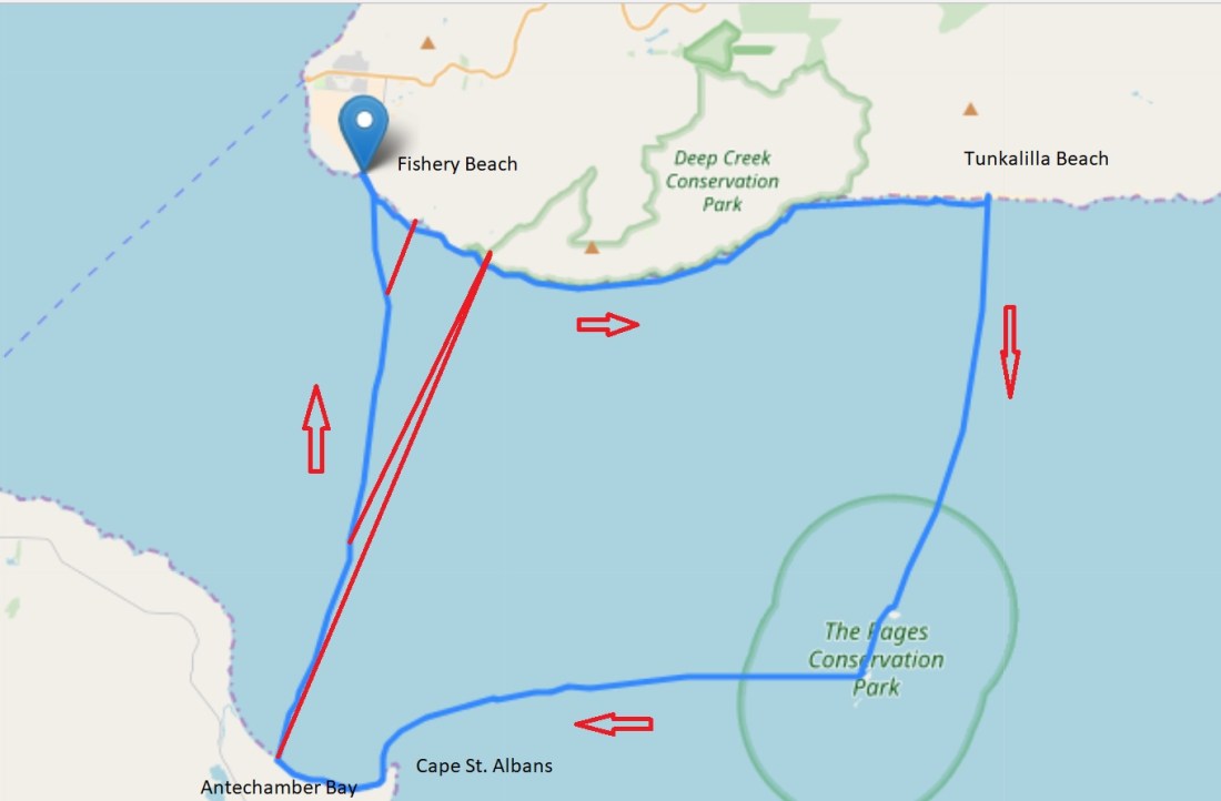
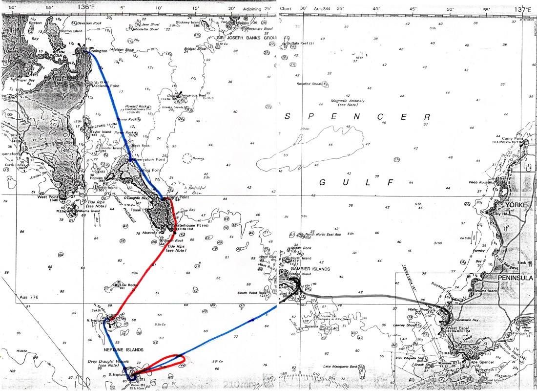
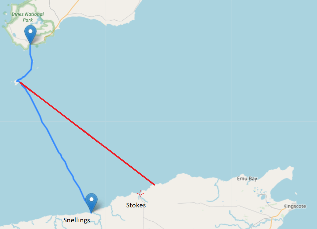
Here is an account of Tresh’s unique paddle to Kangaroo Island in August 2019, where he circumnavigated the Dudley Peninsular by portaging across the island’s narrowest section – Pennington Bay/Pelican Lagoon.
A unique feat. that I believe had never been achieved before.
Tresh is a local to Carrickalinga, an adventurer and an elaborate writer.
Here is his account, picking up after the initial crossing of Backstairs passage to Antechamber Bay. Enjoy!
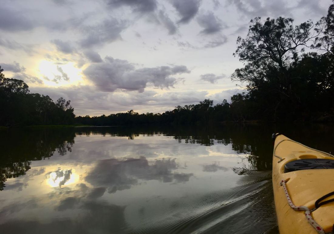
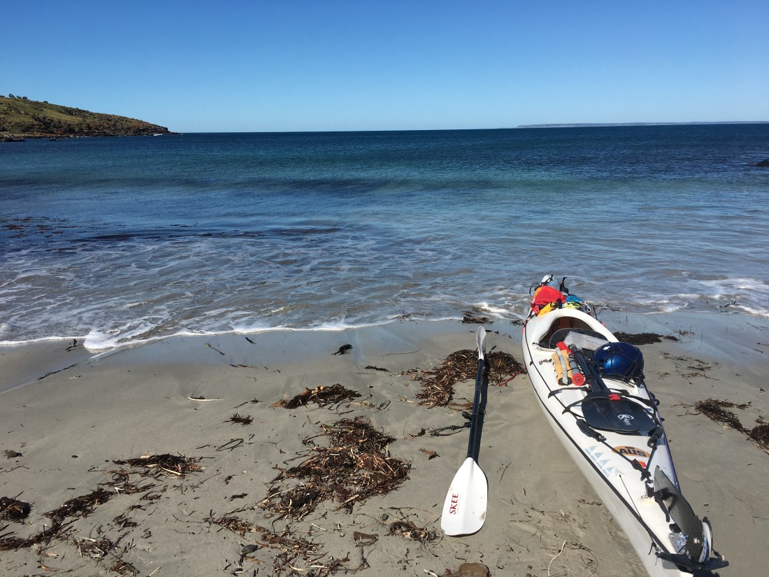
Landing on Antechamber Beach after the bumpy, and rough three or more hour crossing. The immediate registering of the terrestrial heat thick around me like a blanket, as finally, the kayaks’ nose hits the sand, and out I get, the heat comes as a surprise . After only such a short time , I’d already forgotten about that heat back when I left Jervis. I’d got used to the maritime world where the heat can’t beat the oceans’ cool. Wading up through the blanket, up the hot sand, skin drying out by the second, pulling the greenlander just that little bit higher ‘just in case’ ! And pretty damn happy to be here. it is now time for a well earned cup of tea .
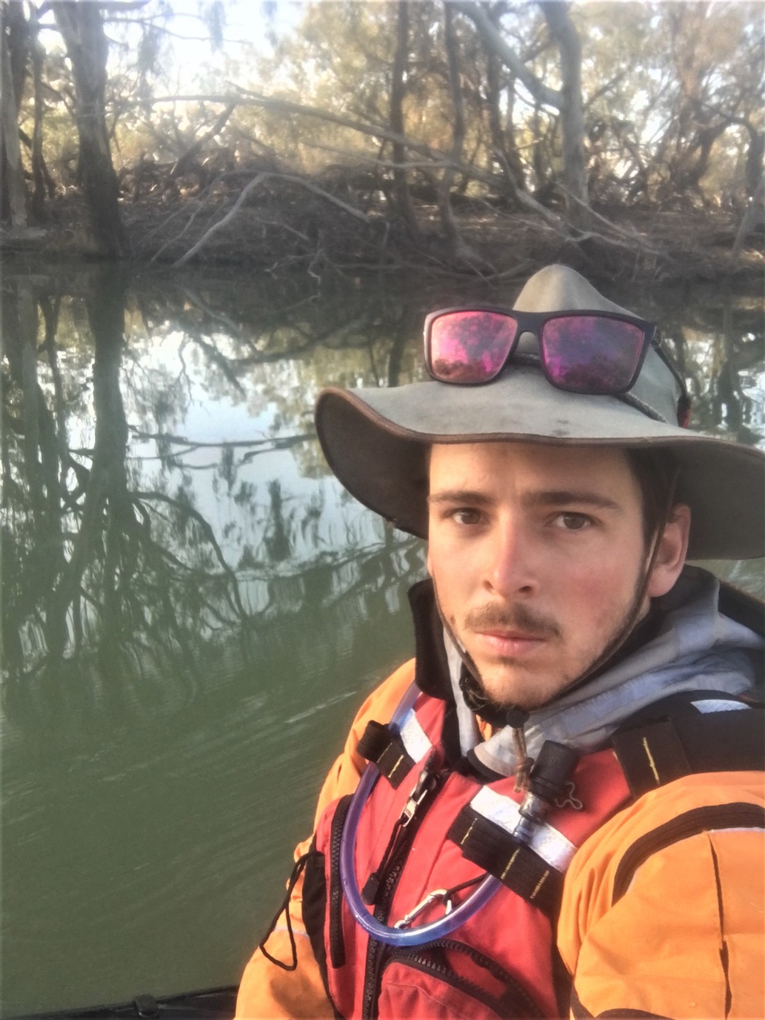
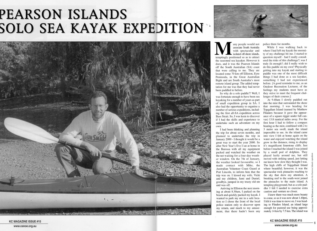
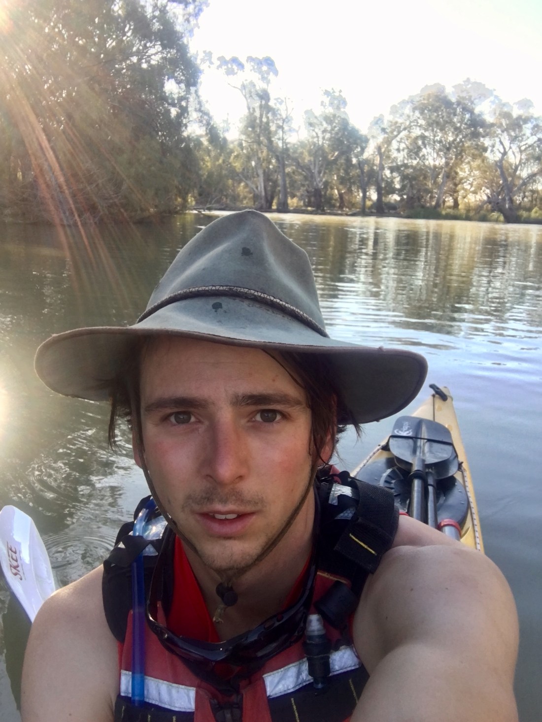
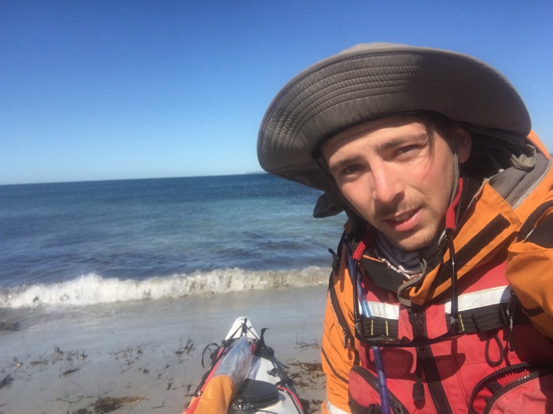
First of course is the by now customary selfie on the beach to send with txt back to my wife Ruth, letting her know that all is well .
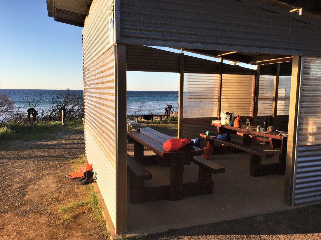
So, over the short stretch of dune , through the sights and sounds of beach heat life along the tiny track opening out to car parking area. Past all that to the Chapman River estuary a couple of hundred metres away. Tall tea tree along the banks casting pretty good shade, lovely open and soft beneath, – completely amenable in every way ! , the buzzing of flies and various insect life keeping me in benign company, most other creatures laying low during the heat of the day. Me too for a short while. Cracking the thermos, I have the almost ‘aholic; anticipation as the chai pours into the enamel mug , spicy and sweet, adding the milk from my trusty old plastic peanut butter jar, giving the richness and body. I imagine myself now, that I rub my palms together with the vigour of an addict just about to score , or imbibe , or whatever it is that we addicts do ! – Not sure what this form of understated mania looks like, but I do know was pretty damn ready for my Chai tipple. lunch was on the cards too , but ended up leaving for still later on. I sometimes like to paddle on an empty stomach, I don’t think i’d eaten much in the morning if at all before the crossing Believe me I eat plenty every day of my life, and somehow when required for short periods , a day say, I feel most natural going without, I never flag energy wise, even when paddling or walking, and when it’s good and proper time, I will eat and fill up on good food.
Well hopefully that will be about it for the food and diet talk !. . . .of course it all only serves to distract from the couple cups delicious chai ! ha ! there we go again. Not many souls around Chapman river , even over on the other side of it where there’s a large picnic shelter. My legs stretched out into their usual shape, it’s now time to get back onto the water. If I’m going to get around the Dudley peninsula in just a few days I better get a cracking !
After a late start this morning, waiting for the ( outgoing ) tide at Cape Jervis, it’s now mid afternoon and want to make landing in Pink Bay in plenty of time without having to push it at all along the way.. . . Aaaahhhh Pink bay , just the memory of it from a previous trip spurs me along ! They say the three pillars of happiness / well-being, are – someone / something to love, something to do, and something to look forward to. . . . . well, Pink bay definitely forms part of my tripod today. . . . .in fact, the the whole lot ! – something to love something to do something to look forward to, and they’re all Pink !
But this time, I certainly had all three working together beautifully right here in the now !
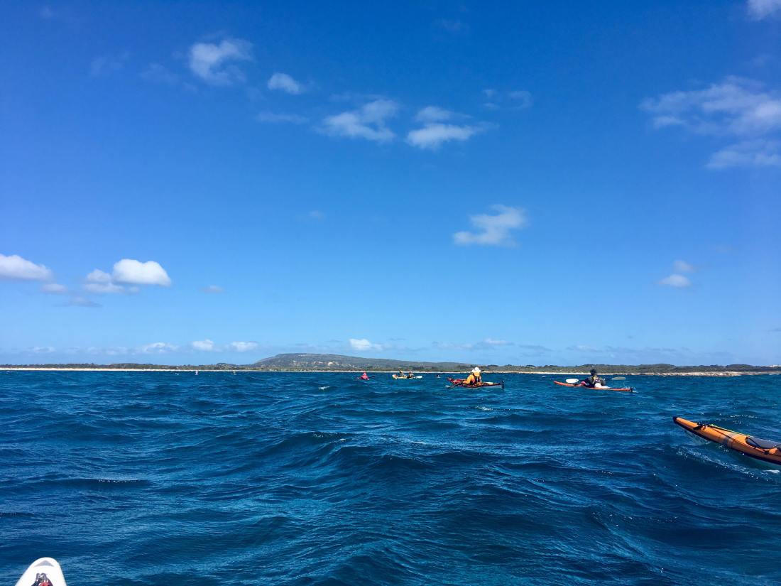
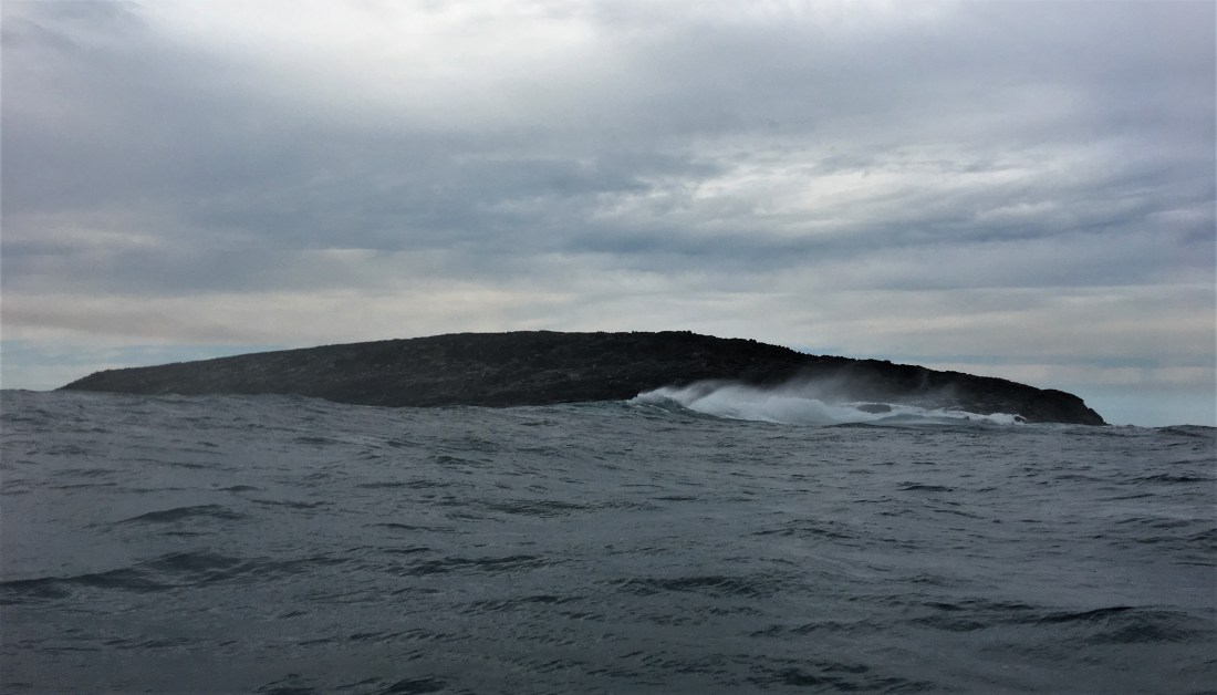
Can’t recall too much of the next leg other than the wind had dropped a fair bit, I probably sailed / paddled along. the point at Cape St Albans pretty bouncy, and the background roar of the surf around the reefs further out a sobering sound. in spite of the strong confused water immediately off the point close in, no way would I be going further out to skirt the Clapotis like I usually would ! That wrap-around sound of surf, even with these pretty mild conditions of 1.5 to 2 m swell, and the wind having dropped , didn;t stop my jaw from dropping at the realization of where I am ,where one stroke after another has brought me. Coz thats how it works really. If I keep up up with the strokes. then somewhere comes along sooner or later.
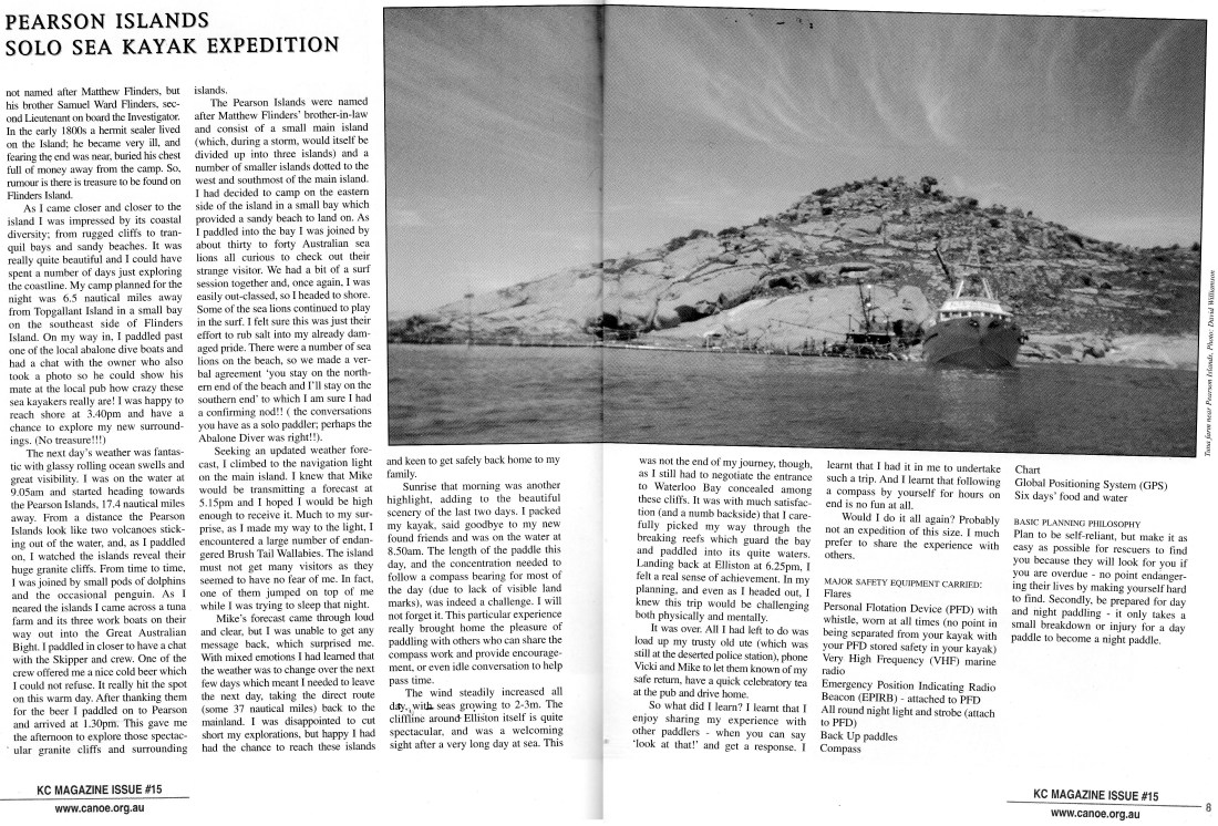
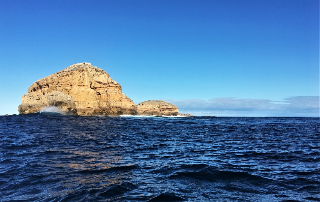
After a short but long while the point with its Lighthouse ( that I always thought must be Cape Willoughby viewed from the sealink ferry and all the countless Deep creek camps, Willoughby is hidden from such vantages) is behind, further to the south and forms one of the true ‘corners’ of Kangaroo Island.
And now once more, as what seems like always, around Cape Saint Albans, the strong headwind coming at me across Moncrieff bay – don’t really know how it manages that, but it’s obviously got the hang of it by now. So, head down and tough it out the short 4 km or so until the PINK is reached , Seriously I feel like writing a love song , or at least taking my place among the throng of Devotees, and laying all of myself as my only offering for this little haven of welcome loveliness. All troubles melt away in the few metres it takes to swing around and enter the protection of this cove.
On this occasion of course, there were two mermaids, in the perfection of youth, frolicking joyously in the small well formed waves out from the beach . I felt very welcomed, and wondered if I was indeed dreaming . so perfect is the scene.. . . . was I Cook entering, then landing on the ‘friendly islands’ ?, finding these pin prick places amid the immense ocean, the big briny, offering to weary mariners, earthly and soulful paradise.
The bay is so narrow , perhaps only 15 or 20 m wide that i wondered whether i would have to pass through the mermaids’ game in order to land on the available sand, rather than hard up against the bookending boulders to either side . Aaahhhh but no , their game of beach ball unfolded in such a way so that the Mermaids parted in their frolicking for me to pass without hinder, or hindering. Aahh, the grace and poise, Just how Pink is that ! ?
And as with my other solo Kangaroo Island trips so far, I seem to have the cape of invisibility around me !. Once again , coming in to land, in almost direct collision course with the only other beings in sight ( or for miles around for all I know ! ), somehow , there is no eye contact, or acknowledgement in any way, no nod of the head , or ( God forbid ), ‘ Hello ‘ . All of which supports the truth that these two were in fact mermaids, invisible to others , as I was invisible to them. so of course, they hold not to the social norms of Humans.. . . . . .
. . . .OR, might there be tens of thousands of sea kayakers landing on these shores every week, that even the tourists tire of it, it must be as nothing, and the people in the kayaks are in fact not there ? , or if we are , then we’re more like the visitation from a fly upon a sandwich in the outback, evoking the corresponding level of wonder and welcome. ?
So , Landing, getting out of the Greenlander after a decent push to arrive, I am very happy, and take a moment to stretch and gain my land legs. Soaking up the Being here, allowing the place to enter and fortify me, recharge me. Down at the south east tip of K I and at this time of day, the temp is unbelievably perfect, the water warm and the seeming maelstrom of wind and waves splashing just a few moments ago seems now to have been a dream. . . . Now , to choose a side of the bay to set up camp ! , deeper into the beach , it’s still only 40 m or so from one side of the ‘valley’ to the other, it;s not a complex decision ! . .. Or is it ? there are always the relevent factors influencing whether here, or maybe there, – breeze , high tide , privacy, ‘feel’ and so on. this time I opted for the side opposite than the last time was here, So ! the current computations did eventuate a different outcome on this occasion. I drag the boat up the beach , Gee you know you;d think the mermaids could take a few moments from frolicking to lend a hand ! ( there I go again me me me me ) Ha ! ? – no such luck, I had eventually broken what seemed to me a (by now) strange silence, and said my hellos. . . . I forgot , they can’t hear me. I guess that’s just how mermaids are in these parts. Nah they were cool, I’m getting used to the invisiblity thing , some times it has turned out quite bizarre, though becomes hilarious later upon reflection. And so it was on that evening , when upon looking up from my short engagement with setting up , I see that I’m alone on the beach, To where and how did they just disappear ? ?
Having set up a bit , time for a walk up and around the hill. There are now quite a few villas and sort of unit things, holiday thingies. up the hill here and there surrounded by trees and shrubs. It doesn’t somehow prove a great walk , but it certainly stretches my legs and broadens my view , and acquaints me superficially with this unusual little settlement of folk , probably none of whom live here. Souls nonetheless, but they all seem to be inside on this gorgeous balmy evening in paradise. i hear music and the telly. . . . .I sort of feel that I may well be strolling through a gated community at the end of a leafy court in a well heeled beach suburb. Rather than a pin prick of a hamlet at the far corner of the Island and of the western world. . . .It hardly feels like country here , but it is , and I’m a newcomer , a visitor, and I won’t feel it any differently until I sit longer and be, as the evening grows and the night embraces me.
To wander as a tourist, ‘looking’ around just doesn’t do it. As the gloom gathers I do some connection to country movements, connection to the elements and with myself. Feels wonderful to change the key, tempo, the language, – everything, and move in Wayapa ( what this connection sequence is called ) . . . . Fire alight now, the day winds down. and having reception here , sent a few generic messages to friends and of course non generic to my darling wife ! Part of me . . . most of me . . . come on Tresh , ALL of me very excited and pleased as punch to be here and to have gotten here at all, following and backing my own star from within. And with lots of mentoring and assistance from all quarters along the way , contributing to confidence in myself and some adequate degree of competence, I am chuffed and so so pleased . In the background behind all the camp life , the cooking, communicating across to the mainland , the walk, the resting , the Wayapa, is the basking in the warmth of being here, of being alive, of being in a kind of Grace. I hope my simple joy is a sufficient return for the great Spirits’ investment ! I hope so , I offer my joy to all, in my own way.
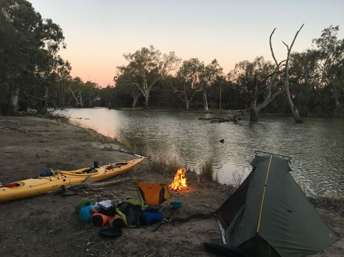
Eventually this time, complete with a lite sleeping bag ( I forgot it another time !) and a tiny tent,. . . I drift off to shooting stars and the gentle lap of you know what. Tomorrow is the big day , out into coast I’ve never seen before . . . .And, it’s ‘ around the corner ‘, – the South Coast. – De Daahhhh ! 43 kms to Pennington Bay with very few if any reliable landing places along the way , I will most likely do it in one without landing if I can. And then , who knows what Pennington will be like to land on , it;s a full on surf beach. I’m only taking an educated guess that in the present very mild conditions that it will be a piece of cake ! .. – What if I’m wrong ? oh well , tomorrow afternoon will tell. That’s the thing with going solo , am I ever sure I’m not just kidding myself , leading myself on with my ‘in-house’ reasoning . . . .With myself as the only listener, it all sounds perfectly reasonable to me ! . . . . . . .The sounding boards are consulted before the trip, rather than during, after that it’s common sense, educated guesses and / or gut feeling. Between all of the above characters in the play, a healthy tension is created on stage, making for an interesting, authentic, unique ,one-off performance .
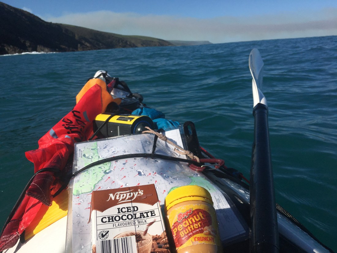
The Big Day Dawns ! well . . . .it doesn’t dawn for a while but we’re up and fiddling around , Wayapering again, breakfasting , making the on-board lunch which i know I probably won’t eat , the thermos of sweet chai, as the Champers for when I do land !. Making sure the sail and all the little things about the boat checked for seaworthiness. . . . it’s all got to work today ! about 8.30 i head out of the Bay into great conditions ( I knew that well beforehand, otherwise I wouldn’t have been here I can assure you that ! )
Oh my goodness this is magic ! water crystal clear, enough movement to keep my interest and attention. A slightly freshening following breeze forecast for later in the day. oh man it’s so good to be to be alive, I wish for everyone in some way or another to feel this sort of just – rightness, at least sometimes, regularly. A creation that has been contributed to by ourselves in very simple recipes.
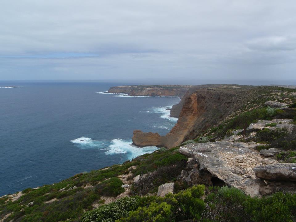
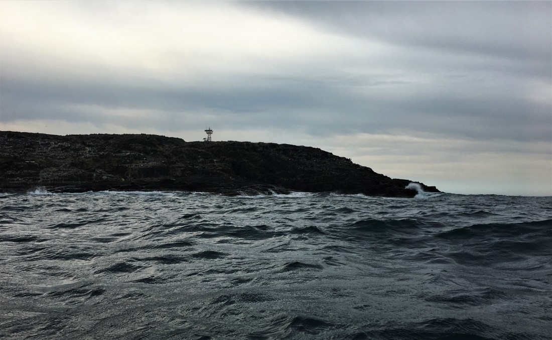
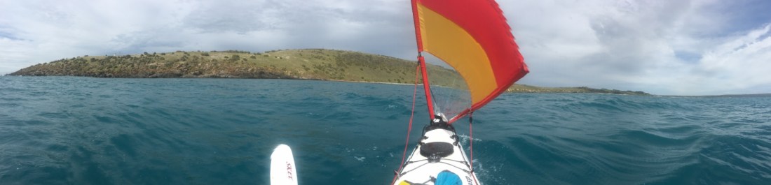
The Light house comes into view, And Cape Willoughby itself is a particularly majestic corner to be rounding. a little lumpy bumpy with the rebound waves creating the clapotis in the area. I would imagine during the larger tides of the cycle, if wind opposed tide at either Cape St Albans or Willoughby then the confused seas would be considerable, and a definite to avoid. But today , manageable and fun. I even raise the sail, steadies the ship, but in the light wind doesn’t contribute much. Never mind we’ve got all day to roll the arms over and enjoy the whole thing , the breeze will spring a bit later on when it counts , and i’ll definitely be looking for it by then !, And admire the awesome coast and the good fortune in being here at all, just a few days squeezed in a busy life on the mainland, . . . aahh but just a few days can be so much.
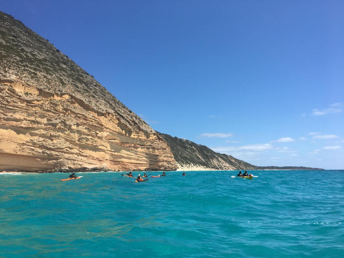
I’m surprised as I coast along how far off shore I’m happy with. With almost continuous cliff there’s almost constant rebound waves and associated clapotis , I’m happy around a Half km off shore, better water. and how much my attention is focused on only two or three things – My heading ( bearing i s’pose ) and the water 15 – 20 mtrs away, from 9 o’clock to 12 o’clock,( port side) as that’s the water that coming my way , and I’m heading into, nothing else sort of exists really. And that focus goes on hour after hour , everything else comes down to punctuating this continueum. . . . .Soaking in the coast , filming , having a break, trimming the sail up, – they’re all necessary punctuations as part of the ‘main game’. I can’t stress it enough, the hour after hour thing is not part of my life on land anymore, it used to be ( Vine and tree pruning, Fruit-picking etc, hour after hour , day after day , month after month, year after year ), but not now. So this facet of the whole experience, is such a stand out for me. Like a million ‘things’ happen over an extended paddle, but also not much that can be readily conveyed to those that haven’t experienced same. I would reckon most folk would relate to in some field of endeavor or another similar experiences of ‘time’ and what’s in there .
Constantly being aware of – me , my bow and the point in the distance- It’s a long haul meditation .The Timeless timefullness of a long day on the water. Paddling south westward toward Cape Hart, passing through the odd floating community of cray pot bouys. Looking how they pull on their anchor lines, I can see an assisting ebbing tidal current evident. wouldn’t be much, as we’re in a small tide part of the lunar cycle, . . . . . every bit must help though, added to a very light 5 knot assisting easterly.
The coastline is healthy looking scrub but I’m not close enough to really relate to it, And also am noticing that it’s not the land I’m predominantly relating to , it’s the SEA, and everything about it that has my rarely divided attention ! I’m in the ocean , and thats my address and home for now.
I notice as the day passes that the lands’ features are generally unnamed, and of course if they are, then never of indiginous origin ( original people cleared out when rising sea levels began encroaching the land bridge to the mainland, I guess they made a choice knowing if they stayed on what was to become the island, any longer, they could no longer come and go to and from the mainland as they had for thousands of years ). So all established names and culture of the ‘island’ faded from memory. most of the stories regarding kangaroo island in contemporary indigenous culture are from the standpoint of how the Island is now , – a place seen from the mainland, where the spirits of the departed souls head for. . . . .for how long , and what for , I ought to find out, and of course there will be way more to the story than that ! Have had the good fortune a couple of times to be round a fire down at the Coorong, with Uncle Moogy Sumner, a true Gentleman and Elder statesman of the Ngarrindjeri people . He willingly shares stories and his understanding of them, in regards anything and everything, including his attitude to Kangaroo Island, and its place in culture. He says ” I’ve never been to Kangaroo Island ( he has travelled the world extensively at the invitation of many first nation peoples) , and I don’t need to , even though it sits there in my backyard, I know my spirit will be goin’ there when I die “,.
So, making my way down this Cliffy coast with only a handful of buildings seen all day, and very few access points down to the water, I really get a sense of the details of this coast are known only to a few , mostly the seafarers and the new locals over the last 150 ysrs or so. So little of it is now part of intense Human culture, Names are used to reference navigation and nautical reference for the Cray boats and fisherpeople., not because of frequent and regular interaction with groups of folk for food gathering , congregating , for ceremony, the central to stories passed down for centuries. – It;s like more of a fresh clean slate, just sitting there being itself, very little influenced by Human activity , but , of course very vulnerable to development. . . . There being few folk around to advocate for this little known chunk of Country. I like being here, I like it a lot. I especially like being the new kid on the block, the know nothing know all. Everything I see and perceive , quite likely projections from my own mind, . . . .looking to be quiet enough sometimes for it to be less so , but for now, – it’s all I have ! !
Around Cape Hart, the ocean seems to push up sizeable combers out of nothing, I went a fair way out to sea to make sure I got well around them , They were so beautiful, but I made damn sure I could hardly see ’em ! I met a young guy the next day who grew up on the island on D’estees bay, population (guessing) 10 , fishing snorkelling surfing all over the island. He reckons Harts and Black point can push up a decent wave from a dead flat sea, some sort of miracle wave machine thing buried on the ocean floor there somewhere.
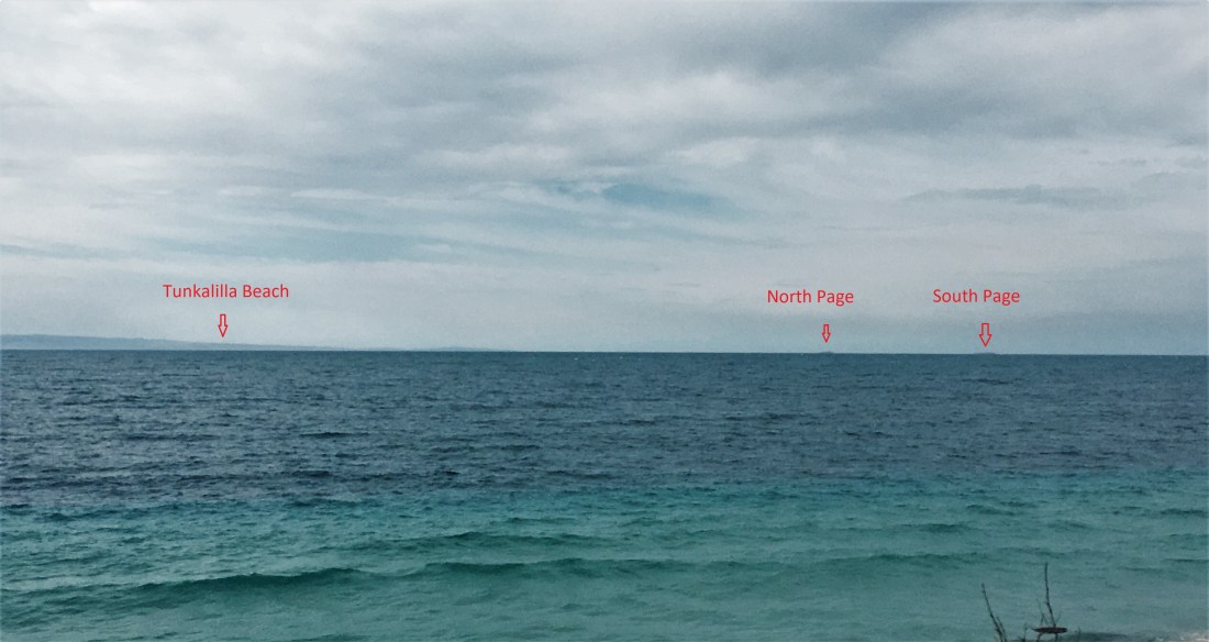
I went a lot closer in after Black point , the cliffs gave way a bit and with it the relentless rebound ( which is actually fun in reasonable doses ), some long beaches. Besides I wanted to get close enough to see if the beaches looked landable. Verdict – well maybe on good days like today, but they all looked pretty dumpy close to shore, like Tunks can be. So at least if I get hammered, I’m not one or two hundred metres from shore !
Breeze began to pick up enough to be useful, paddling along with sail . Along with sea birds visiting , I came across a school of salmon at the very mouth of the Wilson River. They were about the only creatures I saw . No dolphins, seals or other boats .
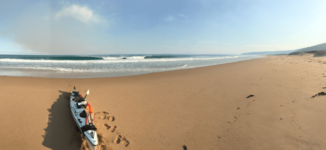
With everything going along even more swimmingly, actually began to relax as well as enjoy the ride ! the question of whether Pennington Bay was going to be good landing material was getting closer to providing an answer . Funny thing is , – that place for which I’d been doing all this in order to reach. . . .well the closer it got, a sort of reverse thing starts happening, – like , I don’t want to get there, – a. I’m having a good time b. what if its completely crashing like at Harts ? c.. . .the good reason for getting there is there’s still heaps of work yet to do today. . . . .- got to get my laden boat up the steep winding steps up to the carpark, Get the trolley organised ( which have never used beyond a trial before I left the mainland ) and Portage along dirt roads to Pelican lagoon, two kms if I’m lucky enough to find a launching place, 5 or 6 if I’m not so lucky. . . . . so now it;s getting on for 4pm and closing in on Pennington, and somewhere in that mix of things ahead to do, lunch would be nice.
I know that if i was keeping on going along the coast , I would have definitely made the far end of D’estrees before dark, now that the breeze had moved closer to 15 knts with low seas.
Back to the mission , Pennington in sight now, a few cars there. . . . .that;s good , might be able to ask for some help up the stairs ( me me me ). Reluctantly the sail comes down and now the beach breaks to recce. Prior to leaving, checking out the beach on Google earth , there were places that looked first choice, but not necessarily close to the steps, in the end, plain common sense and reading the breaks from behind, I chose a passage and a strategy. In the end it was a piece of cake , a bit of bongo surfing half way in, and then txt book in to the welcome sand, Yay ! . . . . I was pretty happy and more than a bit relieved.. . . . And , . . . lo and behold, more Mermaids ! ! ! – This time I seemed to be much more Visible ( these mermaids are a bit older ! ) After securing kayak up the sand a bit , I tentatively approached the two glowing beings before me. The closer I got, the more I perceived that , they could see me , and seemed definitely to have bestowed their welcoming gaze upon me ! . . . .could this be true ? ? , My Heart a flutter , I said ‘Hello ? “. . . , smiling , each “hello d” back to me in return ! . . . wow , Could this possibly be ? ? Not wishing to jump too far in conclusion, and seeing also that , I saw that they were not actually Mermaids ( was that part of the spell beginning to lift ? ), but lovely Humans of the female gender. After a lengthy and animated exchange. . .From deep within my vulnerability, and in my just – birthed rawness I asked the question . . ‘Can you see me ? ‘ . . . . – too softly at first , I was sure my tentative whisper passed unnoticed beneath the crashing shorebreak. -, I;m sure they sensed that I was trying to communicate directly with them. Still glowing , and now smiling, they, and now I, leaned just a little toward each other , an ancient gesture of goodwill, I repeated , just a little louder, – ;Can you see me ?’ . . . . Looks passed between them, my being hung upon the reply.. . could this possibly be ?; But i also needed to know (ever the scientist in me ! ) at what point, the cape of invisibility fell away ? , but I had to find out more.. . . . Yes , we see you, because we’re from Holland ( more or less ! ) The two Dutchies claimed they definitely saw me sail into the Bay . . . can I trust them , should I believe them ? And they saw the negotiating of the surf, compelling evidence true but not conclusive , they could be making it up . I needed to question them seperately to really get to the bottom of this. Of course I immediately want to know at what point did I become visible ?. . . .have they merely deduced me ? . . put two and two together following logic. . . . ie there is a sail , under it is a craft of sorts, maybe a kayak, in the kayak , a person making it go, – not important for them in any way , merely of interest as one of the accessories to the scene of being present on Pennington Bay , Kangaroo Island Australia. – here it comes closer, this configuration, its having a negotiation with the surf and it is heading this way to the beach , not in a random fashion though, seems to be a method with its behaviour , therefore , must be accompanied by a form of intelligence. Did their logic will me into visibility ? . . . .Did they individually or collectively play a major role in the cosmic chemistry, restoring the attribute of my being visible ,. . . .even in a casual . no strings sense . I realised that I would have to question each separately, to see if their stories tallied. Not wishing to be at all weird by asking each in turn to accompany me up the beach a bit out of earshot while i asked deep personal questions in regards to their detailed connection to the present , and the detailed mechanics of their current perceptions. . . . . .no , that might give rise to some measure of apprehension, , , , thus influencing irrepairably the authenticity of their finer sensibilties in regards to our present intercourse. . . . .No , I will just ask the other to cover her ears as I direct my questioning to the other . Damned fine idea ! . . Could be no possible cause for alarm in that ? ! ? . . . . . . . . After much natural too ing and fro ing in conversation as to what are they doing here and where from and why and how’s it all going ,. and likewise re me. We parted, and I felt gladdened that the few hours at sea hadn’t yet rendered myself incapable of stringing a few useful sentences together in the cause of noble empirical processes involved within the practise of the most basic of human sciences . . . .- Havin’ a chat.
Thing was, that at last I knew I’m here and I’m real . . . . . I can be see others in all truth, and in turn, can myself be seen ! ! Halleluehya ( spelling ?)
A strong , fine looking young man offered to help carry the Greenlander up the steep steps – thankyou thankyou !. Gee, Pennington Bay is full of responsive Humans. . . . .there must be intelligent conscious life on Kangaroo Island after all ! After unpacking all the gear and hauling up the steps to the carpark, I find there is a Coffee van set up ! Inhabited by two smiling faces each with a person attached, I’m gestured (lured ?) closer, we exchange stories in the natural manner of tribes meeting on common ground. There was even a couple of locals around to welcome and remark, and myself to snuggle in once more to the bosom of human warmth and intercourse. . . . . .( here for some reason, adopting the tone of the 18th and 19th century male explorers and journalers when feeling warmed by humanity at large and on location ! ) Aahhh but not for long the candour and frivolity, laughter , dance and song, – after many adeius, farewells, and tearful waving, we all parted as must we knew, – I trod off with heavy heart and heavier Kayak, on crappy trolley up the slope out of Pennington Bay, on the gleaming white limestone marl track. dense low coastal bush surrounding. Still in full oceanic sea kayaking garb, jacket, skirt and all, and still very bloody warm.
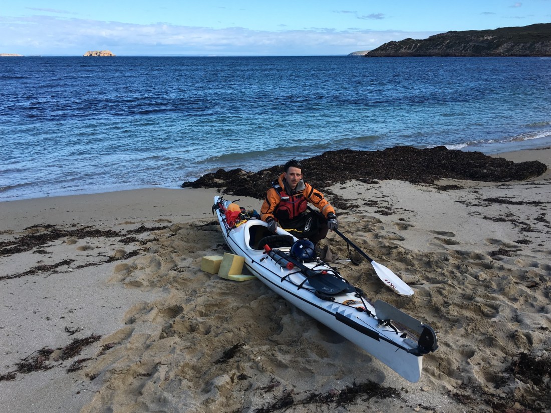
Having found Pelican Lagoon impossible to access on my own, without leaving drag marks through the fragile samphire destroying it and other associated vegetation in my path, visible for the next five years ! So, definitely not wishing to be the one to create an envirornmental legacy for myself to remember with guilt and regret , and others to see and curse for years to come, – I walked up the Muston rd until I could surely find a track in to the lagoon. . . . . wasn’t such a place . . . . kept walking and pulling my friend along behind me. . .(remind me next time to put the trolley a wee bit futher forward to balance the weight, it was getting bloody heavy ) . . . .And by now around 7 o’clock and a few kms behind me and me still in all my paddling gear, I was fast realising that this was the hottest day of the summer on the Island ! South of Muston a guy called John and partner Monique gave me a lift , having seen me land at Pennington earlier. He was a Man of the sea, Life on the water , and mucking around right next to it, was written deeply into every bit of him, probably around seventy or more, I reckon he was fitter and more able than me , and certainly tougher !. . . .He didn’t want to talk me into it , but, ‘we can give you a lift no worries’. He explained how it was gonna work, and gave me a demo by getting himself on the tray, giving me the run-down. So , I sat on the back of the trusty ancient flat tray land cruiser holding the bow rope and craddling the bow with my feet sitting on the back edge of the tray. John had assured me ‘We do this all the time at the “River” (American). I’ll be goin pretty slow ! ‘ — ‘We’d better’. I thought, and said as much, as it’s going to be cactus for 18 ft of fibreglass greenlander if something happens. I was pretty pooped by then too after some 45 km paddling and the longer portage haul than I expected , so I said ‘Ok John, but we better take her veerrrry steady there Mate, she’s only got five inch wheels ! !
‘ Off we went ! I tell you it was by far the most intense and challenging part of the day by a mile ! . . . I had a block of wood next to me to bang on the tray if I needed to communicate to John in cabin. . . .’I’m a bit hard of hearing you see ‘. well I had to do just that half way along the track when the greenlander was starting to slip onto its side with the incredible shaking up from the marl road. – still strapped tight but lying now at an angle off we went again. at first at a slow jog and then increasing as I reckon John was thinking ‘This’ll take forever , why did I offer ??’ Then it became 12 kph then prob 15 + – ‘Holy smoke this is getting hairy!’. Miraculously the little wheels that Malcolm and I pumped up a few days before held up , and so did my tight strapping. And that morning I had cut off a small frayed section of the bow rope (the painter ? ) and retied it. . .thank God for small maintenance. I’d never ever used a trolley before, so I was glad I’d done a pretty good job with such a crappy inadequate piece of equipment ! . . . Corrugations , pot holes, Sand drifts that acted like sea-anchors on the trolley , bogging the heroic tiny wheels, almost pulling the rope out of my hands, or me off the tray with my bouncing boat !. But it’s like anything , one reads the play and anticipates and I was already leaning back toward the cabin the instant I saw the sand speed under me ( I had half an instant before the trolley hit the sand ! ) . And after a million corrugations and bouncy bumps, and very intense physicality of keeping it all working my end, I sort of accepted the whole thing and began to enjoy the moment,and extreme novel ironic adventure on a few ordinarily tame few kms of road on land , after hours and hours of remote ocean coast, as part of the whole portage fiasco ! The temp was still around 36 while all this going on .
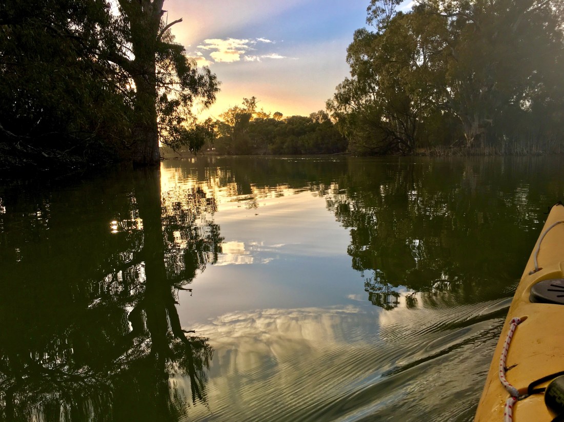
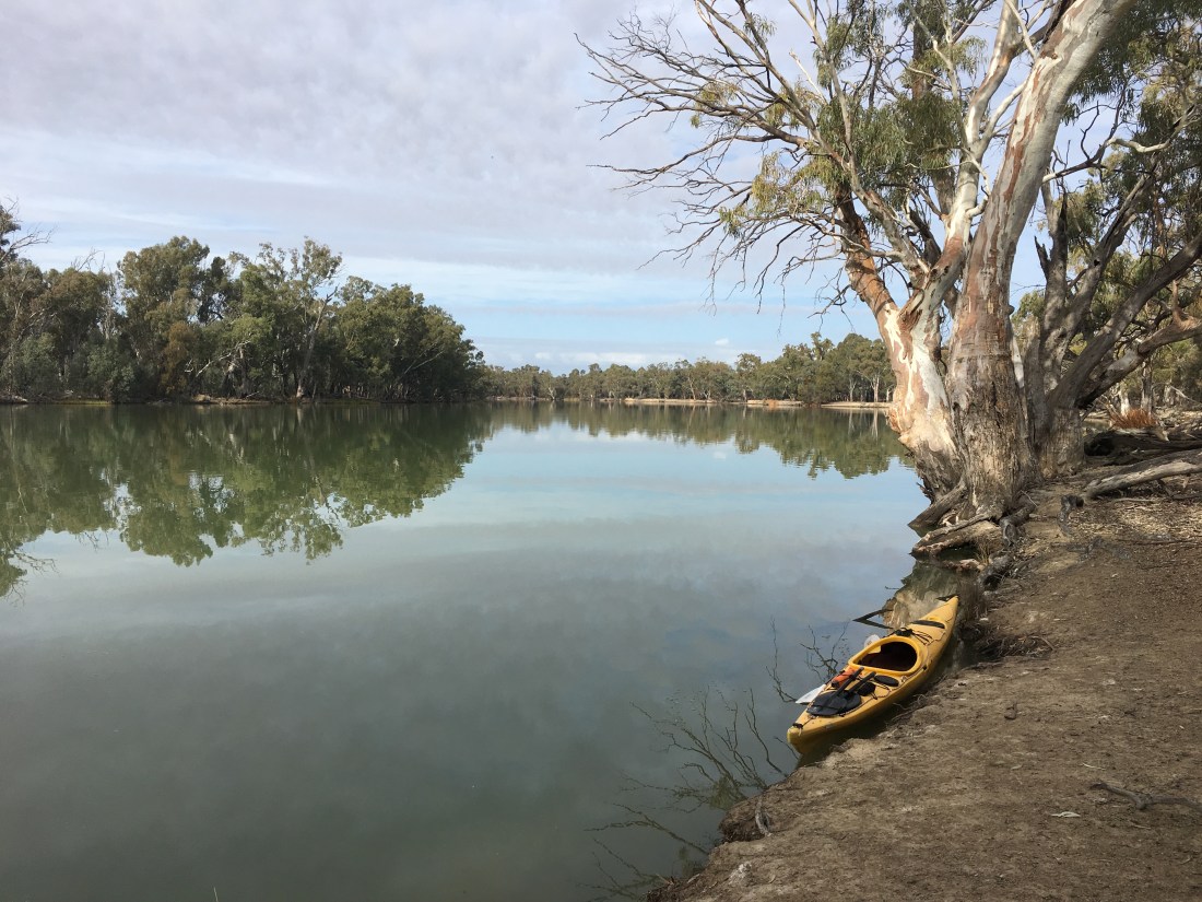
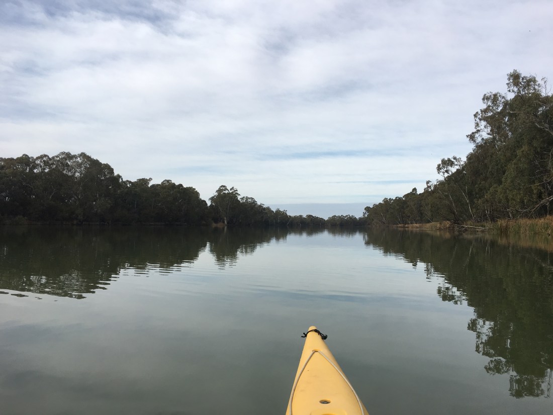
Eventually we got to Muston , where my saviours/torturers reside. John stopped at what to me looked like a freeway, down to the middle reaches of the lagoon. It looked Ideal . . . . Before any of that really sunk in , I was just mostly aware that we had stopped ! and the world had so much stillness and my friend on the trolley was in one piece still, and . . .the shaking and the tension in my hands from holding on for dear life on that bow rope, was over ! While I was still marvelling at the now tranquil sedentary universe surrounding me, John got himself out of the cabin, took a look at me , – said something like ‘ well , I bet that shook your balls around a bit ay ? ! ‘ – Still sitting on the tray, and having lowered my treasure to the ground, I looked upon him as the oracle of unbounding truth and cosmic understatement, leaned myself back flat on the tray and laughed and laughed, loud , ongoing belly laughs, for what seemed an eternity. . . . . I reckon John and Monique thought I may have become unhinged or had a breakdown on the short trip ? ? . . . .well , in a small way , yeah. Arms outstretched flat on my back looking up at the sky laughing until it was all gone, I got my self up, and off the tray, took a few steps, looking all the while into his ‘old salt’ blue eyes, and said ‘John, that’s the understatement of the century !’ And then we both laughed some more. Monique took a pic on her phone, which later I thought I ought to have asked her to send to me, as a record of this life affirming moment in time !. as it was definitely one of the high points of the trip. I couldn’t thank them enough. John offered to help get me down to the water , ‘Bit if a rough , half-path down there, not easy with that long thing. . . . look I’ll give you a hand.’ . .. . . to me , I don’t know what John was looking at , but all I could see was a royal Avenue down through the teatree , tight , with a few little bumps sloping down to the water . . . heaven ! ! He offered again, Nah , really , John , I reckon I’ll be right from here, thanks though, reckon too that your dinner tonight’s going to be a bit later now than you’d have thought an hour ago. Thanks again , I’ll see you around ! ‘ . . .The wind was still up for some good flatwater sailing northward , and a bit of daylight left, American river here we come !.! . . . .And so it was, beautiful sailing along the tea-treed shore swans honking the evening call , pelicans duck waterfowl close and far away, Pelican lagoon , what a heaven, and balm for the soul after such a mighty day. Entered American River as the evening gloom descended.
The evening honks, quacks, natterings , the hustle bustle of the settling in, as the day passes into evening. All around, the flotillas of every kind of waterfowl, the taking off and landing around and over me, the strong strong scent of estuary- salty, weedy . teatreey, birdy and me , all enveloped by the fresh ocean air. A fair inward tidal flow characterised the middle of the channel opposing my heading. So I kept to the shoreward of that, in slightly shallower waters to the left bank as we headed northward. Over crystal waters , the fertile shallows of water vegetaion passing a foot or two beneath me, skimming along under sail, . . . a gentle whoopeee ! !
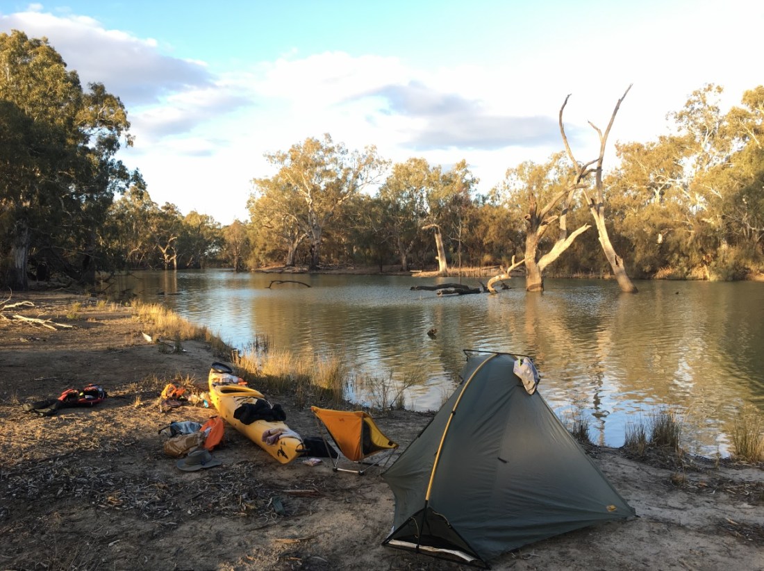
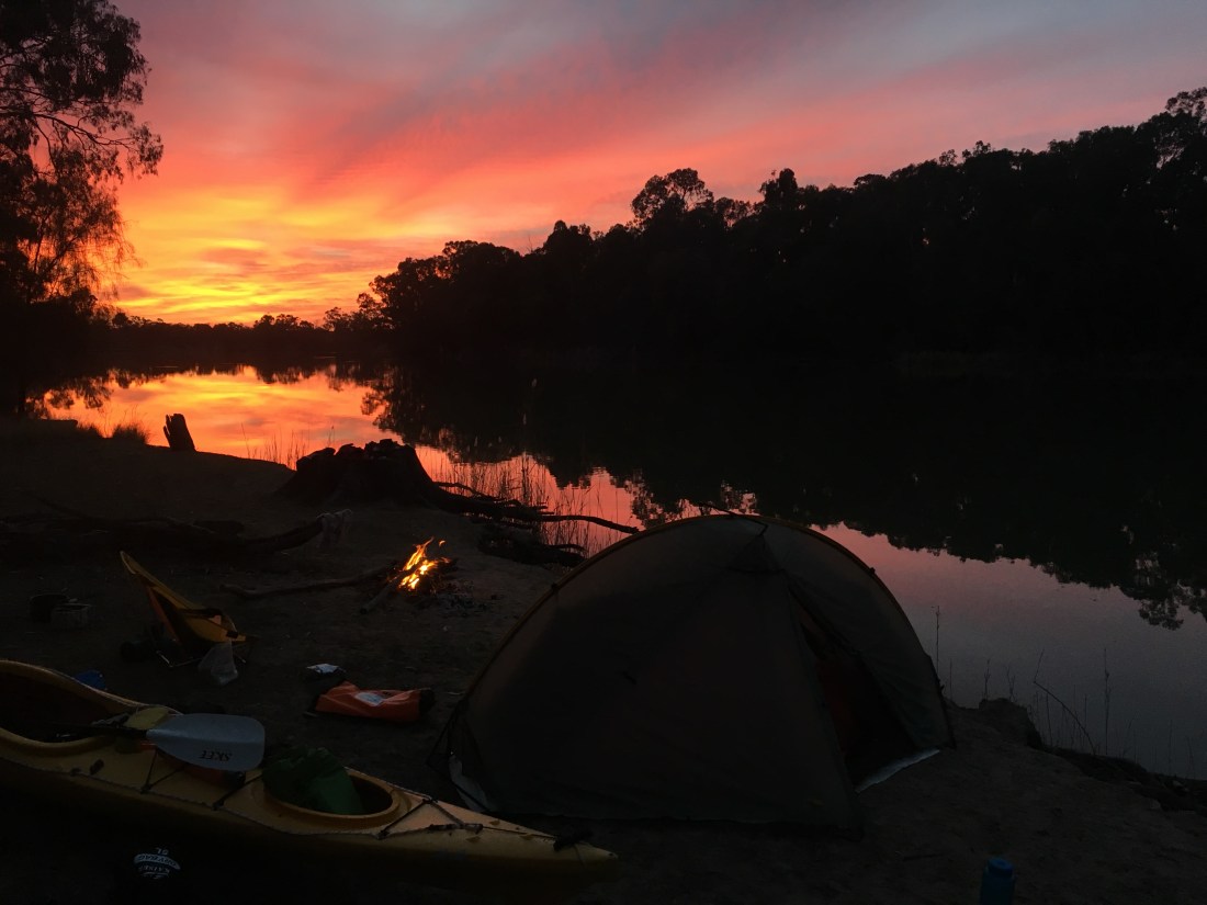
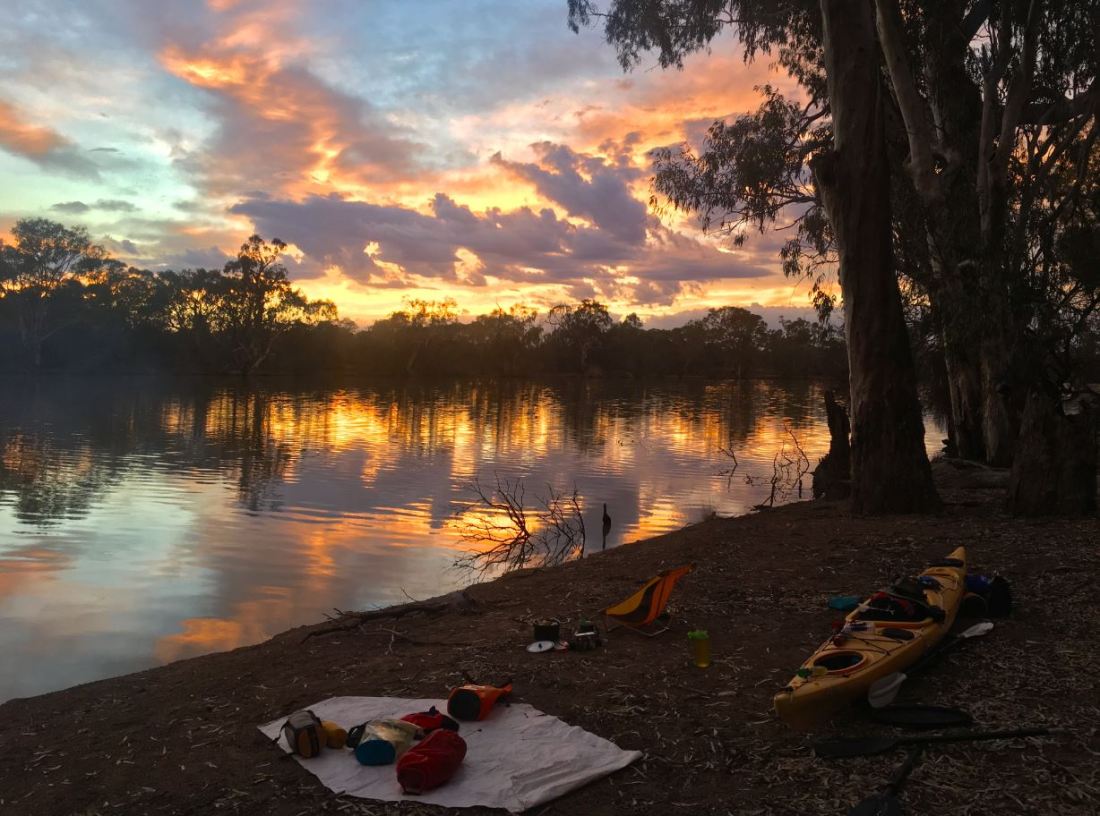
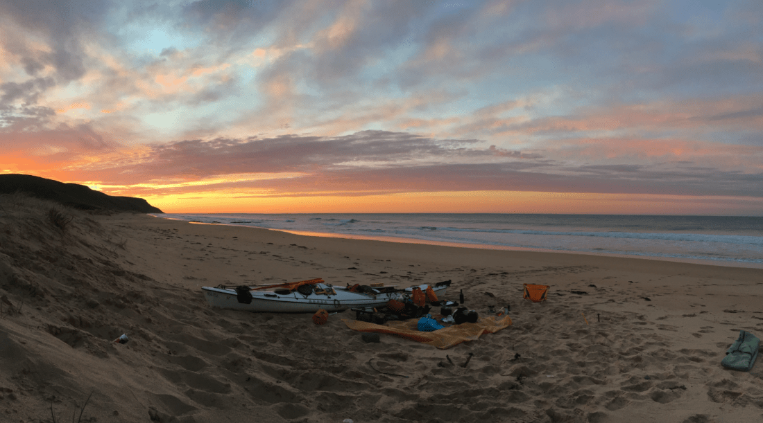
Eventually paddling through the rocking yachts and fishing boats of all description and varying degrees of seaworthiness. all that remained was to suss out a decent camp for the night. there being no time for second choices, the first had to be golden ! . . . .and so it was , across from the town near the spit mouth of the ‘river’ near a tiny creeklet into which I moored Greenlander next to camp. the ‘creek’ went a little further into the . . . .( I don;t know what into ? nothing and nowhere really, but it had a tiny falling down footbridge over it, so must have been a walking path ) the rest is history, the campsite was absolutely terrific. sandy little rise a metre above high tide amid coastal shrubbery, the twinkling lights of American River across the water. And having a lovely little fire on the sand, a yummy dinner of something or other, . . . .Thankyou day, thankyou everything, for all the grace in every part of it, I could not be fuller. I slept like a log.

 Tuesday 24th
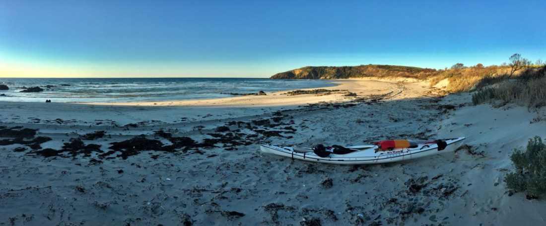
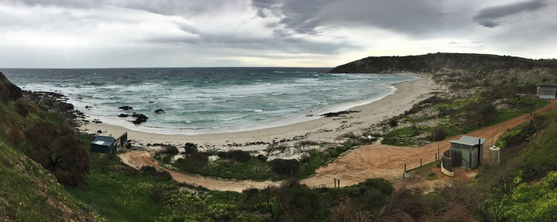


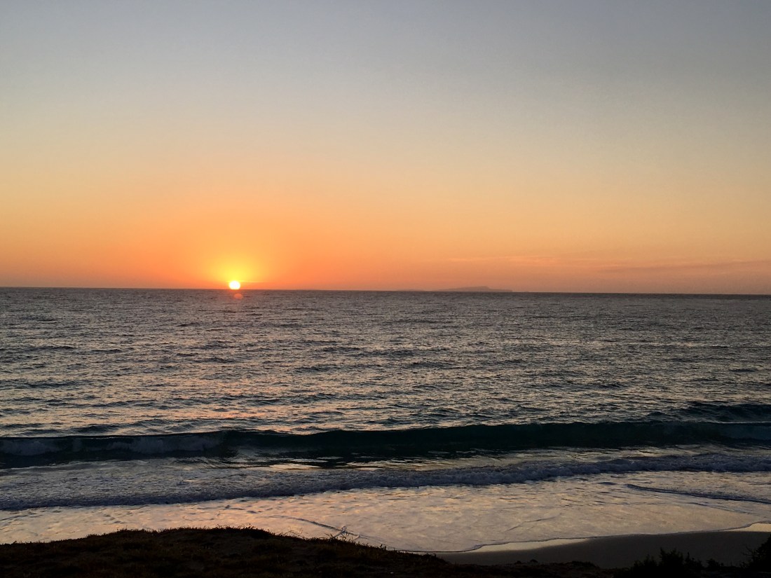
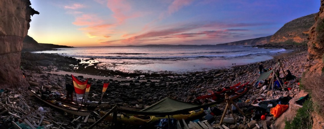
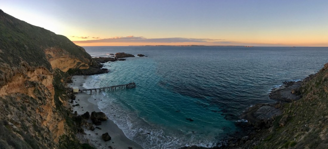
 Tunkalilla sunrise

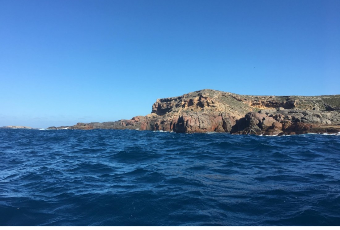
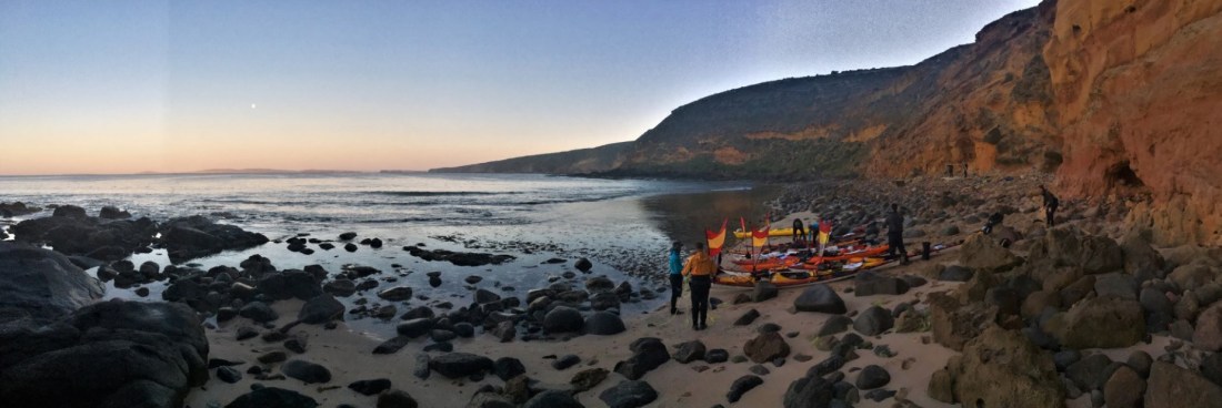
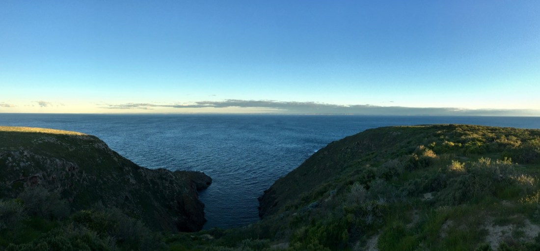
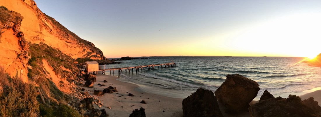
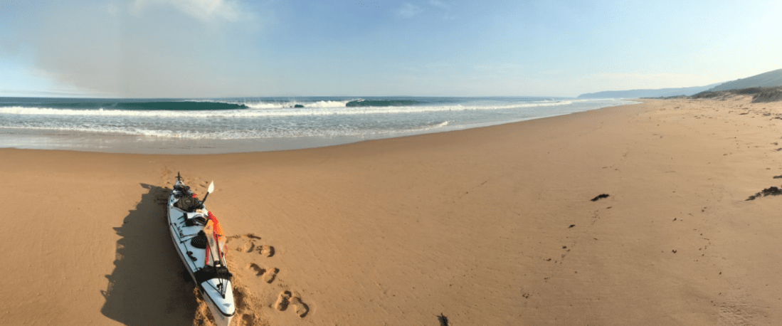
 Looking back on the journey
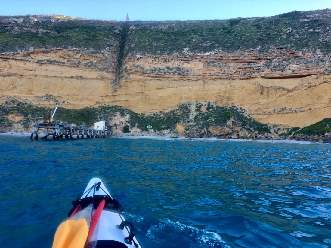
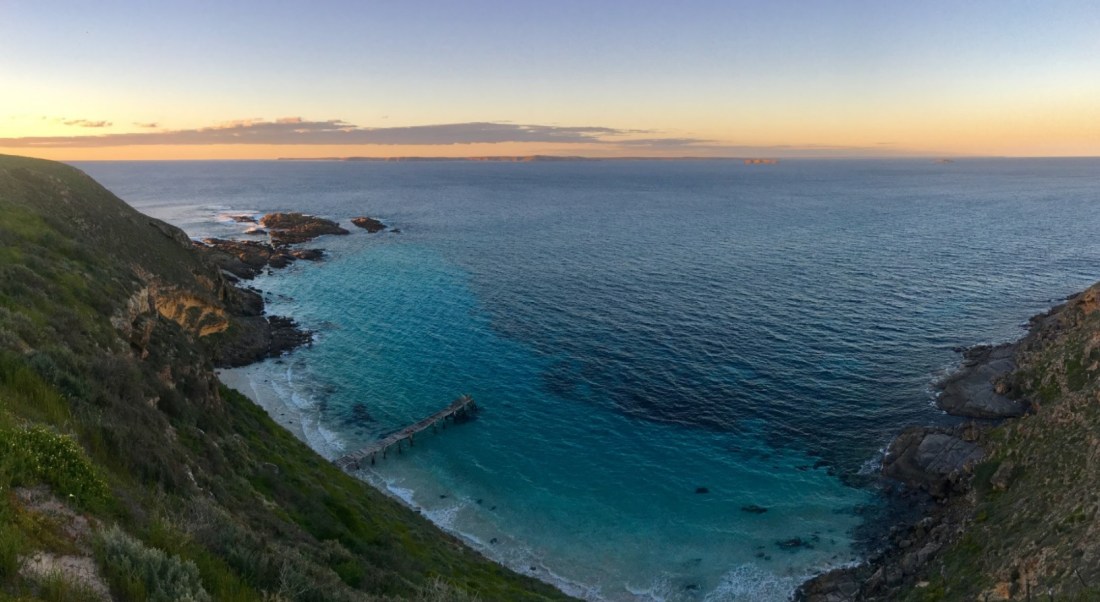
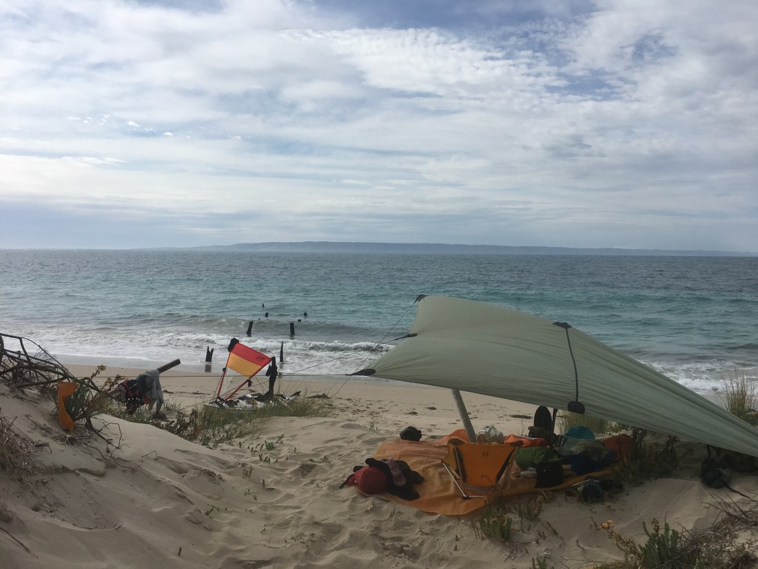 The abandoned jetty, Antechamber Bay
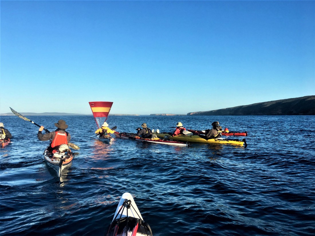
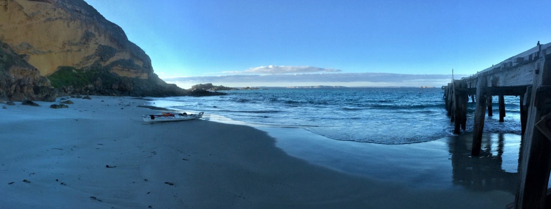
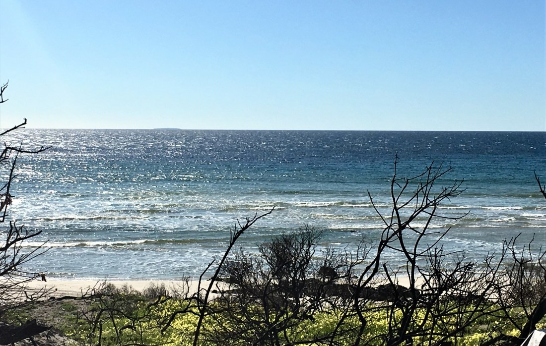
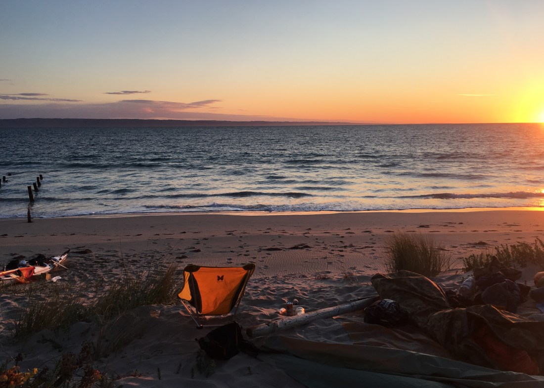 Sunrise over backstairs passage.
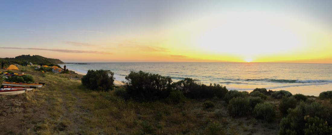