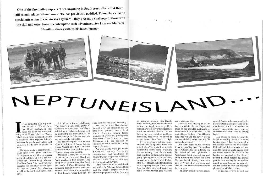
One of the fascinating aspects of sea kayaking South Australia is that there still remain places where no one else has previously paddled. These places have a special attraction to certain see kayakers – they present a challenge to those with the skill and experience to contemplate such adventures.
It was during the 1995 trip from port Lincoln to Wirrina Cove that David Williamson first raised the issue. We were paddling from Thistle island to wedge island when David expressed desire to paddle out to the Neptune’s. “It hasn’t been done before,” he said, “And it would be nice to be the first to paddle out there.”
The opportunity to meet this challenge came several years later when David presented the idea to a larger group of paddlers, so it was that Phillip Doddridge, Gordon Begg, Malcolm Hamilton, Scott Polly and Tim Vogt accepted the challenge. The suggested time to pursue this adventure would be April 1998 school holidays.
Phil added a further challenge -the Pages, a small group of islands off the South Coast that hadn’t been paddled out to either; So he proposed we use that trip as a training run. At the second attempt in February that trip was successfully completed.
The previous support crew on most of our expeditions of Dennis Wright, Gloria Wright and Ken Salt were now included, so now the expedition to the Neptune’s was up and running.
On Easter Monday the two vehicles of the support crew with David and Scott travelled to Port Lincoln. They set up a base camp at September beach just south of Donnington Point. The remaining paddlers met the next afternoon at the Adelaide airport and flew to Port Lincoln where Ken met the plane and then drove us out to base camp.
The camp became a hive of activity with everyone preparing for the next day’s paddle. Later a local reporter from the Lincoln Times interviewed David and photographs were taken. Then followed a group discussion with the paddlers, we finalised how we would handle the coming days on water.
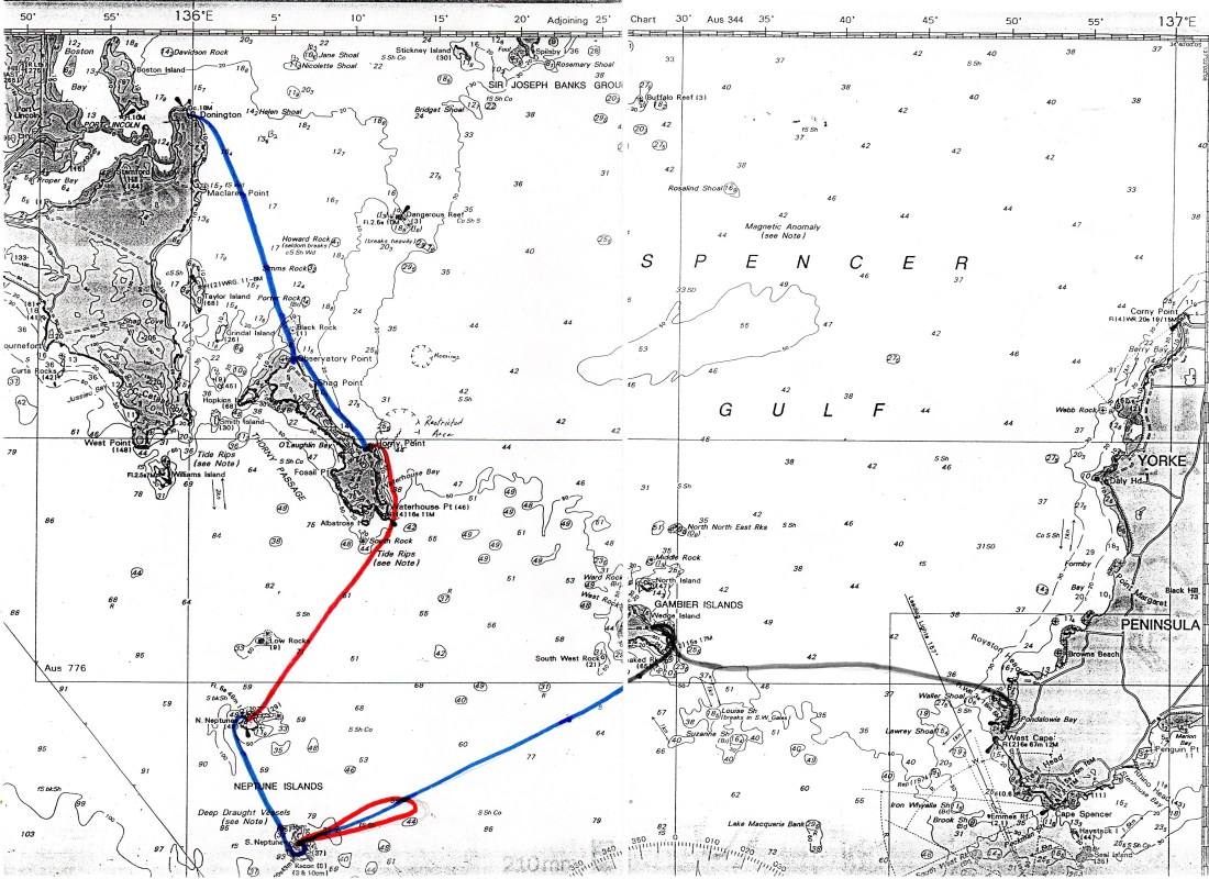
We were on the water just before 8:30 the next morning. Due to the unfavourable tide conditions in Thorny Passage we paddled a wide ark across to Thistle Island, arriving near its northern tip at 2:30 PM.
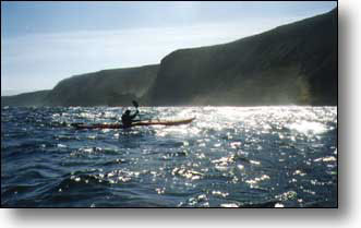
After almost an hours’ lunch break, we headed for Whalers Bay, paddling past the island’s magnificent cliffs. However, progress was slow; there was an unknown problem with David’s kayak requiring both Phil and Gordon to alternatively tow the kayak. Upon landing David’s front hatch was found to be full of water. Tim was having his own paddling problems. Fortunately, they could be solved by removing some foam from his cockpit.
My own problems with my cockpit mysteriously filling with water were solved when Tim advised me that the submersible electric pump I was using did not have a one way valve so the water kept splashing in through the external pump opening and was slowly filling the cockpit. At the lunch break Phil cut off a piece of foam and offered it to me as a temporary stopper. Later I used a corck from one of the wine bottles. It acted as a better stopper – another reason to carry wine on a trip.
Darkness was closing in as we landed at Whalers Bay at 5:50 PM, well short of our intended destination of Waterhouse Bay some 6 kilometres to the South. One of the locals, Ginni Hussey, suggested we use the newly elected communal shelter as our campsite. We gratefully accepted.
Just after 8 in the morning we were paddling around the southern tip of Waterhouse Bay into a lumpy sea. We rested off the lighthouse at Waterhouse point, checked our paddling direction and headed for North Neptune Island. Shortly there were cries of “there it is!” As some paddlers saw our destination from atop the larger waves.
The lumpy conditions soon caught up with Scott – he became seasick. As I was paddling alongside him at the time, I towed him for a short time. He quickly recovered, more out of embarrassment than actually feeling better.
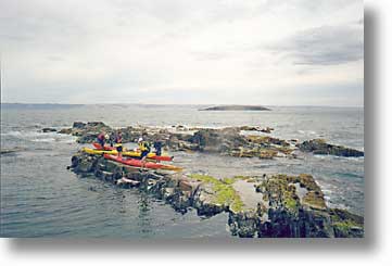
Mid-afternoon found us near the Island wondering about a possible landing place. A boat lay anchored in the passage between the two islands. Phil and I paddled to the northmost island to check out a safe landing spot. The others headed for the boat. No landing was practical on this Island. I notice the other paddlers had moved past the boat heading for the southern island. Unusual because we normally use the chance to stop and exchange pleasantries with boat crews.
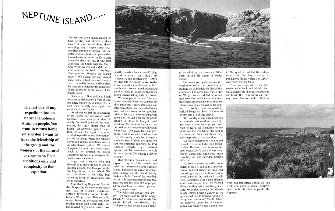
Tim paddled over to us and said “by the way, don’t paddle around the back of the boat, There’s a shark there.” It was one of those shark watching boats where some foul-smelling mixture is thrown into the water to attract sharks. People are then lowered into the water inside a cage when the shark arrives. It was later confirmed on South Neptune that a 15-foot white pointer and a Mako shark were seen out the back of the boat. Next question, where is the nearest beach? We picked our way around some rocks to land on a small Sandy beach backed by large round boulders. We were entertained for the remainder of the afternoon by the antics of the playful sea lions.
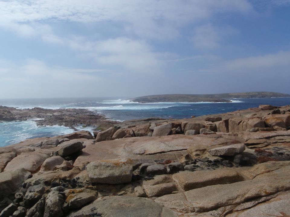
With only a 15-kilometre paddle to South Neptune on day three, we were able to rise later and explore the island briefly on foot. After which we then casually investigated the coastline in our kayaks. At midday we left for the southern tip of the island, destination South Neptune island clearly in view. A steady 5 metre swell pounded the coast sending its spray higher than the island – an awesome sight to watch from the seat of a kayak. The group decided to paddle around the southern part of the island where the rebound waves and choppy conditions made it an adventurous paddle. We landed alongside the jetty on the steep sandy beach to be greeted by Roger Cavanagh, the person in charge of the islands’ weather station.
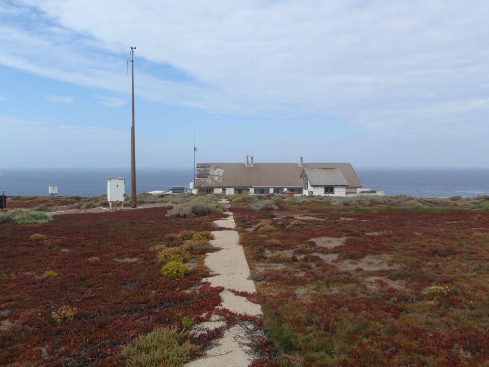
Roger was a superb host and allowed us to have the use of one of the three cottages that form part of the one large house on the island. We were introduced to his wife, Sue and showing the layout of the cottage, then left to ourselves.
After thanking Roger and Sue for their hospitality we were on the water the next day at 8:00 AM . Conditions seemed favourable as we headed towards wedge island. However, after several hours and the occasional GPS reading, things did not seem right – we had covered only a short distance. We paddled another hour to see if things would improve but they did not. By 1:00 PM we had covered only 12.5 kilometres. At that rate we would make wedge island midnight – not a pleasant thought. So, we turned around and paddled back to South Neptune, the return journey taking only two hours.
We were perplexed and frustrated at not knowing what was causing a slow paddling. Roger came down and after some discussion headed off to try and find an answer to our problem. After an hour or so he returned having spent most of the time on the phone talking to those he thought could assist us. The bottom line was, that due to the consistency of the South Easterly winds for the past five days, they had produced what is called a wind set current. The steady wins had created a surface current of about two knots. We had contemplated returning to port Lincoln – Roger advised against that. The answer was to wait for the expected Southwest change a day or so away.
That gave us a chance to relax and explore, very carefully though, the small but impressive South Neptune island. The place has a fearful reputation. In large seas the island literally shakes with the force of the pounding waves. It is these treacherous seas that have claimed the lives of five people -all washed away from the island, presumably by rogue waves.
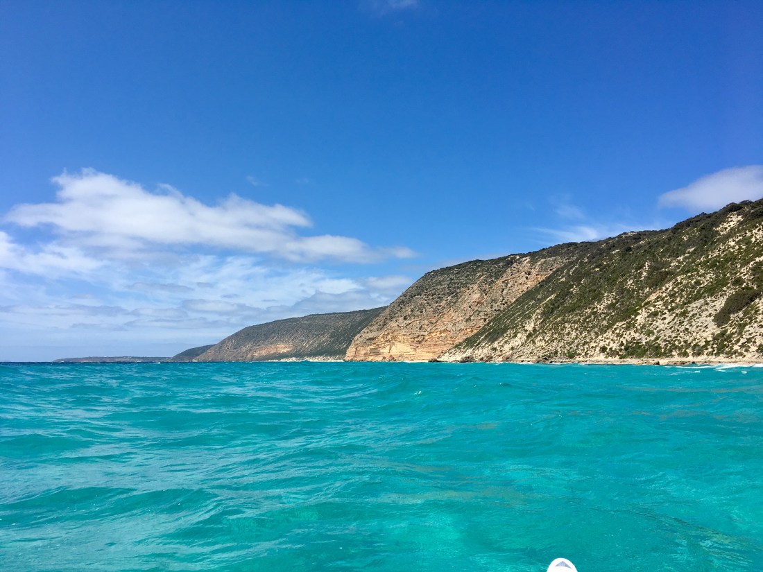
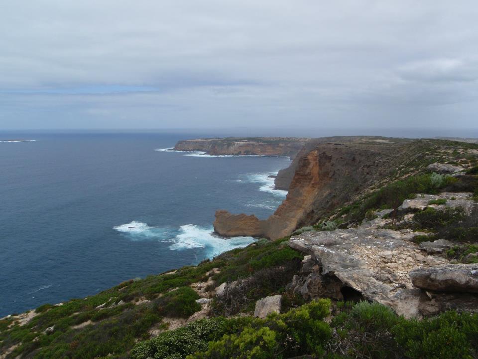
The delay had caused some anxiety. We were keen to get to Wedge Island. At 7:30 AM we left with the assistance of steady south-westerly winds. By 12:45 we had covered some 40 kilometres to be admiring the awesome 200 metre cliffs on the South East corner of Wedge Island.
Due to our good paddling time discussion turned to the possibility of pushing on to Pondalowie Bay that afternoon. The consensus was to stay on Wedge. So we paddled on to land near John Culshaw’s house and then used the remainder of the day to explore the island. Four of us walked to the summit of Wedge and successfully radioed Roger on South Neptune to inform him of our safe arrival.
The last day of any expedition has an unusual emotional drain on people. You want to return home, yet you don’t want to leave the friendship of the group and the wonder of the natural environment. Poor conditions only add complexity to that equation. We were paddling by 8:00 AM and cruised over 2 the Falie for a friendly chat. However, conditions on the open ocean didn’t make things easy. Strong winds and large seas made travelling on our intended bearing difficult.
An hour or so out my rudder completely broke off, adding to a tense situation.
Without rudder or skeg, Phil was still getting used to how his new kayak handled the awkward conditions. Landmarks over a long distance were confusing at first. We were not always heading where we thought we were. We pushed through the adversity and things became clear as we approached our destination. Sitting in the quieter waters off Middle island we reflected upon the challenging paddle and what we had learned from it. We quickly paddled the calmer waters of the bay, landing at Pondalowie Beach where our support crew were waiting for us.
Time was against us. Most needed to be back in Adelaide. So it was a quick cold shower, tea, pack up and head off. It was during the car journey home that we could reflect on what had transpired during the last week and upon a special achievement – To be the first to paddle the Neptunes.
Malcolm Hamilton 1998
DAY Destination Distance
1 September beach to Thistle Is. 36
2 Thistle Island to North Neptune Is. 30
3 North Neptune to South Neptune Is. 19
4 South Neptune Is – Out and back 25
5 Rest Day
6 South Neptune Island to Wedge Island 43
7 Wedge Island to Pondalowie Bay 37
190KM

Well done Mal a great account of a defining sea kayak adventure!
LikeLike
Great for me to read this James and Malcolm, having heard parts of it these last few years. Am enjoying soaking it in, all put together in one read ! Thanks you two. congrads twenty plus years on, top class trip and top shelf effort putting it all together, and then to pull the thing off ! Sounds like a really good bunch of folk, which makes all the difference.
LikeLike